
The third-largest island in the Solovetsky archipelago, linked to its neighbour by a monastic dam and marked by centuries of religious and penal history.
At a glance
Bolshaya Muksalma covers 17 square kilometres and lies east of Bolshoy Solovetsky Island, separated by two straits known as the Iron Gates. A stone dam, built between 1865 and 1871 by monks of the Solovetsky Monastery, now bridges the southern strait and spans several hundred metres at 6.5 metres wide. The island’s landscape includes smaller neighbours: Malaya Muksalma and several islets to the southeast.
History
Archaeological evidence indicates human settlement in the second millennium BC. By historical times, the island served as a farm for Solovetsky Monastery, whose rules prohibited keeping female livestock near the main complex. A small, secluded monastery called Sergeyev skete operated here in the 19th century, managing the monastic farm and its animals.
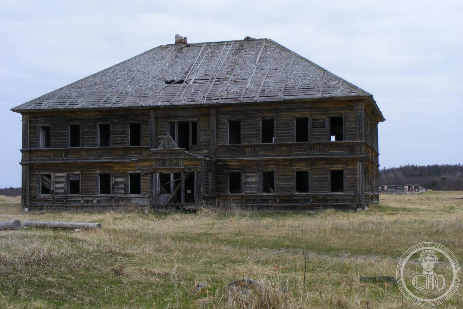
Two key structures were erected in the early 1900s: wooden St. Sergius cells in 1900, followed by a stone building (1901–1905) that combined residential cells with agricultural facilities. After the monastery’s closure in 1920, the skete was repurposed as a women’s prison camp within the Solovetsky Gulag. This facility operated until 1939.
What you see
The most prominent feature is the monks’ dam crossing Yuzhnye Zheleznye Vorota Strait, an engineering feat of the 19th century. Remnants of early 20th-century monastic buildings—the wooden and stone cell structures—survive on the island, testifying to successive uses as religious and penal institutions.
Cultural significance
Bolshaya Muksalma embodies the history of Solovetsky Monastery’s broader operations and the radical transformation of Soviet sacred spaces. The island’s passage from monastic farmstead to penal camp reflects the archipelago’s larger story of religious suppression and Soviet labour camps. The dam itself represents monastic ingenuity and engineering skill in a remote northern environment.
Key facts
- Country: Russia
- Location: White Sea, Solovetsky Islands
- Area: 17 square kilometres (6.6 square miles)
- Third-largest island in the archipelago
- Coordinates: 65.0375°N, 35.95°E
- Dam construction: 1865–1871
Practical information & getting there
Bolshaya Muksalma is accessible only as part of visits to the Solovetsky Islands. The islands are reached by boat or helicopter from Arkhangelsk on the mainland. Today, algae production operates on the island. There is limited public access; consult local tourism authorities about visiting permissions and seasonal availability.
Sources & resources
Find it on the map
See this place and what’s around it →📷 Become a Cultural Heritage Online photographer
Share your photos of places: they stay published under your name as the author. The more they're seen, the more you get noticed — and soon a contest will reward the most appreciated photos.
Log in or sign up free to add a photoIs this page about you?
This page is read by travellers and heritage enthusiasts who find it on Google. Tell us how you are connected to this place and we will take it from there.