
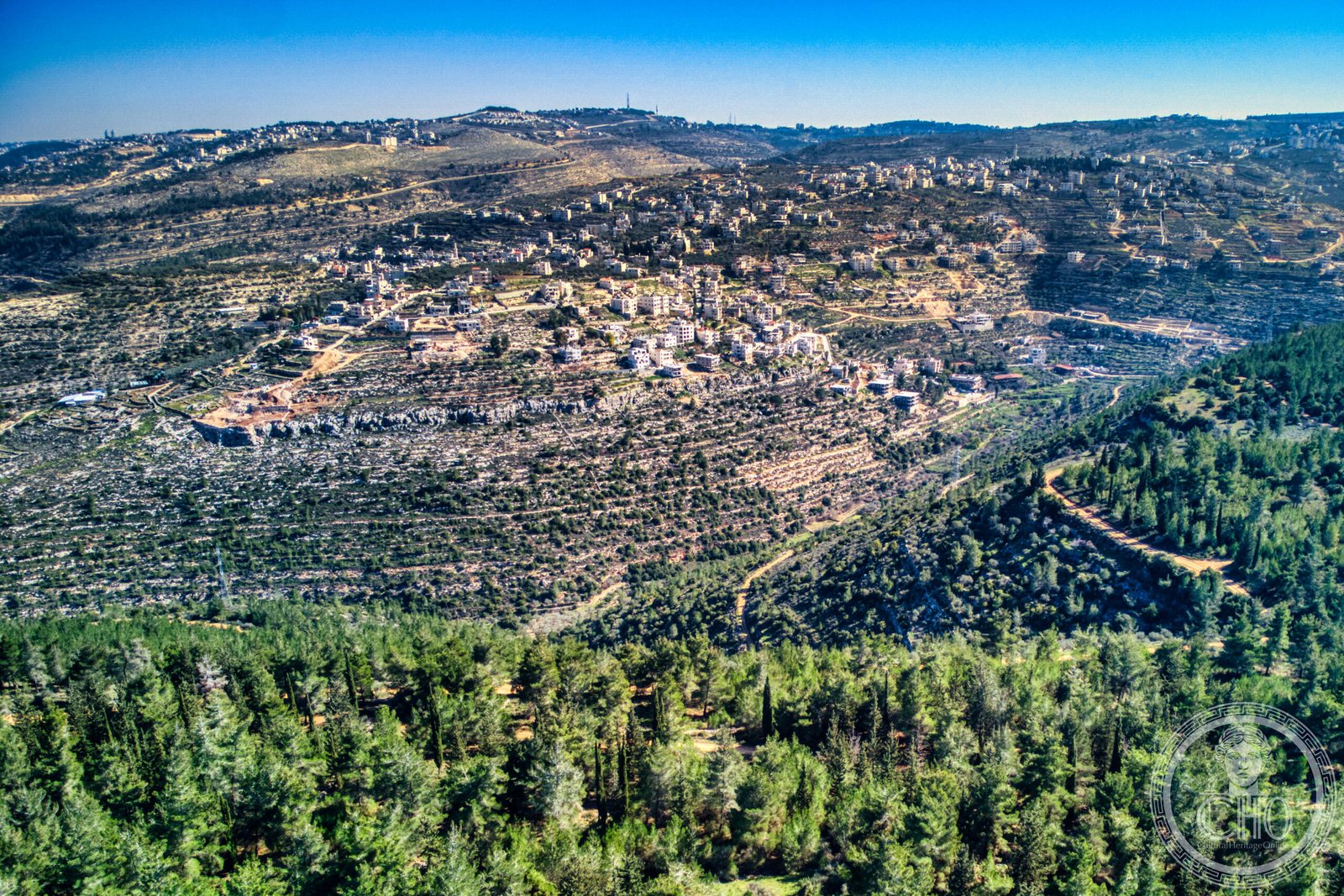
A Palestinian village west of Bethlehem, Battir preserves remarkable Roman-era agricultural terraces and irrigation systems alongside archaeological remains of Beitar, the final stronghold of the Bar Kokhba revolt.
At a glance
Battir lies 6.4 kilometres west of Bethlehem in the West Bank, home to approximately 4,696 residents. The village’s defining feature is its ancient engineered landscape: a network of stone terraces and water systems built during the Roman period that continue to shape the terrain and agricultural practices today. In 2014, UNESCO inscribed Battir as a World Heritage Site, recognising it as a cultural landscape of exceptional value.
History
Human settlement at Battir extends back to antiquity. The site contains archaeological remains of Beitar, an ancient Jewish village that served as the last centre of resistance during the Bar Kokhba revolt against Roman imperial rule in the 2nd century CE. The village continued to be inhabited through the Byzantine and Islamic periods. Ottoman and British Mandate records document a primarily Muslim population. For centuries, Battir lay along the road connecting Jerusalem to Bayt Jibrin. Following the 1949 armistice between Israel and Jordan, the Jaffa–Jerusalem railway marked the boundary between the two states until the Six-Day War of 1967, when Israeli forces occupied the area.
What you see
The landscape itself is Battir’s principal monument. Thousands of stone terraces cascade down the hillsides, constructed to prevent soil erosion and maximise arable land on steep slopes. An intricate irrigation system, engineered during the Roman period, channels water through channels and pools to support olive groves and vineyards—the crops that gave the village its UNESCO designation. These structures demonstrate sophisticated hydraulic knowledge and remain largely functional and in use.
Cultural significance
Battir represents a living cultural landscape shaped by two millennia of continuous agricultural practice. The terraces and irrigation systems embody an adaptation to the region’s topography and climate, sustaining food production across generations. The archaeological layer—particularly the connection to Beitar and the Bar Kokhba period—links the village to pivotal moments in Jewish and Roman history. UNESCO recognised the site for demonstrating the interaction between human settlement and the natural environment over centuries.
Key facts
- Location: Bethlehem Governorate, Palestine; 6.4 km west of Bethlehem
- Coordinates: 31°43’29″N, 35°08’12″E
- Population: 4,696 (2017 census)
- UNESCO status: World Heritage Site (2014), inscribed as Battir – Land of Olives and Vines—Cultural Landscape of Southern Jerusalem
Practical information & getting there
Battir is accessible from Bethlehem by road. The village remains an active community where terraced agriculture continues. Visitors should be aware of current access conditions and local circumstances in the West Bank. The terraces are best explored on foot, allowing time to observe the irrigation channels and understand the layout of the landscape.
Sources & resources
Find it on the map
See this place and what’s around it →📷 Become a Cultural Heritage Online photographer
Share your photos of places: they stay published under your name as the author. The more they're seen, the more you get noticed — and soon a contest will reward the most appreciated photos.
Log in or sign up free to add a photo