
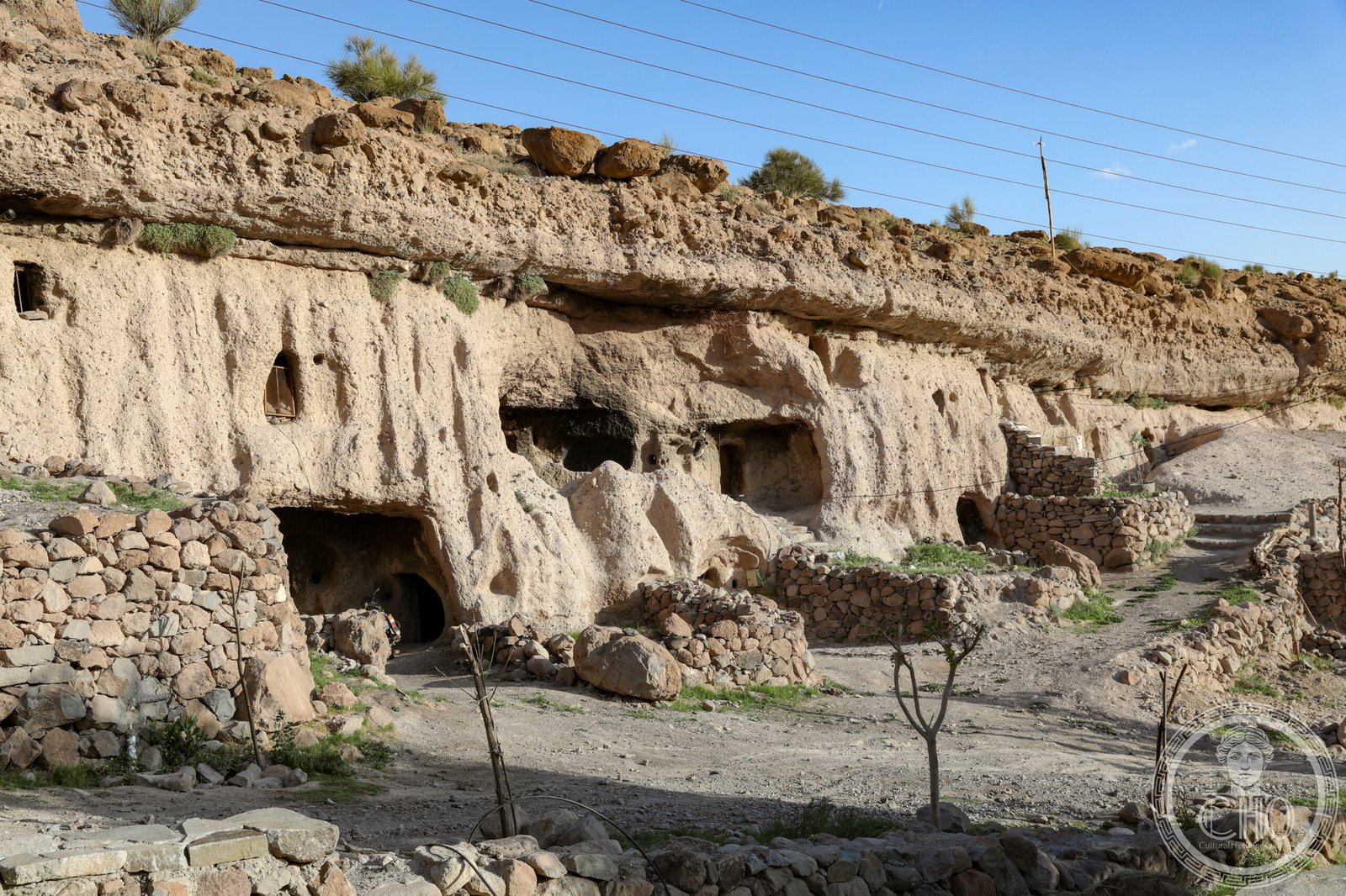
A remote village in Kerman province whose ancient troglodytic settlement exemplifies the ingenuity of desert communities adapting to harsh environments.
At a glance
Meymand is a rural settlement serving as the capital of Meymand Rural District in Shahr-e Babak County. Its significance lies in its long history of cave dwelling and traditional settlement patterns that continue to shape life in this isolated Kerman community.
History
Meymand represents centuries of human habitation adapted to the arid conditions of eastern Iran. The village’s development reflects the strategies of mountain communities seeking shelter and water in an unforgiving landscape. Its persistence as a living settlement demonstrates the sustainability of traditional architectural solutions across generations.
What you see
The village comprises dwellings carved into and built against natural rock formations. Structures combine cave rooms with stone construction, creating thermal mass that moderates temperature extremes. This hybrid approach—part excavation, part built—remains visible throughout the settlement, revealing how inhabitants worked with rather than against the topography.
Cultural significance
Meymand holds UNESCO World Heritage status for its exceptional testimony to traditional rural settlement patterns in arid regions. The village preserves knowledge of vernacular architecture, water management, and social organization that developed over centuries in one of Iran’s most challenging environments. It stands as evidence of human resilience and adaptive design.
Key facts
- Location: Shahr-e Babak County, Kerman Province, Iran
- Coordinates: 30.2294°N, 55.3756°E
- UNESCO World Heritage Site: Yes
- Status: Capital of Meymand Rural District, Central District
Practical information & getting there
Meymand lies in remote eastern Iran, approximately 175 km south of Kerman city. Access requires private transport; the journey takes several hours on mountain roads. Local accommodation and facilities are minimal; visitors should prepare accordingly and consider hiring a local guide familiar with the settlement’s layout and history.
Sources & resources
Find it on the map
See this place and what’s around it →📷 Become a Cultural Heritage Online photographer
Share your photos of places: they stay published under your name as the author. The more they're seen, the more you get noticed — and soon a contest will reward the most appreciated photos.
Log in or sign up free to add a photo