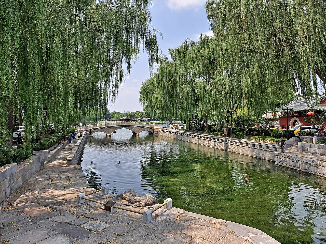
The Grand Canal (UNESCO 2014) stretches 2,700 kilometres from Hangzhou in Zhejiang Province to Beijing, crossing six provinces and municipalities: Zhejiang, Jiangsu, Shandong, Hebei, Tianjin and Beijing. Construction of its earliest sections began under the State of Wu in the 5th century BCE; the Sui Emperor Yangdi conscripted an estimated 3.6 million labourers between 605 and 610 CE to complete the integrated north-south waterway, and died in 618 CE — three years after its operational completion — following a military revolt connected in part to the canal’s catastrophic human cost. The 27 locks on the Jiangnan Canal section raise boats 42 metres above sea level across the Shandong ridge between Hangzhou and Beijing, a feat of hydraulic engineering that sustained the canal’s commercial function for more than 1,300 years.
Southern terminus: West Lake Hangzhou and Archaeological Ruins of Liangzhu City West Lake at canal terminus; Liangzhu 30 km north of Hangzhou, 30 min metro+bus
The Grand Canal’s southern terminus is at Hangzhou, where the waterway meets the Qiantang River at the city’s northern edge; the West Lake Cultural Landscape, inscribed as UNESCO World Heritage in 2011, begins approximately 3 kilometres west of this junction. The lake covers 3.23 square kilometres, with a maximum east-west dimension of 3.3 kilometres; it sits at an elevation of 5 metres above sea level, bounded to the west and north by hills rising to 400 metres and to the east by the urban centre. The UNESCO inscription for West Lake (2011) and the Grand Canal (2014) are separate designations, but the two properties are functionally and historically inseparable: the canal supplied the economic activity that made Hangzhou one of the wealthiest cities in Song-dynasty China, and the Song-dynasty administrators who managed canal commerce were the same officials who commissioned the lake’s causeways, pagodas and garden structures. Su Shi (Su Dongpo), who supervised the dredging of West Lake and the reconstruction of the Su Causeway in 1089 CE, served as Governor of Hangzhou at a moment when the city was a primary node on the canal’s trade network. The canal’s commercial role also directly determined the aesthetic character of the Suzhou Classical Gardens 200 kilometres to the northeast: the garden-owning literati class of Suzhou drew its wealth from canal trade, and the gardens were designed as retreats from a mercantile urban life sustained by the waterway. Stone supply for the imperial construction projects in Beijing, including the Forbidden City, was shipped via the Grand Canal; the logistics required a detour of approximately 500 kilometres beyond the direct overland route from the Hebei quarries, but the canal’s load capacity made it preferable to road transport for multi-tonne stone blocks. Visiting the West Lake district provides the clearest view of what the canal’s southern terminus looked like as a commercial-cultural hub: the Qinghe Fang historic street area along the canal bank in the old Hangzhou city centre retains its canal-side merchant architecture in partial form, and the China National Silk Museum near the southern lake shore documents the silk trade that constituted the canal’s primary southbound cargo for over a millennium.
The Archaeological Ruins of Liangzhu City, inscribed as UNESCO World Heritage in 2019, are 30 kilometres north of Hangzhou and accessible in approximately 30 minutes by Metro Line 2 to Liangzhu Station followed by a 10-minute bus or taxi ride to the site. The Liangzhu site predates the Grand Canal by approximately 3,500 years: the urban settlement at Yuhang dates to 3300–2300 BCE, built by the Liangzhu culture on the alluvial plain of the same river system that later supported the canal’s southern network. The site covers approximately 6.3 square kilometres, with a royal palace complex raised on an artificial earthen platform 630 metres long and 450 metres wide, built from approximately 2.2 million cubic metres of compacted fill. A hydraulic engineering system of 11 dams and reservoirs, identified only in 2015 through LiDAR remote sensing and confirmed by excavation between 2016 and 2019, controlled water from the adjacent Tianmu Mountains; the system had an estimated storage capacity of 4.5 million cubic metres, making it the earliest confirmed large-scale dam network in China. The canal passes within 15 kilometres of the Liangzhu site, and the geographic logic is the same in both cases: the flat, well-watered Yangtze Delta plain was always the most productive agricultural and commercial zone in eastern China, and both the Liangzhu city-builders and the Sui-dynasty canal planners exploited the same hydraulic geography. The Liangzhu Museum at the site entrance, opened in 2018, displays jade cong tubes, bi discs and ceremonial axes from elite burials alongside sedimentary core samples and LiDAR imagery documenting the dam system; it is open Tuesday to Sunday with last entry one hour before closing.
Northeast to Beijing: Classical Gardens of Suzhou and the Forbidden City Suzhou 200 km northeast, 1h HSR; Forbidden City / Beijing 1,200 km north, 5h HSR
The Classical Gardens of Suzhou, first inscribed as UNESCO World Heritage in 1997 and extended in 2000 to cover nine gardens, lie 200 kilometres northeast of Hangzhou along the canal corridor; the city is reachable in approximately 1 hour by high-speed rail from Hangzhou East or Hangzhou Station. Suzhou was the commercial capital of the canal’s Jiangnan section: the waterway passes through the city, and the families who owned and designed the inscribed gardens drew their wealth primarily from silk manufacturing and canal-borne trade. The Humble Administrator’s Garden (Zhuozheng Yuan), at 5.2 hectares the largest of the inscribed gardens, was established in the early 16th century by the retired official Wang Xianchen on land that had previously been a monastery; its central water element of ponds, channels and islands covering approximately 60 percent of the garden area directly mirrors the compositional logic of the West Lake landscape at a fraction of the scale. The garden’s name, which translates approximately as “The Humble Administrator’s Garden” or more literally “The Garden of the Stupid Administrator,” is drawn from a classical text noting that watering trees and selling vegetables was a form of administration appropriate to a man of limited ability; the self-deprecatory naming was itself a literati convention. The Lingering Garden (Liu Yuan, 0.23 hectares) represents the same tradition compressed to a town-house scale; its Qing-dynasty central hall, Wufeng Xian Guan, contains a timber screen partition of 16 carved sashes whose combined weight is approximately 1,800 kilograms, and the garden’s Guanyun Feng limestone rock stands 6.5 metres tall and is considered one of the three finest garden stones in China. The canal supplied the stone: the limestone rocks (taihu shi) used in Suzhou gardens were quarried from Lake Taihu 30 kilometres west, loaded onto barges and transported via the local canal network to the garden sites. An additional historical detail connects the stone trade to the canal’s function: the jade merchant Zhu Yizun, writing in the 17th century, documented how imperial construction projects in Beijing during the Ming dynasty shipped decorative stones from Suzhou to the capital via a canal route that extended 500 kilometres beyond the direct overland option, because the canal’s bulk-load capacity made it cheaper despite the additional distance.
The Forbidden City (Imperial Palace, Beijing), part of the Imperial Palace UNESCO inscription of 1987 that also covers the Imperial Palace of the Shenyang Palace Museum, stands at the northern terminus of the Grand Canal. Beijing’s designation as the Yongle Emperor’s capital beginning in 1403 CE was inseparable from canal logistics: the court chose Beijing precisely because the Grand Canal could supply the city with grain and building materials from the productive Yangtze Delta provinces, and the canal’s northern section (the Tonghui River, connecting Beijing’s moats to the main canal channel) terminated at the Houhai lakes immediately north of the palace compound. Canal warehouses adjacent to the Houhai and Shichahai lake systems stored the grain tribute that sustained the imperial court; the warehouse district (Dongzhimen, just northeast of the Forbidden City) remained the logistical heart of Beijing until the 19th century. The Forbidden City itself was constructed between 1406 and 1420 CE, using approximately 1 billion bricks fired at kilns near Suzhou and transported to Beijing by canal; the timber for the major halls came from Sichuan Province via the Yangtze River tributaries; and the decorative marble for the three great ceremonial terraces and the imperial garden was quarried from Fangshan County 50 kilometres southwest of Beijing and hauled to the city in winter on ice-sledges along frozen waterways connected to the canal network. Beijing is reachable from Hangzhou by high-speed rail in approximately 5 hours on the Beijing-Shanghai line from Hangzhou East Station. The Palace Museum (Gugong) within the Forbidden City is open Tuesday through Sunday; queuing for the main Meridian Gate entrance before 8:00 AM is standard practice during peak season.
Practical information
The Grand Canal’s inscribed heritage sites span six provinces, making a complete traversal a multi-week journey. For a practical circuit of the canal’s key UNESCO neighbours, Hangzhou is the logical starting point: it combines the canal’s southern terminus with West Lake (3 km from the canal bank) and Liangzhu (30 km north, half-day excursion). Suzhou makes a natural second stop: 1 hour by HSR from Hangzhou East, with four or five of the inscribed gardens visitable in two days without rushing. Beijing is the logical terminus: 5 hours by HSR from Hangzhou East or 4 hours from Suzhou on the Beijing-Shanghai line. Spring (March to May) and autumn (September to November) offer the most moderate temperatures across the full canal corridor; summer (June to August) is hot and humid in the Jiangnan delta region but brings full lotus bloom on West Lake. The best single canal-heritage town for architecture is Tongji in Jiangsu Province, roughly midway along the canal and reachable by bus from Suzhou in 1 hour; it retains Ming and Qing canal-side merchant buildings along a 1-kilometre stone-paved street. Canal boat tours are available in Suzhou (Grand Canal scenic section) and Hangzhou (short evening cruises from the Gongchenqiao bridge area near the canal bank); the Hangzhou section is less scenic than Suzhou’s urban canal stretches but gives a direct sense of the waterway’s current commercial function, still used by cargo barges.
Frequently Asked Questions
How was the Grand Canal built, and what was the human cost of its construction?
The Grand Canal was not built in a single phase. Its earliest section, the Hangou Canal connecting the Yangtze River to the Huai River in Jiangsu Province, was dug around 486 BCE under the King of Wu, Fuchai, who needed to move troops northward for military campaigns. Later sections were extended under various dynasties over the following 1,100 years. The integration of earlier canals into a single north-south system was undertaken by the Sui Emperor Yangdi (Emperor Yang of Sui), who ordered construction of the main southern section (the Tongji Canal and the Jiangnan Canal) between 605 and 610 CE. Chinese historical sources record that approximately 3.6 million labourers were conscripted for the Tongji Canal alone, with additional millions mobilised for related projects. The Zizhi Tongjian (“Comprehensive Mirror in Aid of Governance”), compiled by Sima Guang in the 11th century, records mortality rates during canal construction in terms suggesting that more than half of the conscripted workforce died during the work. The canal’s completion enabled the Sui court to move grain from the Yangtze Delta to the north, solving a chronic food supply problem for the northern capitals; it also enabled Yangdi to launch three disastrous military campaigns against the Korean state of Goguryeo (612–614 CE) that together resulted in an estimated 300,000 Chinese military deaths with no territorial gain. The combination of canal construction deaths, military campaign losses, and grain tax burdens triggered a series of peasant rebellions from 613 CE onward; Yangdi was assassinated by his own generals in 618 CE, three years after the canal’s completion, ending the Sui dynasty. The canal itself outlasted the dynasty that built it by 1,300 years and is still navigable today.
What goods did the Grand Canal carry, and how did stone for the Forbidden City reach Beijing?
The Grand Canal’s primary economic function for most of its operational history was the transport of grain tribute (caoyun) from the productive rice-growing provinces of the Yangtze Delta (Jiangsu, Zhejiang) to the northern capitals (Luoyang under the Sui and Tang, Kaifeng under the Northern Song, Beijing under the Yuan, Ming and Qing). At peak operation under the Ming and Qing dynasties (15th to 19th centuries), the annual grain tribute transported by the canal reached approximately 4 million shi (approximately 240,000 metric tonnes) per year, moved by a fleet of approximately 11,500 grain barges crewed by a permanent flotilla workforce of over 120,000 men. Beyond grain, the canal carried silk from Suzhou and Hangzhou’s weaving workshops (the southern terminus region was the primary production zone for imperial-grade silk), porcelain from Jingdezhen in Jiangxi Province (shipped northeast via the Yangtze to the canal), salt from coastal Jiangsu and Shandong (the canal intersected with the salt-production zone and provided the distribution channel), and timber from Sichuan and Hunan (shipped east on the Yangtze and then north). The construction of the Forbidden City between 1406 and 1420 CE required approximately 1 billion bricks, fired at kilns near Suzhou (Linqing in Shandong also supplied imperial-grade bricks); these were shipped north on the canal in purpose-built brick barges. Decorative marble for the ceremonial terraces came from Fangshan quarries southwest of Beijing; the standard method for moving multi-tonne marble blocks was to wait for winter, pour water on the road surface to create ice, and haul the blocks on wooden sledges by teams of men and animals along prepared ice roads, with wells dug at intervals to replenish the ice surface. Some blocks required hundreds of men per block and weeks of transport over distances of 50 to 80 kilometres. The timber for the main ceremonial halls — columns of nanmu cedar (Phoebe zhennan) reaching 13 metres in height and 1 metre in diameter — was harvested in Sichuan and Guizhou forests and floated down the Yangtze and then north by canal, a journey that could take 3 to 4 years from felling to installation.
Why did the Grand Canal decline, and what is its current operational status?
The Grand Canal’s decline as a primary transport artery began in the second half of the 19th century and was caused by a combination of factors. The Yellow River catastrophically shifted its course in 1855 CE, breaking through its northern levees and flooding across a path that cut the canal’s main north-south channel; the Shandong section of the canal became unnavigable for large vessels for extended periods thereafter. The opening of coastal steamship routes between Shanghai and Tianjin in the 1870s provided a faster and cheaper alternative to canal transport for grain and bulk goods; the canal’s advantage — the ability to move large volumes of goods inland without unloading and reloading at a port — was negated by the steamship’s speed advantage on the coastal route. The opening of the Jinpu Railway (Tianjin to Pukou, 1912) and the Shanghai-Nanjing Railway (1908) created a land alternative that further eroded canal freight. The grain tribute system was formally abolished in 1901, removing the state-managed barge fleet that had maintained the canal’s northern sections for centuries. Today, the Grand Canal remains partially navigable and commercially active. The Jiangnan section (Hangzhou to Zhenjiang in Jiangsu) carries significant commercial barge traffic: it is part of the inland waterway network used for moving coal, construction materials and bulk goods within the Yangtze Delta. The sections in Shandong and Hebei are largely non-navigable due to reduced water levels and are maintained primarily as cultural heritage features. The UNESCO inscription of 2014 covers 3,200 kilometres of canal channel and 27 component sites, including lock systems, bridges, docks, warehouses and management buildings; the inscription was intended in part to provide legal protection for the canal corridor against urban encroachment that had already destroyed significant sections of the historic bank structures in Jiangsu and Zhejiang cities.
Sources
- S1 — UNESCO World Heritage Centre — The Grand Canal (Ref. 1443) — https://web.archive.org/web/20230601000000/https://whc.unesco.org/en/list/1443/
- S2 — Grand Canal Heritage Conservation Centre — https://whc.unesco.org/en/list/1443/
- S3 — Kuhn, Dieter. <em>The Age of Confucian Rule: The Song Transformation of China</em>. Harvard University Press, 2009. ISBN: 978-0-674-03661-1.
Spotted an error? Write to editorial@culturalheritageonline.com and we correct it the same day.