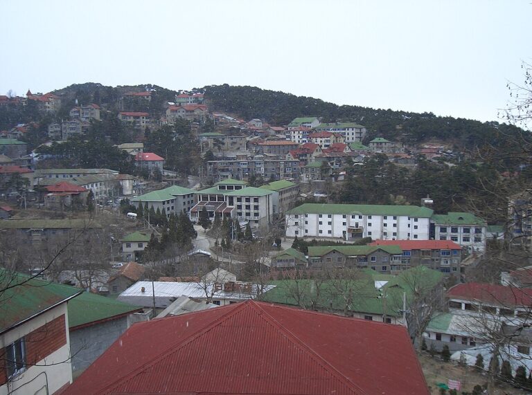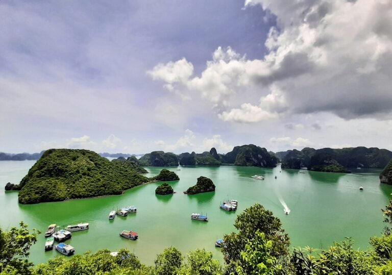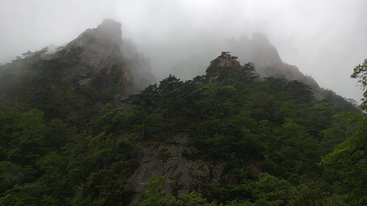
Mount Huangshan in Anhui Province rises to 1,864 metres at its highest point, Lotus Peak, across a massif of 72 named peaks shaped by granite intrusions that cooled roughly 100 million years ago. UNESCO inscribed it in 1990 as a mixed natural and cultural heritage site, recognising both its geological formations — vertical granite spires, a cloud inversion that creates the “sea of clouds” effect on average 200 days per year — and its role in the development of Chinese landscape painting from the 16th century onward. Geothermal springs on the lower slopes surface at approximately 42°C.
Anhui Province: The Ancient Villages Next Door 65 km east / 1 h by car
The closest UNESCO property to Mount Huangshan requires no high-speed rail and no overnight stay. It is, in fact, in the same province.
The Ancient Villages of Southern Anhui — Xidi and Hongcun, inscribed in 2000, sit 65 km east of the Huangshan scenic area, connected by a direct road that passes through the foothills of the mountain. Two villages anchor the inscription: Xidi, founded in the 11th century and reaching its peak prosperity between the 14th and 19th centuries, and Hongcun, established in the 12th century and notable for a hydraulic engineering system that redirects a natural stream through the village’s streets and into a central moon-shaped pond.
Both villages were built and maintained by merchants of the Huizhou trading network — the class that dominated China’s salt, timber, and grain trade during the Ming and Qing periods. The merchants’ wealth came back to Anhui in architectural form: white-plastered courtyard houses with distinctive stepped gable walls, carved wooden screens and door panels, and stone gateways bearing relief sculpture in styles influenced by the court workshops of Hangzhou and Suzhou. What survives in Xidi and Hongcun is not a set of monument buildings but an intact residential fabric: 124 original Ming and Qing structures in Xidi, 137 in Hongcun, arranged along street patterns unchanged since the 17th century.
Hongcun’s hydraulic system is genuinely unusual: the South Lake pond at the village’s south entrance was enlarged in 1607 to its current scale, serving simultaneously as a fish farm, a fire reservoir, and — according to the Feng Shui reasoning behind the village’s layout — as the “belly” of an ox-shaped topographic form that the village’s founders identified in the surrounding hills. The central Moon Pond (Yueyue) at the village’s heart was created in 1405 by diverting Lixihe Stream and is maintained today at the same water level by the same gravity-fed channel.
Hongcun appeared in Ang Lee’s 2000 film Crouching Tiger, Hidden Dragon, which accelerated its tourism growth significantly. Both villages charge admission; Hongcun is larger and more visited, Xidi quieter and better preserved in its street proportions. From the Huangshan Scenic Area main entrance (Tangkou): 65 km northeast, approximately 1 hour by car or tourist bus. Combined as a full day with a Huangshan mountain visit, they require two days minimum — the mountain alone demands at least a one-night stay in the summit hotels if the sunrise cloud-sea is the objective.
Eastward by High-Speed Rail: Suzhou and Hangzhou 280–340 km northeast / 2.5–3 h by HSR
High-speed rail from Huangshan North Station, opened in 2014, places two major Yangtze Delta UNESCO inscriptions within three hours. The rail connection transformed Huangshan from a remote mountain destination into a realistic component of a multi-city heritage circuit.
The Classic Gardens of Suzhou, inscribed in 1997 and extended in 2000, represent the most concentrated survival of Chinese private garden design outside the imperial compounds of Beijing. Nine gardens are included in the inscription; four — the Humble Administrator’s Garden (Zhuozhengyuan, the largest, covering 5.2 hectares), the Lingering Garden (Liuyuan), the Master of the Nets Garden (Wangshiyuan), and the Garden of the Lion Grove (Shizilin) — are open to the public and walkable within a single long day. Garden construction in Suzhou reached its peak between the 14th and 20th centuries, driven by the city’s role as the commercial and cultural capital of the Jiangnan region. The design vocabulary — scholar’s rock formations, covered walkways connecting pavilions, water surfaces calculated to reflect the architecture above them, and the deliberate use of framed views to create the illusion of space beyond the wall — influenced garden design across East Asia. The Humble Administrator’s Garden was built by a retired imperial official, Wang Xianchen, beginning in 1509; it changed hands repeatedly over the following centuries, at one point reportedly staked and lost in a single night of gambling. Distance from Huangshan North Station: approximately 340 km northeast, 3 hours by high-speed rail to Suzhou station.
The West Lake Cultural Landscape of Hangzhou, inscribed in 2011, differs from most Chinese UNESCO properties in that the inscription recognised an evolved cultural landscape rather than individual buildings or archaeological remains. West Lake is an artificial lake of 6.5 square kilometres at the edge of Hangzhou city, modified by dredging and embankment since the 7th century, with its current configuration largely established under the Song Dynasty (960–1279). The ten canonical views of West Lake — codified by the Song court and repeatedly repainted, written about, and referenced in Chinese literature ever since — include the reflection of the Leifeng Pagoda (rebuilt in 2002 on the original 975 CE footprint after the original collapsed in 1924), the lotus-covered Quyuan Garden, and the Su Causeway, a 2.8-km embankment built in 1090 by the poet-official Su Shi (Su Dongpo). The lake is freely accessible at its perimeter; boat hire provides the closest approach to the three artificial islands at its centre. Distance from Huangshan North Station: 280 km northeast, approximately 2.5 hours by high-speed rail to Hangzhou East station.
South by Train: Wuyishan 500 km south / ~5 h by rail
The Wuyishan Scenic Area in Fujian Province, inscribed in 1999 as a mixed natural and cultural World Heritage Site, shares notable geological characteristics with Huangshan while representing a distinct ecosystem and cultural tradition. The Nine-Bend River (Jiuqu Creek) carves through a sandstone massif — the Danxia landform, characterised by red-layered horizontal strata eroded into vertical cliffs — over 9.5 km, with the traditional bamboo raft descent taking approximately 2 hours. Culturally, Wuyishan is significant as the site where Zhu Xi (1130–1200), the most influential Neo-Confucian philosopher of the Song Dynasty, taught, wrote, and established the Wuyi Academy. His synthesis of Confucian ethics with Buddhist metaphysics — written partly in Wuyishan and widely read from the 13th century onward — shaped Chinese, Korean, and Japanese intellectual culture for 600 years. Distance from Huangshan North Station: approximately 500 km south, roughly 5 hours by rail (requiring at least one change; direct HSR to Wuyishan North station is now available via Fuzhou). The greater distance makes Wuyishan a standalone destination rather than a day trip; it pairs naturally with Fujian Tulou or the city of Quanzhou for an extended Fujian itinerary.
Practical information
Mount Huangshan requires cable cars or on-foot ascent (the shortest trail from Yungu cable car station to the summit area takes 1.5–2 hours of stairs). The mountain receives more than 3 million visitors annually; the peak-season crush between April and November is most severe during Chinese national holidays. Booking cable car tickets and summit hotels — there are six hotels on the summit plateau, above the cloud line — at least two weeks ahead during peak season is essential. The cloud-sea inversion (a temperature differential that traps fog below the peaks, creating the “sea of clouds” visible from above) occurs most reliably in autumn and winter mornings after rain; it cannot be predicted with certainty more than a day ahead.
Getting there: Huangshan North Station (高铁黄山北站) serves high-speed rail connections to Shanghai Hongqiao (2 hours), Hangzhou East (2.5 hours), and Nanjing South (2 hours). The scenic area itself is 30 km from the station by shuttle bus or taxi. For Xidi and Hongcun, tourist buses run directly from Huangshan City (Tunxi) bus station.
Suggested circuit: Arrive Huangshan, spend Day 1 ascending and one night at the summit. Day 2: descend, afternoon visit to Xidi or Hongcun. Day 3: HSR to Hangzhou, full day at West Lake. Day 4: HSR Hangzhou to Suzhou, full day across two gardens. Return from Suzhou by HSR to Shanghai (30 min) for onward travel.
Frequently Asked Questions
What is the “sea of clouds” at Huangshan and when is the best time to see it?
The sea of clouds (云海, yúnhǎi) is a meteorological phenomenon specific to mountains where a temperature inversion traps fog or low cloud below the summit level, leaving the peaks above a white floor of cloud that extends to the horizon. At Huangshan, the vertical granite spires — some rising over 100 metres from the plateau — project above this cloud layer on approximately 200 days per year, creating the visual effect repeatedly documented in Chinese landscape painting since the 16th century. The phenomenon occurs most reliably in autumn (October–November) and spring (March–April), typically in the morning hours following a night of rain or high humidity. Summer monsoon season (June–August) brings frequent cloud cover but also afternoon thunderstorms that can close the cable cars. Winter (December–February) offers the highest probability of clear-sky sea-of-clouds mornings, combined with snow on the granite, but also the coldest summit temperatures (routinely below 0°C at night at the 1,800-metre summit plateau) and shorter days. The mountain’s five named cloud-sea viewpoints — North Sea, South Sea, West Sea, Front Sea, and Sky Sea — face different directions and catch different light. Photographers consistently favour the North Sea viewpoint (Beihai) for sunrise, positioning there before 06:00 on a promising morning. No forecast is reliable more than 24 hours out; flexibility in summit hotel booking (a two-night stay increases the statistical likelihood of catching the phenomenon) is the most practical strategy.
Why are the Huizhou villages of Xidi and Hongcun significant beyond their visual appeal?
The inscription of Xidi and Hongcun by UNESCO in 2000 was notable because it recognised a vernacular residential fabric rather than individual monuments. The villages preserve the complete built environment of Huizhou merchant culture: not just landmark buildings but the spatial relationship between houses, streets, water systems, and the surrounding agricultural landscape. The Huizhou merchants (Huishang) were one of China’s dominant commercial classes during the Ming and Qing periods, their networks controlling the empire’s salt distribution monopoly and significant portions of the timber and pawnbroking trades. Unlike the court-based cultures of Beijing or the scholarly-official culture of Suzhou, Huizhou mercantile culture left its traces in domestic architecture: the distinctive white walls and black-tile roofs, the carved wooden interiors visible only from within the courtyard houses, the elaborately staged gateways announcing family wealth without ostentation on the public street. The villages also preserve a complete Confucian social geography: clan halls where lineage rituals were performed, memorial arches (pai fang) erected by imperial decree to honour widows who maintained celibacy after their husbands’ deaths — Xidi has eight surviving pai fang — and schools funded by merchants whose success was contingent on producing sons who could pass the imperial examinations. This layered social record, intact in its physical setting, is what the UNESCO inscription sought to protect: not scenic charm but the material evidence of a specific social and economic system.
How does Huangshan compare to Wuyishan, the other major mountain UNESCO site in southeast China?
The two mountains represent distinct geological formations and different cultural associations. Huangshan is a granite batholith — intrusive igneous rock pushed up through the earth’s crust approximately 100 million years ago — whose vertical spires result from the preferential erosion of horizontal and vertical joint systems in the granite. The peaks are sharp, pale grey, and relatively free of vegetation above the treeline. Wuyishan in Fujian is Danxia landform — sedimentary red sandstone laid down in lake basins during the Cretaceous and Paleogene periods, then uplifted and eroded into flat-topped mesas and sheer red cliffs. The landscape is lower (highest peak 2,158 metres, though the scenic area’s cliffs are at much lower elevation), wetter, and more biodiverse: Wuyishan is one of China’s designated biodiversity hotspots, with roughly 2,500 plant species and significant endemic fauna. Culturally, Huangshan’s importance is primarily aesthetic — it shaped the Huangshan School of painting in the 16th–17th centuries, and the mountain’s imagery permeates Chinese visual culture from classical scroll painting through to contemporary photography. Wuyishan’s cultural significance is more philosophical and educational: it is the site most closely associated with Zhu Xi and the development of Neo-Confucianism. In terms of visitor experience: Huangshan is more physically demanding (summit ascent, cable cars, high altitude), more scenically dramatic at the summit, and more crowded. Wuyishan is more accessible, more ecologically varied, and allows the combination of river rafting, temple visits, and philosophical-historical sites in a lower-intensity itinerary.
Sources
- S1 — UNESCO World Heritage Centre — Mount Huangshan (Ref. 547) — https://web.archive.org/web/20230601000000/https://whc.unesco.org/en/list/547/
- S2 — Huangshan Scenic Area Management Committee — https://whc.unesco.org/en/list/547/
- S3 — Seidensticker, John. <em>Riding the Tiger: Tiger Conservation in Human-Dominated Landscapes</em>. Cambridge University Press, 1999. ISBN: 978-0-521-64835-6.
Spotted an error? Write to editorial@culturalheritageonline.com and we correct it the same day.