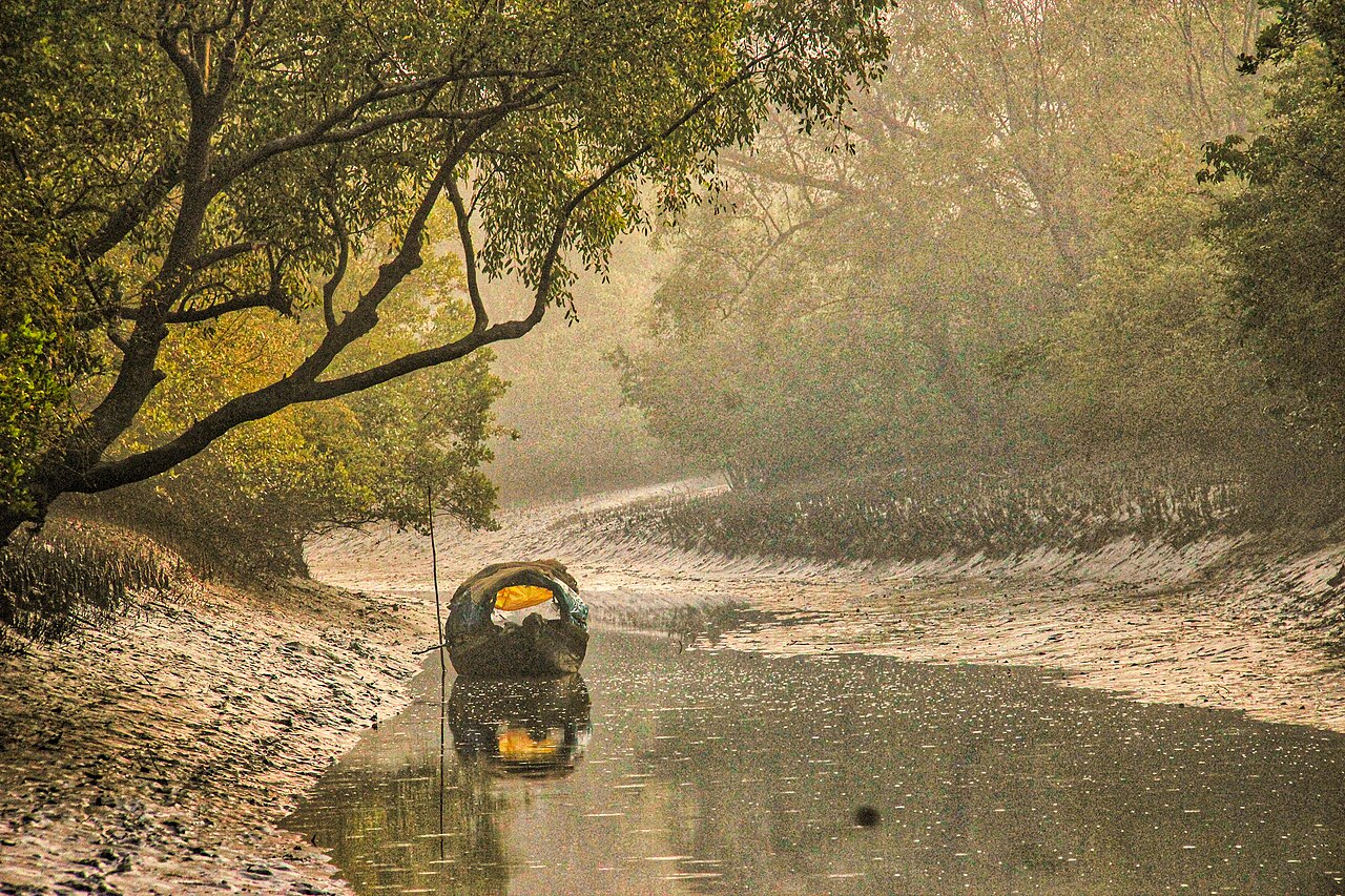
The Sundarbans form the world’s largest contiguous mangrove forest — roughly 10,000 square kilometres of tidal woodland across Bangladesh and India at the mouth of the Ganges, Brahmaputra, and Meghna rivers. The Bangladesh portion, 6,017 square kilometres, was listed as a UNESCO World Heritage Site in 1997; the Indian portion had been listed separately in 1987 as Sundarbans National Park. There are no roads inside the forest: all access is by boat.
How the world’s largest mangrove grows and what lives in it Khulna Division, Bangladesh and West Bengal, India
The Sundarbans take their name from the Sundari tree, Heritiera fomes, a mangrove species whose aerial roots — buttress and stilt roots that arch up from the water at low tide — give the forest its characteristic visual texture. The species is the dominant canopy tree across much of the Bangladesh portion and gives the landscape a uniformity broken only by the tidal channels, or khals, that cut through the forest in every direction. At low tide the root systems are exposed and walkable in some areas; at high tide the same roots disappear under water that, in the innermost reaches of the delta, is close to fresh, while near the coast it is fully saline.
The forest is not static. Himalayan rivers deposit sediment at the rate of 500–1,000 million tonnes per year into the Bay of Bengal, and a significant portion of that material accumulates at the delta front. New land forms as sediment consolidates and mangroves colonise it; estimates put the net land-building rate at 20 or more square kilometres per year in the active outer delta. This accretion partly offsets, but does not eliminate, the erosion driven by sea-level rise: measurements across the Bangladesh Sundarbans indicate sea levels rising at 3–8 millimetres per year — faster than the global average because the delta is also subsiding under the weight of its own sediment and due to groundwater extraction further upstream. UNESCO monitors the site under its climate-vulnerability programme, and several low-lying islands within the protected area have measurably shrunk since the 1980s.
The Bengal tiger (Panthera tigris tigris) population in the Sundarbans is the only mangrove-adapted tiger population in the world. The Bangladesh portion holds an estimated 100–150 animals based on the most recent camera-trap census; the Indian Sundarbans National Park holds approximately 86, according to India’s 2020 tiger census. These tigers exhibit behaviours not documented in any other tiger habitat: they swim regularly across channels 3–5 kilometres wide, effectively treating the Indian and Bangladesh portions of the Sundarbans as a single territory divided by an international border. The swimming ability means individual tigers move freely between the two countries, and animals tagged in India have been photographed in Bangladesh within weeks.
The historical record of tiger attacks on humans in the Sundarbans is unusually high compared to other tiger habitats. Honey collectors, fishermen, and wood-cutters who enter the forest have historically faced attack rates exceeding 100 per year. The reasons are debated — the absence of large ungulate prey in some areas, tigers habituated to approaching humans rather than retreating, salt-water stress affecting tiger temperament — but the practical response has been the development of specialised protective equipment including clay face-masks worn on the back of the head (tigers preferentially attack from behind and are reportedly confused by the false face) and electric shock shields. Recent decades have seen attack rates drop with better enforcement of no-entry zones and community-based conservation programs.
The ecosystem beyond the tiger: dolphins, crocodiles, and the honey collectors 60 km south of Bagerhat UNESCO site
The Sundarbans support four species of cetacean, of which the most ecologically significant are the Irrawaddy dolphin (Orcaella brevirostris) and the Ganges river dolphin (Platanista gangetica), both of which are IUCN-listed as endangered. The Irrawaddy dolphin is a coastal and estuarine species found from India to the Philippines; the Sundarbans is one of its last strongholds in the Bay of Bengal region. The Ganges river dolphin — effectively blind, navigating entirely by echolocation — occupies the freshwater channels in the northern and inland portions of the delta where salinity is low enough for it to survive.
Estuarine crocodiles (Crocodylus porosus) are present in the tidal channels, though population numbers within the Sundarbans are uncertain. The species is the world’s largest living reptile by mass and is fully at home in saltwater, explaining its wide Indo-Pacific distribution. Olive Ridley sea turtles (Lepidochelys olivacea) nest on the Sundarbans beaches facing the Bay of Bengal; the nesting season runs from January to April. The beaches at Dublar Char island, in the southern Bangladesh Sundarbans, host one of the largest seasonal fishing camps in Bangladesh and are also known for sea turtle nesting — a combination that creates significant pressure on the nesting habitat.
The Mawali honey collectors are the community most directly dependent on the forest’s biological productivity. Licensed under a centuries-old system that the Bangladesh Forest Department now formalises with annual permits, Mawali teams enter the Sundarbans between March and May — the bees’ primary nectar season — to harvest wild honey from the hives of the giant honey bee (Apis dorsata). Each team traditionally includes a Baoli (spiritual guardian) who performs rituals before entering, invoking the goddess Bonbibi for protection from tigers. The honey collected is unambiguously one of the world’s most distinctive wild-harvest food products: the bees range across the full floral diversity of the mangrove, including Sundari, Gewa (Excoecaria agallocha), and Khalsi (Aegiceras corniculatum) flowers, producing a honey with a flavour profile that varies markedly with the season and sector of the forest.
Sajnekhali Wildlife Sanctuary, within the Bangladesh Sundarbans, is the main base for ecotourism operators. It has a watchtower, a small museum, a crocodile breeding programme, and a forest department interpretation centre. All launches entering the Sundarbans must stop here to have permits checked. From Sajnekhali, boat itineraries typically head into the Katka, Kotka, and Jamtola sectors, where tiger pugmark surveys are conducted and where the beach-forest interface provides the best wildlife observation. Overnight launches anchored in the channels offer the best chance of hearing, if not seeing, tigers moving through the forest at night.
Practical information
Khulna is the primary gateway for the Bangladesh Sundarbans. Launches (large passenger boats) and speed launches depart from Khulna’s Rupsha River terminal. The journey to Sajnekhali takes 3–4 hours by speed launch; standard tourist itineraries are two nights / three days at minimum to reach the southern sectors where wildlife density is highest. One-day trips from Khulna reach only the peripheral zones and are not recommended for anyone whose principal interest is wildlife.
Permits are mandatory for all visitors and must be obtained from the Bangladesh Forest Department office in Khulna (or arranged in advance through a licensed tour operator). The permit system divides the Sundarbans into zones with different access restrictions; Zone 1 (core zone) is closed to all tourism. Khulna has good hotel infrastructure at budget to mid-range level; Dhaka-to-Khulna flights resume periodically but train and bus remain the reliable options (Dhaka to Khulna: intercity express trains 8 hours, buses 6–7 hours).
The Indian portion (Sundarbans National Park, UNESCO 1987) is accessed from Canning or Basanti in West Bengal, about 100 km from Kolkata. Permit and access rules on the Indian side differ from the Bangladesh side; cross-border itinerary planning is not practical as the boundary is an international border with no tourist crossing point in the delta.
The best season is October to March (dry, cooler, tigers more active near water). April–June is hot and humid but bees are active for the honey collectors. The monsoon (July–September) closes much of the sanctuary; launch operators pause operations. The Sundarbans is a malaria-risk area; prophylaxis is recommended for visits of more than one day into the interior.
Frequently Asked Questions
Why are the Sundarbans listed twice by UNESCO — once for Bangladesh and once for India?
The Sundarbans mangrove ecosystem straddles an international border. India successfully nominated and listed Sundarbans National Park (the Indian portion, covering 1,330 sq km of core zone within a larger Tiger Reserve) as a UNESCO World Heritage Site in 1987. Bangladesh then separately nominated the Bangladesh portion — 6,017 sq km — and achieved listing in 1997. The two inscriptions share the same ecosystem but are formally independent entries on the World Heritage List because UNESCO listing is a national government prerogative and requires sovereign territory. The two countries have discussed but not formalised a joint transboundary nomination, which would recognise the ecological unity of the system and could potentially be listed as a single serial property. The difference in size between the two listed areas reflects different protection boundaries, not a difference in ecological character: the Indian listed area is smaller because India defined the core zone tightly; the Bangladesh portion encompasses a much larger area of managed forest alongside the strictly protected core.
How do Bengal tigers in the Sundarbans differ from tigers elsewhere in India and Bangladesh?
The Sundarbans tigers are the same subspecies — Bengal tiger, Panthera tigris tigris — as those in Ranthambore, Corbett, or Kaziranga, but they have developed behaviours specific to mangrove ecology that are not found in savanna or dry-forest tiger populations. Most significantly, they are strong and habitual open-water swimmers: documented crossings of 3–5 kilometre tidal channels are routine. In terms of diet, Sundarbans tigers prey primarily on spotted deer (Chital), wild boar, and rhesus macaque — the same prey species as tigers elsewhere — but in the Sundarbans these animals also swim between islands, and tigers have been observed hunting in the water. The high historical rate of attacks on humans has been studied intensively; one hypothesis links it to the salt stress tigers experience from drinking brackish water (the Sundarbans has no permanent freshwater source), which may affect temperament and increase territorial aggression. Another hypothesis notes that the flat topography and dense vegetation mean tigers and humans encounter each other at close range with no visibility to allow either party to retreat. Camera-trap monitoring has confirmed that individual tigers do cross the India-Bangladesh border, making the two-country population effectively a single genetic unit.
What is the climate threat to the Sundarbans, and how serious is it?
The Sundarbans faces a convergence of three climate-related pressures: sea-level rise, increased cyclone intensity, and freshwater reduction from upstream diversion. Sea-level rise in the Bay of Bengal runs at 3–8 mm per year in the delta zone — higher than the global average of approximately 3.3 mm per year — because the Bengal Delta is itself subsiding as its sediment compacts and as groundwater extraction in the greater delta region removes support. Satellite studies published in the 2010s documented measurable shrinkage in several Sundarbans islands: Lohachara Island in the Indian Sundarbans, once inhabited, has been largely submerged. Cyclone Sidr (2007) and Cyclone Aila (2009) caused major damage to embankments protecting communities at the forest margin and caused significant saltwater intrusion into previously freshwater zones. The reduction in freshwater inflow from the Ganges — partly a result of the Farakka Barrage in India, which diverts Ganges water away from the Bangladesh channels — has allowed salinity to penetrate further north into the delta, stressing freshwater-tolerant mangrove species and altering species composition. UNESCO’s World Heritage Outlook assessment classifies the Sundarbans as a site of “significant concern” for climate impacts, and both India and Bangladesh have presented adaptation plans to the World Heritage Committee.