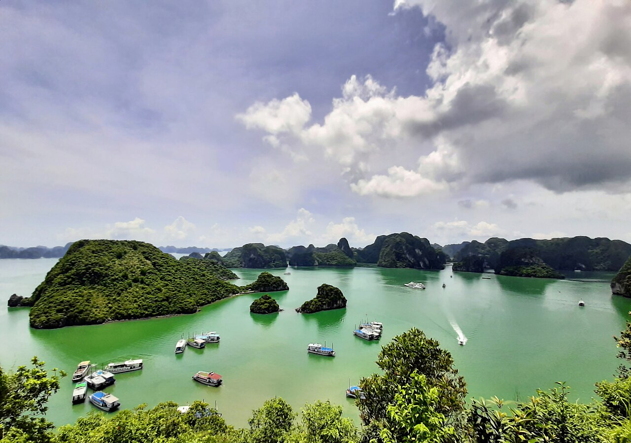
Hạ Long Bay, covering 1,553 square kilometres of the Gulf of Tonkin in northeastern Vietnam’s Quảng Ninh Province, was first inscribed by UNESCO in 1994 for its outstanding natural beauty and extended in 2000 to include Bái Tử Long Bay, at which point the scientific criteria for geological and geomorphological value were also added; the limestone karst islands visible above water today formed through a process beginning 340–240 million years ago and shaped by at least five distinct sea-level change cycles. The 1,969 islands within the inscribed area range from rock stacks a few metres wide to Cat Ba Island, which at 354 square kilometres is also a UNESCO Biosphere Reserve designated in 2004. Within a southward corridor of 700 kilometres, four further UNESCO World Heritage Sites — Tràng An, Phong Nha-Kẻ Bàng, the Citadel of Hồ Dynasty, and Hội An — connect Hạ Long’s karst geology to archaeological records spanning 30,000 years of human settlement.
The geology of Hạ Long Bay and the Tràng An karst 120 kilometres south 120 km south of Hạ Long Bay — 2 hours by road from Hạ Long City to Ninh Bình; or 3 hours by bus from Hanoi (which is 165 km west of Hạ Long Bay)
The limestone of Hạ Long Bay belongs to the same geological formation — the South China Karst — that extends through southern China and across northern Vietnam. The rock was deposited as marine sediment on the floor of a shallow tropical sea during the Devonian and Carboniferous periods, roughly 340 to 280 million years ago, then uplifted, folded, and subjected to prolonged tropical weathering and dissolution by slightly acidic rainwater percolating through joints in the rock. The resulting karst towers, locally termed “fengcong” (clustered peaks) and “fenglin” (isolated peaks), were subsequently drowned to their current height as sea levels rose at the end of the last glacial period approximately 10,000 years ago, leaving only the upper portions visible.
The name “Hạ Long” translates from Vietnamese as “Descending Dragon.” The origin legend holds that a dragon sent by the gods spat out jewels and jade as it descended into the sea, and that the jewels transformed into the islands, forming a protective barrier against maritime invaders. The story attaches different emperors or historical periods depending on the telling, but functions consistently as an explanation for the visual character of the bay’s clustered formations.
The 1994 inscription covered a 434-square-kilometre core zone; the 2000 extension added Bái Tử Long Bay to the east and expanded the listed area to 775 square kilometres of core zone within the total 1,553 square kilometres. The bay contains at least 775 documented cave systems within its islands. The most visited include Hang Đầu Gỗ, a three-chambered stalactite cave recorded by French explorers in the 19th century, and Hang Thiên Cung, discovered during tourist development work in 1993 and notable for its scale — the main chamber is 130 metres long, 80 metres wide, and 30 metres tall. Floating fishing villages within the bay have historically housed several hundred residents, though a resettlement programme moved the Cửa Vạn and other communities to shore between 2014 and 2016 as part of heritage zone management.
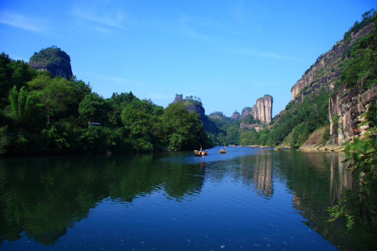
Tràng An Landscape Complex, inscribed in 2014 under all four natural criteria and one cultural criterion — making it Vietnam’s first mixed cultural-natural UNESCO site — lies approximately 120 kilometres south by road, centred on the town of Ninh Bình. The karst landscape here, while geologically related to Hạ Long Bay, is an inland formation: the towers and cave systems sit above rice paddies and connected waterways rather than above sea. Boat tours navigate through cave passages connecting several of the valleys, a journey of 2 to 4 hours covering the most accessible routes. Archaeological excavations in the area have produced evidence of human habitation in rock shelters dating to approximately 30,000 years ago, with stratified records of Hoabinhian culture (a Southeast Asian stone-tool tradition) and subsequent Neolithic occupation. The site includes the ancient capital of Hoa Lư, where the Đinh and Early Lê dynasties established their administrative centres in 968–1009 CE before the capital was moved north to what is now Hanoi. Tràng An gained additional international visibility when its landscape was used as a filming location for the 2017 film Kong: Skull Island.
Phong Nha-Kẻ Bàng caves and the historic corridor south to Hội An 330 km south to Phong Nha — 6 hours by bus from Ninh Bình or 5 hours from Hanoi; a further 100 km south to Huế monuments; 300 km more to Hội An
Phong Nha-Kẻ Bàng National Park in Quảng Bình Province, inscribed by UNESCO in 2003 and extended in 2015, covers 885 square kilometres of karst territory on the Annamite mountain range along the border with Laos. Geologically, the park’s limestone is among the oldest karst in Asia, with formations dated to approximately 400 million years ago. The park contains more than 300 documented caves, including the world’s largest by volume and cross-section: Sơn Đoòng Cave (also written Hang Sơn Đoòng), a passage 5.5 kilometres long with sections reaching 200 metres wide and 150 metres tall. A local hunter, Hồ Khánh, discovered the cave entrance in 1991 but found it impassable due to wind and the sound of an underground river; a team from the British Cave Research Association surveyed it fully in 2009. The cave contains its own localised weather system, including cloud formation above the passages, and two dolines (ceiling collapses) large enough to have allowed the growth of jungle vegetation inside.
Phong Nha Cave itself — the site’s namesake — extends 8 kilometres through the mountain and is navigable by boat for the first 1.5 kilometres of its main passage. During the Vietnam War period (1965–1973), Phong Nha and adjacent caves were used by North Vietnamese forces as supply caches and field hospitals; American bombing campaigns targeted the area and caused documented damage to cave formations. The Phong Nha-Kẻ Bàng area sits directly astride what was the DMZ (demilitarised zone) and the Ho Chi Minh Trail supply corridor, giving it both natural heritage significance and a dense modern historical record.
One hundred kilometres further south, the Complex of Huế Monuments was inscribed in 1993 under criteria (iii) and (iv). The Imperial City of the Nguyễn Dynasty (1802–1945) covers 10 square kilometres on the north bank of the Perfume River and replicates the layout of the Forbidden City in Beijing at a reduced scale, with a citadel, Imperial Enclosure, and Forbidden Purple City arranged along a north-south axis. Huế was the administrative capital of unified Vietnam under the Nguyễn for 143 years and was the location of the Tết Offensive’s most intense urban fighting in February 1968, during which portions of the complex were damaged. Restoration work, supported by UNESCO and the Polish government in the 1980s and 1990s, has stabilised the majority of the standing structures.
Hội An Ancient Town, 300 kilometres south of Phong Nha and roughly 700 kilometres from Hạ Long Bay, was inscribed in 1999 under criteria (ii) and (v). The town functioned as a major international trading port from the 15th through the 19th centuries, with established merchant communities from Japan, China, and the Netherlands operating simultaneously from different quarters. The Japanese Covered Bridge — a two-storey wooden structure built in approximately 1593, with a small Buddhist shrine inside — is the most photographed element, but the listing covers the entire old town of approximately 1.1 square kilometres, including 1,107 registered heritage structures. Trade through Hội An declined after the Thu Bồn River silted up in the 19th century and the port of Đà Nẵng, 30 kilometres north, became the region’s primary harbour. That loss of commercial function is precisely what left the old town architecturally intact.
Between Hạ Long Bay and Hội An, the Citadel of Hồ Dynasty, inscribed in 2011, adds a fourth UNESCO site to the corridor. Located in Thanh Hóa Province approximately 200 kilometres south of Hanoi (and roughly 130 kilometres north of Phong Nha), the citadel was built in 1397–1400 CE on the orders of Hồ Quý Ly, who was then First Minister and effectively the power behind the Trần dynasty throne. Construction used large blocks of green schist — some weighing 20 tonnes each — transported from quarries 50 kilometres distant. The citadel walls, roughly 900 metres on each side and still standing to 5–6 metres, represent the only stone royal citadel in mainland Southeast Asia, a distinction driven by the local geology and a building tradition that favoured fired brick elsewhere in the region.
Practical information
Hạ Long Bay is best visited between October and April, when northeast monsoon winds from the South China Sea bring cooler, drier air. May through September brings southwest monsoon rains, higher humidity, and occasional typhoons; Quảng Ninh Province can receive direct tropical storm impacts in August and September. Water temperatures in the bay range from approximately 17°C in January to 29°C in August. Most international visitors fly into Noi Bai International Airport in Hanoi and transfer to Hạ Long City by road (165 km, about 3 hours by private transfer or 3.5 hours by limousine bus); the Hanoi-Hạ Long expressway, completed in 2018, reduced the journey significantly. Hạ Long City itself is an industrial port town; the bay is accessed by boat from Hòn Gai or Tuần Châu harbours. Overnight cruises of 2–3 nights are the standard format for visiting the bay’s interior areas beyond the day-cruise zone.
Vietnam issues e-visas for citizens of most countries, valid for 90 days, processed through the official Vietnam Immigration portal. The currency is the Vietnamese đồng (VND); major hotels and cruise operators accept USD and credit cards, but small transactions require đồng. The southward corridor from Hạ Long to Hội An is well served by the North-South Railway, with overnight sleeper trains connecting Hanoi to Huế (11 hours) and Đà Nẵng (14 hours); the train does not stop at Phong Nha, for which a bus from Đồng Hới (connected by train) is required.
Frequently Asked Questions
Why was Hạ Long Bay listed by UNESCO twice, and what did the second listing add?
Hạ Long Bay was first inscribed on the UNESCO World Heritage List in 1994, initially under aesthetic criteria (vii) for its exceptional natural beauty — a visual landscape of 1,969 limestone islands in the Gulf of Tonkin. The original inscribed area covered approximately 434 square kilometres of core zone. Six years later, in 2000, UNESCO extended both the geographic boundaries and the criteria of the inscription. The extension added Bái Tử Long Bay immediately to the northeast of the original core zone, expanding the total listed area to 1,553 square kilometres. More significantly, the 2000 inscription added the natural science criteria (viii) and (ix), recognising the site’s geological and geomorphological importance: the karst towers represent a record of limestone platform formation beginning 340–240 million years ago, with the current above-water configuration shaped by multiple Quaternary sea-level oscillations over the past 2 million years, the most recent of which raised sea levels by roughly 120 metres after the last glacial maximum. The site also received additional recognition for its biodiversity, including endemic species in the cave systems. Cat Ba Island, at the western edge of the extended zone, had been designated a UNESCO Biosphere Reserve independently in 2004, adding a third layer of international recognition to the area. The double listing process is unusual at UNESCO but reflects genuine new scientific documentation of values that were not fully articulated in the original nomination.
What is the Citadel of Hồ Dynasty, and how does it connect to the Vietnam UNESCO corridor?
The Citadel of Hồ Dynasty, inscribed in 2011, sits in Vĩnh Lộc District of Thanh Hóa Province, approximately 200 kilometres south of Hanoi and roughly midway along the coastal corridor that connects Hạ Long Bay in the north to Hội An in the south. It was constructed between 1397 and 1400 CE — just three years, an unusually compressed building period for a major royal fortification — under the direction of Hồ Quý Ly, the First Minister of the Trần dynasty who deposed the last Trần emperor in 1400 and declared himself founder of the short-lived Hồ dynasty. The citadel served as Vietnam’s capital for only seven years: the Hồ were overthrown by a Ming Chinese invasion in 1407, and Vietnam’s capital subsequently returned north. The outstanding feature that distinguished the citadel for UNESCO is its construction material: large blocks of green schist (a metamorphic rock), quarried 50 kilometres distant and assembled without mortar using a dry-stone interlocking technique. Blocks at the base of the main gates weigh up to 20 tonnes each. This makes it the only stone-walled royal citadel in mainland Southeast Asia; comparable fortifications in the region — from Huế to Angkor — were built primarily in fired brick. The four city gates, particularly the South Gate with its triple-arched opening framed by massive schist lintels, are the most intact surviving elements. The surrounding archaeological landscape includes the remains of the Hồ capital’s road network and administrative buildings.
How do you actually get from Hạ Long Bay to the other UNESCO sites along the Vietnam coast?
The most practical approach depends on how many sites you intend to visit and your time constraints. Hạ Long Bay to Hanoi is a 165-kilometre road transfer of approximately 3 hours; Hanoi is the main transport hub for connecting southward. From Hanoi, the North-South Railway (Thống Nhất railway line) runs the full length of the country to Ho Chi Minh City, with major stops at Ninh Bình (for Tràng An, 2 hours), Huế (11 hours overnight), Đà Nẵng (14 hours, for Hội An, 30 km onward by road), and Đồng Hới (for Phong Nha, then 45 km by bus or taxi). Budget airlines including VietJet Air and Vietnam Airlines operate domestic routes from Hanoi to Huế, Đà Nẵng, and Đồng Hới; flight times are 1 to 1.5 hours. Phong Nha-Kẻ Bàng is the most logistically isolated site: the closest town with accommodation is Phong Nha village, 50 kilometres from Đồng Hới, reachable by local bus or taxi. The underground Phong Nha cave boat tour departs from the park entrance; Sơn Đoòng Cave requires a multi-day guided expedition with a single licensed operator (Oxalis Adventure) and advance booking of 6 to 12 months. Tràng An near Ninh Bình works well as a half-day stop between Hanoi and the southward train journey, with boat tours of 2 to 4 hours covering the main passages.