The Historic District of Old Québec, inscribed as a UNESCO World Heritage Site in 1985, encompasses the fortified core of Québec City — the only walled city remaining in North America north of Mexico — along with the two contrasting urban quarters that developed on either side of the cliff formed by the Cap Diamant promontory. Founded in 1608 by Samuel de Champlain as a French trading post commanding the narrowing of the Saint Lawrence River, Québec City is the oldest continuously inhabited European settlement in what is now Canada. The walls, the cliff, the Upper Town around the Château Frontenac and the Lower Town around Place Royale encode 400 years of French, British and Canadian history in a geographically legible form.
The cliff, the walls and two contrasting quarters Québec City, 250 km northeast of Montréal
Québec City’s urban geography was shaped from the beginning by the Cap Diamant cliff, a promontory of hard Precambrian rock that rises roughly 98 metres above the Saint Lawrence at the point where the river narrows — “Québec” is commonly said to derive from an Algonquin word meaning “where the river narrows.” Champlain’s original 1608 settlement was at the base of the cliff, on the flat ground beside the river. The strategic advantages of the high ground above were apparent from the outset, and by the mid-17th century the administrative, religious and military functions of the colony had migrated to the Upper Town on the cliff top, while the Lower Town remained the commercial and mercantile quarter.
The fortifications that define Old Québec were built progressively over two centuries. The original French palisades of the 17th century were replaced and extended by stone walls beginning in the 1690s, when the threat of British attack from New England became acute. After the British Conquest of 1759, military engineers of the British Army — particularly following the War of 1812 and the perceived threat from the newly independent United States — undertook a systematic strengthening and extension of the walls. The current circuit of stone walls, with its four surviving gates (Saint-Louis, Kent, Saint-Jean and Prescott), is largely the product of British military engineering between 1820 and 1850. The walls are 4.6 kilometres in circumference and remain largely intact, making them unique in North America as a functioning demonstration of 19th-century military fortification engineering.
The Upper Town (Haute-Ville) on the cliff top contains the most immediately recognisable structures of Québec City. The Citadelle, a star-shaped fortification completed between 1820 and 1850 on the highest point of Cap Diamant, remains an active Canadian Forces base and the official residence of the Governor General of Canada in Québec. The ceremonial Changing of the Guard takes place here in summer. Directly below the Citadelle, the Plains of Abraham — now a public park administered by the National Battlefields Commission — mark the site of the decisive military engagement of 13 September 1759.
Dominating the Upper Town skyline is the Château Frontenac, a hotel built in 1893 to the designs of the American architect Bruce Price for the Canadian Pacific Railway. The CPR commissioned a chain of grand hotels along its transcontinental rail route to generate passenger traffic; the Château Frontenac, with its turreted silhouette resembling a French château adapted at vast scale to the Canadian landscape, became the most commercially successful of these and rapidly acquired the status of an architectural emblem of Canada. It has been described as the most photographed hotel in the world. The building is still operating as a hotel (Fairmont Château Frontenac) and remains central to the Upper Town’s urban composition.
Lower Town, Place Royale and the battle that changed North America Old Québec’s cliff-base quarter
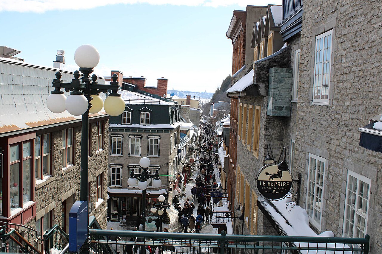
The Lower Town (Basse-Ville) at the base of the Cap Diamant cliff is reached from the Upper Town by the funicular (in operation since 1879, rebuilt several times since) or by the steep Escalier Casse-Cou — “Breakneck Staircase” — a wooden staircase that has connected the two levels since the 17th century. The Lower Town’s character is dense, commercially textured and considerably older in fabric than the Upper Town, with a concentration of stone buildings from the 17th and 18th centuries that survived the bombardment of 1759 and subsequent urban development to form the most coherent ensemble of early North American urban architecture surviving anywhere on the continent.
Place Royale, at the centre of the Lower Town, was the original marketplace of New France and remained the commercial heart of Québec City through the French period. It is surrounded by stone merchants’ houses from the late 17th and 18th centuries, many restored in the 1970s and 1980s. On the south face of the square, the Fresque des Québécois — a large trompe-l’œil mural completed in 1999 — covers an entire building facade with painted figures representing key figures in Québec’s history, from Champlain and Frontenac to 20th-century cultural personalities, depicted looking out from painted windows and balconies onto the real square below.
Notre-Dame-des-Victoires church, facing Place Royale, was built in 1688 — damaged in the bombardment of 1759 and subsequently restored — and is the oldest stone church in North America. Rue du Petit-Champlain, running along the cliff base south of Place Royale, has a claim to being the narrowest commercial street in North America; it is lined with 17th and 18th-century stone buildings and is today a principal concentration of boutiques, galleries and restaurants in the historic district.
The battle of 13 September 1759 that determined the future of the city — and, effectively, of North America — lasted approximately 15 minutes on the plateau above the cliff. The British commander, General James Wolfe, had spent the summer of 1759 attempting to find a way past the French defences commanded by the Marquis de Montcalm. On the night of 12–13 September, British troops scaled the cliff at a point called L’Anse-au-Foulon, using a lightly guarded path, and deployed in battle formation on the flat plateau of the Plains of Abraham before dawn. The engagement that followed was brief and decisive: French troops, drawn out of the city’s defences, were routed. Both Wolfe and Montcalm died of wounds received during or shortly after the battle — Wolfe on the field, Montcalm the following morning. Under the subsequent Treaty of Paris (1763), France ceded New France to Britain, ending 150 years of French colonial rule in Canada and reshaping the demographic and political future of the continent. The French-speaking majority that Québec City retains to this day — approximately 95% of the city’s population uses French as its first language — is a direct consequence of the post-Conquest accommodation between the British administration and the established French-Canadian population.
Practical information
Old Québec (Vieux-Québec) is located in Québec City, Québec Province, Canada, approximately 250 km northeast of Montréal. The historic district is compact and largely walkable; the walls circuit can be walked in its entirety in approximately 1.5–2 hours. VIA Rail operates frequent passenger train services between Montréal Centrale and Québec City Palais station (journey time approximately 3 hours 20 minutes); bus services are also available. Jean Lesage International Airport, approximately 16 km from the city centre, handles domestic and some international connections. The Citadelle and Château Frontenac are both open for guided visits (entrance fees apply at the Citadelle; the hotel’s public areas are accessible without charge). Notre-Dame-des-Victoires church and Place Royale are freely accessible. The Plains of Abraham park is free to visit. Winter (December to March) brings significant snow and temperatures regularly below −15°C; the city’s famous Winter Carnival (Carnaval de Québec), held in February, is a major draw. Summer (June to September) is the principal tourist season, with street festivals and open-air programming throughout the historic district. French is the working language of the city; English is widely understood in tourist contexts.
Frequently Asked Questions
What makes Old Québec unique among North American cities?
Old Québec’s combination of surviving fortification walls, intact 17th and 18th-century urban fabric, and documented continuity of European settlement since 1608 is without parallel in North America north of Mexico. Several factors account for this unusual preservation. The stone construction that characterised Québec City’s major buildings from an early period — partly a practical response to the fire risk of wooden construction in a densely built urban setting, partly a reflection of the French colonial administration’s investment in permanent infrastructure — gave the buildings greater physical durability than the timber-framed colonial buildings that were the norm in the British colonies to the south. The bombardment of 1759 was destructive but not total; the Lower Town in particular retained much of its 17th and 18th-century fabric. The relative economic stagnation of the city through the late 19th and early 20th centuries, which might in other circumstances be considered a disadvantage, had the preservation effect of reducing the pressure for large-scale urban renewal that stripped historic fabric from many more economically dynamic North American cities during the same period. The city’s French-speaking majority maintained a strong cultural identification with the historic built environment as a physical expression of a distinct identity within anglophone Canada — a factor that produced active heritage advocacy well before international designation frameworks were available. The UNESCO inscription of 1985, one of the earliest such inscriptions in the Americas, formalised international recognition of what local and national heritage bodies had been working to protect for decades.
What happened at the Battle of the Plains of Abraham, and why did it matter?
The Battle of the Plains of Abraham, fought on 13 September 1759, was the decisive military engagement of the Seven Years’ War in North America — the conflict that determined whether the future of the continent would be primarily French or British in language, law and institutional character. The British commander Major-General James Wolfe had commanded a besieging force outside Québec City since June 1759, attempting without success to force the French commander the Marquis de Montcalm to fight on open ground. On the night of 12–13 September, Wolfe’s forces used intelligence about a lightly guarded path up the cliff at L’Anse-au-Foulon to scale Cap Diamant before dawn and form battle lines on the flat plateau of the Plains of Abraham to the west of the city walls. Montcalm, rather than remaining within the city’s defences and waiting for the British to exhaust themselves, chose to engage in the open field. The battle that followed lasted approximately 15 minutes; the French line broke, and Québec City surrendered to British forces four days later. Both commanders died of wounds: Wolfe was shot on the field and died within the hour; Montcalm, wounded during the engagement, died the following morning. The fall of Québec led directly to the fall of Montréal in 1760 and, under the Treaty of Paris signed in February 1763, France ceded New France — the vast territory encompassing modern Québec, Ontario, and the Mississippi Valley — to Great Britain. The immediate consequence was the end of French imperial presence in continental North America; the longer-term consequence was the establishment of a French-speaking majority population under British governance, the accommodation that produced the distinctive character of modern Québec.
Who built Château Frontenac, and why does it look like a French château?
The Château Frontenac was designed by the New York-born architect Bruce Price (1845–1903) and built for the Canadian Pacific Railway between 1892 and 1893, opening in 1893. Price was commissioned to design a sequence of grand hotels along the CPR’s transcontinental route — the railway company’s strategy was to generate passenger traffic by placing destination hotels at intervals across the Canadian landscape, encouraging wealthy travellers to make the transcontinental journey as a tourism experience rather than purely as a means of getting from one place to another. Price’s design for the Québec property drew deliberately on the forms of the Loire Valley château: the steep copper roofs, the corner towers, the elaborate dormer windows and the general verticality of the composition were intended to evoke a specifically French historical tradition appropriate to a city founded by France and retaining a French-speaking majority. The building’s position on the edge of the Cap Diamant cliff, with the Saint Lawrence River visible below, gave the towers and roofline a dramatic skyline presence that made the architectural strategy extremely effective. The CPR expanded the original building considerably in 1897 and again in the early 20th century; the current structure is substantially larger than Price’s original design, but retains its essential character. The claim that it is the world’s most photographed hotel is commercially asserted rather than statistically verified, but its position at the top of the Old Québec skyline — visible from the river, from the Lower Town and from the Lévis shore across the Saint Lawrence — has made it the dominant image of the city for over 130 years. It continues to operate as the Fairmont Château Frontenac.