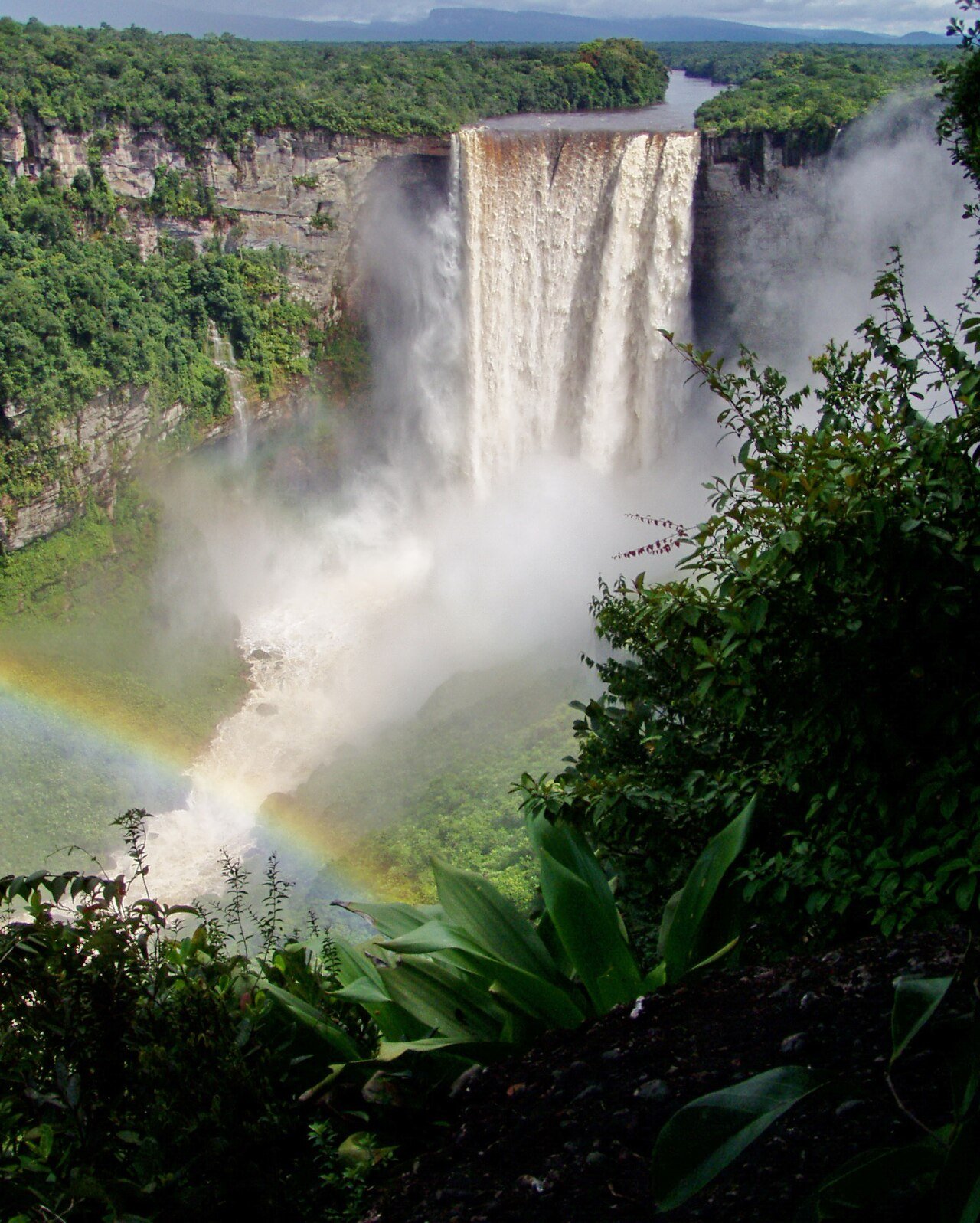
Guyana has no UNESCO World Heritage Sites. The most significant natural heritage site is Kaieteur Falls in Kaieteur National Park (approximately 250 km southwest of Georgetown) — one of the world’s most powerful waterfalls, located in intact Amazonian rainforest on the Pakaraima plateau. The nearest inscribed UNESCO site is the Central Suriname Nature Reserve, approximately 700 km east in neighbouring Suriname. From Cultural Heritage Online.
Kaieteur Falls and the Pakaraima Plateau
Kaieteur Falls is formed where the Potaro River drops 226 metres over the edge of the Pakaraima sandstone plateau into a narrow gorge below — making it one of the most powerful waterfalls in the world by the combination of height and volume. The falls discharge approximately 663 cubic metres of water per second during the wet season. Unlike Niagara Falls (which is wider and higher volume but only 57 metres high) or Angel Falls in Venezuela (highest at 979 metres but very low volume), Kaieteur combines both significant height and significant volume, making it widely regarded as the world’s most powerful waterfall per square metre of crest.
The plateau surrounding Kaieteur Falls is covered by tepui ecosystems — the ancient sandstone table mountains of the Guiana Shield, one of the world’s oldest geological formations (Precambrian basement rock, approximately 1.7 billion years old). The tepui vegetation supports extremely high levels of endemism, including the golden rocket frog (Anomaloglossus beebei), which breeds exclusively in the water pools that accumulate in the bromeliad plants growing on the cliff faces near the falls. Several endemic plant and animal species have been described from the Kaieteur plateau that are found nowhere else on earth. Kaieteur National Park was established in 1929 and covers approximately 627 km².
Central Suriname Nature Reserve (Nearest UNESCO Site) ~700 km east in Suriname — overland via Berbice River or flight to Paramaribo
The Central Suriname Nature Reserve (inscribed 2000), approximately 700 km east of Georgetown across the Suriname border, covers approximately 1.6 million hectares of pristine Amazonian rainforest in the interior of Suriname, constituting approximately 10% of Suriname’s total land area. The site protects the upper watersheds of several major rivers and an essentially undisturbed sample of the Guiana Shield highland flora and fauna, including large populations of jaguar, giant otter, black spider monkey, and harpy eagle. The Raleighvallen Falls and the Tafelberg (a prominent sandstone tepui) are within the reserve. The site was established with support from Conservation International and the United Nations Foundation.
Getting there from Georgetown: Kaieteur Falls: small plane from Cheddi Jagan International Airport to Kaieteur airstrip (approximately 35 min); organised day trips are the most common access. Central Suriname Nature Reserve: fly to Paramaribo, Suriname (approximately 1.5 hr), then boat/helicopter into the reserve interior. Allow: Kaieteur: half to full day (day-trip possible). Central Suriname NR: minimum 3–5 days. Best for: Waterfall heritage; Amazonian rainforest ecology; tepui biodiversity.
Frequently Asked Questions
Does Guyana have any UNESCO World Heritage Sites?
No. Guyana has no inscribed UNESCO World Heritage Sites. Kaieteur National Park (containing Kaieteur Falls and pristine tepui ecosystems) is the most frequently cited candidate for UNESCO inscription, and there have been periodic discussions about a nomination. The Iwokrama Forest (a 371,000-hectare protected rainforest block in central Guyana, managed by the Iwokrama International Centre for Rainforest Conservation) has also been discussed as a candidate. Neither has been formally nominated.
Why is the Guiana Shield significant for biodiversity?
The Guiana Shield is one of the world’s oldest geological formations — a Precambrian crystalline basement rock complex exposed by billions of years of erosion, covering approximately 1.7 million km² across Guyana, Suriname, French Guiana, Venezuela, and northern Brazil. Because the Shield has been continuously above sea level for approximately 1.7 billion years (unlike the adjacent Amazon basin, which has been inundated by shallow seas multiple times), it has served as a biological refuge for ancient plant and animal lineages and as an evolutionary laboratory for the development of endemic species. The tepui (table mountain) ecosystems on the ancient sandstone layers above the Shield basement support extremely high rates of endemism — some tepuis have 40–50% of their plant species found nowhere else.
What is the history of Georgetown and Guyana’s colonial heritage?
Georgetown (originally Stabroek) was founded by the Dutch in approximately 1781 and developed as the capital of the colony of British Guiana after the British took control in 1796 (formalized by the Treaty of Paris 1814). The city is laid out on a Dutch colonial grid of wide streets and canals (the streets are above sea level, but the city sits below sea level and requires continuous drainage). Georgetown’s surviving colonial architecture — wooden Victorian buildings on stilts with louvred verandahs and ornate white woodwork, including St George’s Cathedral (1892, one of the tallest wooden buildings in the world at 43 metres) and the Law Courts (1887) — reflects the British colonial period. Guyana achieved independence in 1966 and is the only English-speaking country in South America.
How powerful is Kaieteur Falls compared to other famous waterfalls?
Kaieteur Falls is unique in combining significant height (226 m) with significant volume (approximately 663 m³/s average discharge). Niagara Falls is higher volume (approximately 2,400 m³/s) but only 57 metres high. Victoria Falls (Zimbabwe/Zambia) is larger horizontally (1.7 km wide, 108 m high) and has higher volume at peak, but is lower. Angel Falls in Venezuela is far higher (979 m) but has much lower volume — a thin ribbon during dry season. Kaieteur’s combination of single-drop height and volume makes it the most powerful waterfall in the world when measured by the product of height times volume. The setting — surrounded by untouched Amazon rainforest, with no roads or tourist infrastructure visible — adds to the impact.
Sources
- S1 — Daly, Vere T. A Short History of The Guyanese People. Macmillan, 1975. ISBN 978-0-333-18304-5.
- S2 — Roopnarine, Lomarsh. The Indian Caribbean: Migration and Identity in the Diaspora. University Press of Mississippi, 2018. ISBN 978-1-4968-1588-0.
Spotted an error? Write to editorial@culturalheritageonline.com and we correct it the same day.