
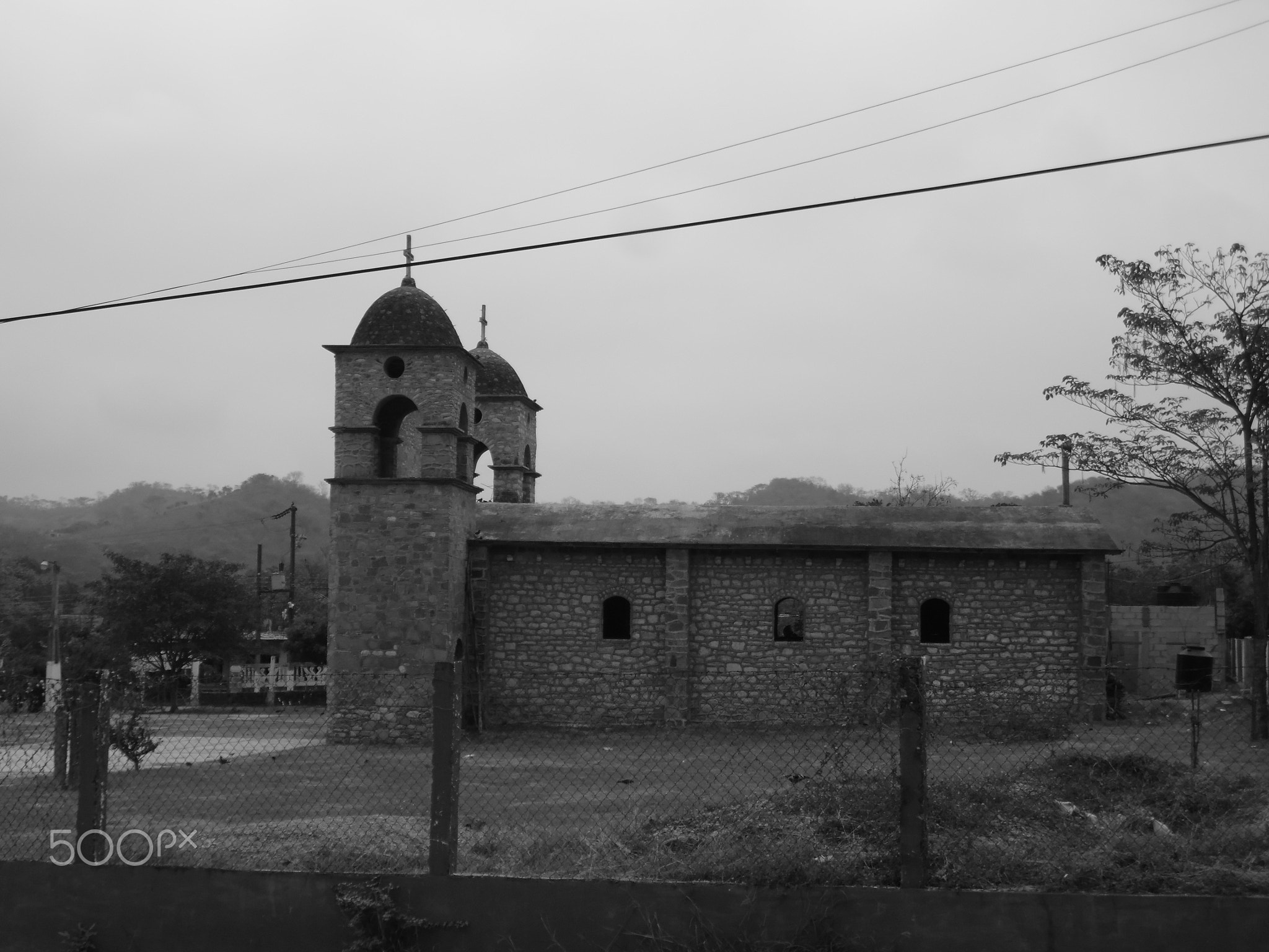
No metropolitan area on earth layers so many millennia of civilisation into so compact a radius: Mexico City and its surroundings contain four UNESCO World Heritage inscriptions encompassing Aztec chinampas, the largest pre-Columbian city in the Americas, and a ring of fortress-churches built to evangelise a continent. From Cultural Heritage Online.
Historic Centre of Mexico City Within the city — no travel required
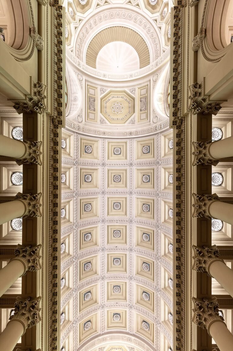
The Zócalo — formally the Plaza de la Constitución — is one of the largest public squares in the world, and everything around it was built on top of something older. The Metropolitan Cathedral, whose construction began in 1573 and stretched across three centuries, rises on the north side; the Palacio Nacional closes the east flank and houses Diego Rivera’s extraordinary 1929–35 mural cycle charting Mexican history from pre-Hispanic times to the revolution. Underfoot, the entire grid follows the cardinal orientation of Tenochtitlan, the Aztec capital that Spanish engineers attempted to erase and never quite could.
The Templo Mayor makes that impossibility literal. The twin pyramid at the heart of Tenochtitlan was discovered in 1978 when electrical workers cut through a stone disc depicting the dismembered moon goddess Coyolxauhqui. Excavations since then have exposed multiple superimposed building phases; the exposed stonework sits in an open pit beside the cathedral, close enough to touch the boundary between two civilisations. UNESCO inscribed the Historic Centre in 1987 for the way colonial urban planning was superimposed on, and could not entirely suppress, the Aztec urban fabric beneath it.
The neighbourhood rewards slow walking. The streets immediately north of the Zócalo contain colonial palaces converted into cultural centres, markets selling produce that would have been recognisable to Aztec merchants, and the Torre Latinoamericana whose observation deck frames the valley’s full extent on clear days.
Getting there: Metro Line 2, Zócalo station, exits directly onto the plaza. Allow: Half a day minimum; a full day to include the Templo Mayor museum. Best for: First-time visitors, urban history, art history.
Xochimilco 30 km south — 45–60 min by metro and light rail
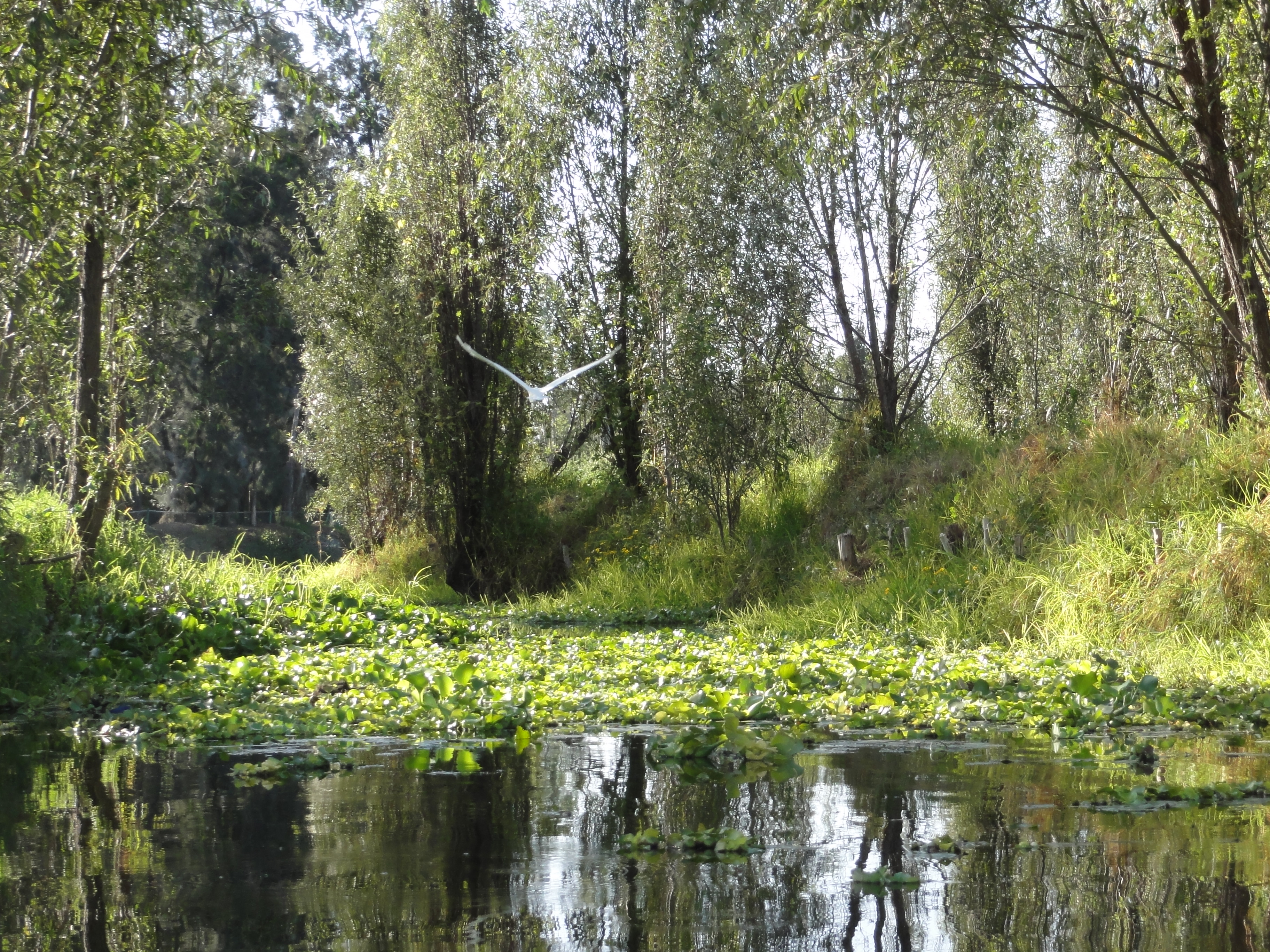
When the lake that once covered the Valley of Mexico was drained by colonial engineers, Xochimilco’s canal network survived as the only functioning remnant of the pre-Hispanic agricultural system that fed Tenochtitlan. The chinampas — artificially constructed planting islands anchored to the lakebed with willow roots — still produce vegetables and flowers; the canals between them are navigated by trajineras, flat-bottomed wooden boats whose painted wooden arches carry the names of their owners.
On weekends the embarcaderos fill with families, and the canal traffic becomes a slow procession of colour and cumbia. On weekday mornings the atmosphere shifts: the flower market stalls on the canal banks open early, herons stand in the shallows, and the water carries the smell of vegetation rather than sunscreen. UNESCO inscribed Xochimilco in 1987 alongside the Historic Centre, recognising the chinampas as a living continuation of Aztec hydraulic agriculture — the only surviving example of its kind in the world.
The axolotl, the neotenic salamander that became a global symbol of ecological fragility, is native to these canals. Conservation zones in the southern section of the network restrict boat access in order to protect the remaining population; guided ecological visits can be arranged through the local ejido.
Getting there: Metro Line 2 to Tasqueña, then Tren Ligero (light rail) to Xochimilco terminal. Taxis and ride-shares also available. Allow: 2–3 hours on the water; half a day with the markets. Best for: Families, ecological interest, photographers.
Pre-Hispanic City of Teotihuacan 50 km northeast — 1 hr by road
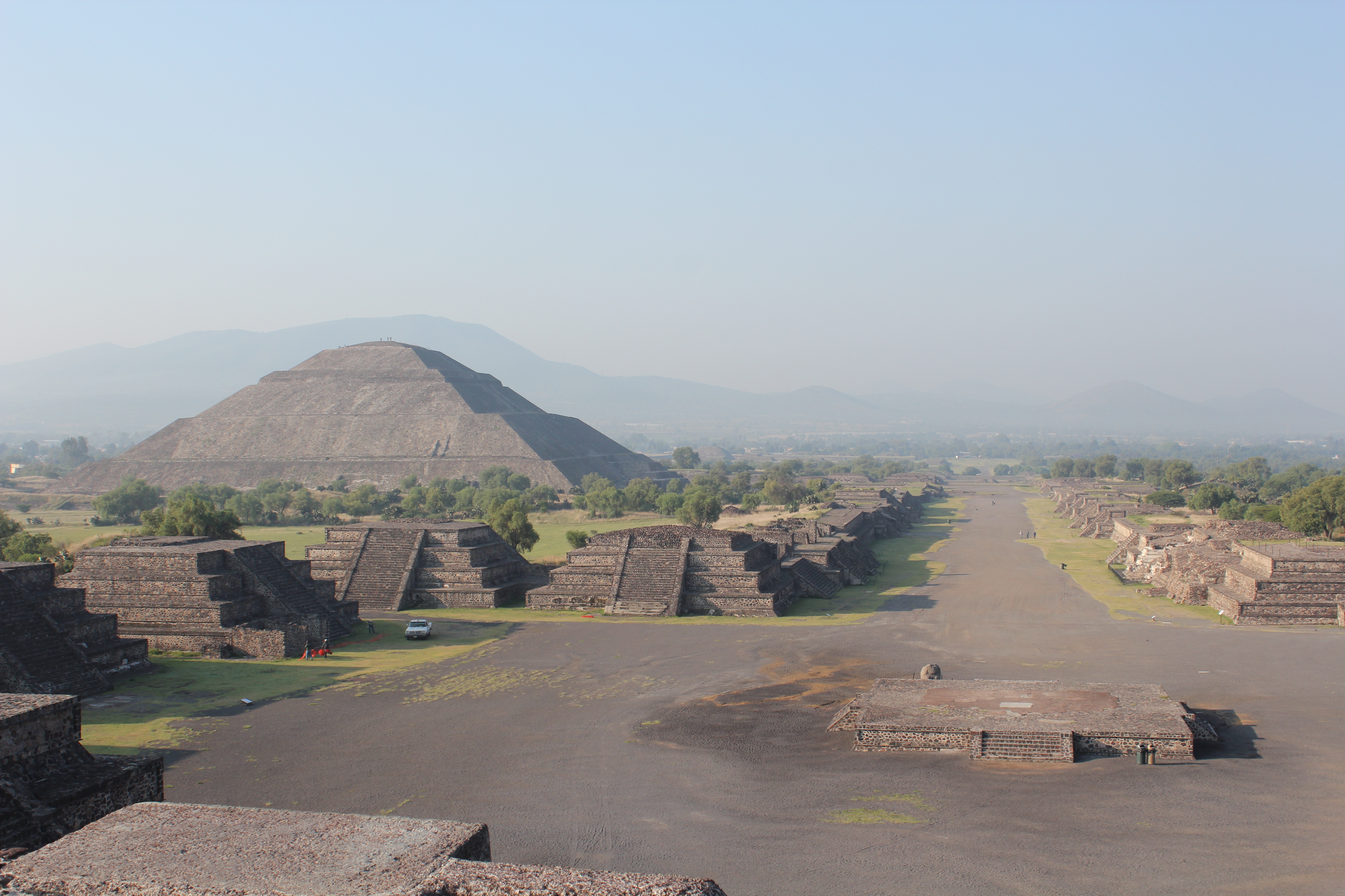
At its peak in the fourth century AD, Teotihuacan housed roughly 125,000 people and was among the largest cities on earth. The Avenue of the Dead runs four kilometres from the Pyramid of the Moon at its northern terminus through a processional landscape of platforms and apartment compounds. The Pyramid of the Sun, at 65 metres, is the third largest pyramid in the world by volume; from its summit the valley grid of the modern city is visible to the southwest, and on clear mornings Popocatépetl’s snowcap catches the early light to the south.
The builders of Teotihuacan remain unidentified. The city was deliberately abandoned around 550 AD — possibly following internal conflict or environmental stress — and by the time the Aztecs arrived centuries later, they found ruins already old enough to mythologise. They named the site “the place where the gods were created” and incorporated it into their cosmology. UNESCO inscribed Teotihuacan in 1987 for its exceptional urban planning, monumental architecture, and the influence its iconography exercised over the entire Mesoamerican cultural sphere.
The Temple of Quetzalcoatl, at the southern end of the Avenue of the Dead, carries the most detailed sculptural programme on the site: alternating feathered serpent heads and rain deity masks project from talud-tablero facades at intervals that originally would have been painted in vivid colours. The on-site museum houses objects from the archaeological excavations and explains the current state of scholarly debate about the city’s ethnic composition and political organisation.
Getting there: Direct buses depart every 30 minutes from Terminal Central del Norte (Metro Autobuses del Norte, Line 5). Organised tours from the Historic Centre are widely available. Allow: 4–5 hours on site; a full day if you include the museum. Best for: Archaeological interest, history, sunrise visits.
Earliest 16th-Century Monasteries on the Slopes of Popocatépetl 60–150 km southeast — 1.5–2.5 hrs by road
In the decades immediately following the Spanish conquest, Augustinian and Dominican friars constructed a ring of monasteries on the flanks of Popocatépetl to serve the mass evangelisation of indigenous populations. The buildings they created were unlike any ecclesiastical architecture in Europe: thick-walled, fortress-like structures with enormous open-air atria designed to hold thousands of recently baptised worshippers who had no frame of reference for enclosed churches. Corner chapels — known as posas — punctuated each atrium, functioning as stations in outdoor processions adapted from indigenous ceremonial practice.
The fourteen monasteries inscribed by UNESCO in 1994 — including Acolman, Actopan, Yecapixtla, and Tlayacapan — represent a distinct architectural type that emerged nowhere else: a direct response to the logistical and theological challenge of converting a continent in a single generation. The frescoes inside many of the churches survive in remarkable condition, depicting a hybrid visual language that blended European iconographic conventions with indigenous symbolic forms in ways that neither tradition had anticipated.
The route also passes through landscapes of considerable drama: active fumaroles from Popocatépetl are often visible from the road, and the colonial towns that grew around the monasteries retain historic centres largely intact.
Getting there: Best accessed by hire car or organised day tour from Mexico City; public buses reach the larger towns (Cuernavaca, Cuautla) with local connections. Allow: A full day for a circuit of 3–4 monasteries; two days to cover the full inscription. Best for: Art history, religious architecture, road-trip itineraries.
Frequently Asked Questions
How many UNESCO World Heritage Sites are near Mexico City?
There are four UNESCO World Heritage inscriptions within day-trip distance of Mexico City: the Historic Centre of Mexico City and Xochimilco (1987, a joint inscription covering two areas within the city), the Pre-Hispanic City of Teotihuacan (1987, 50 km northeast), and the Earliest 16th-Century Monasteries on the Slopes of Popocatépetl (1994, 60–150 km southeast). No other major city in the Americas has a comparable density of World Heritage designations within a two-hour radius.
How do you get to Teotihuacan from Mexico City?
The easiest independent option is the direct bus service from Terminal Central del Norte, which departs approximately every 30 minutes and takes around one hour. The terminal is served by Metro Line 5 (station: Autobuses del Norte). Arrive early — the site opens at 9:00 and the Pyramid of the Sun is significantly more comfortable before midday heat. Organised tours that include hotel pickup are widely available and typically cost more but save navigation time.
What is the best time of year to visit the Mexico City UNESCO sites?
November through February offers the most reliable weather for outdoor sites: Teotihuacan and the monastery circuit are most comfortable in the dry season, and the Valley of Mexico’s notorious air quality is typically better in winter. March through May brings clear skies but increasing heat; the rainy season (June–September) produces afternoon thunderstorms that can cut short outdoor visits but also clears the air dramatically after rain. Xochimilco is best visited in the morning regardless of season, before weekend crowds arrive at the embarcaderos.
What civilisation built Teotihuacan, and what happened to it?
The identity of Teotihuacan’s founders remains genuinely unknown — one of the most significant open questions in Mesoamerican archaeology. DNA and isotope analysis of burials suggests a multi-ethnic population that may have included migrants from the Gulf Coast and Oaxaca. The city reached its maximum extent and population around 400 AD, then experienced what appears to have been a deliberate destruction of its civic buildings around 550 AD, followed by gradual depopulation. The Aztecs, arriving in the region centuries later, found the site already ancient and attributed its construction to the gods — an interpretation that gave the site its current name.


.jpeg)

.jpg)