
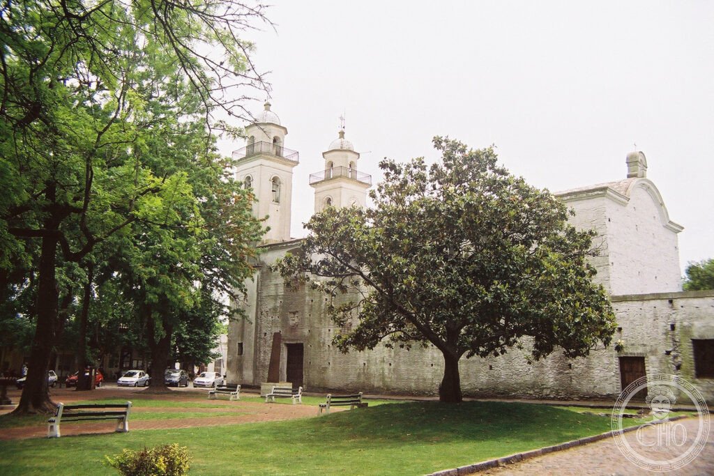
A small riverside town where Portuguese and Spanish colonial architecture sit side by side on the same cobbled streets, the result of nine changes of sovereignty over a century and a half. Its historic quarter, barely a quarter of an hour’s walk across, has kept its original stonework and its river light largely intact.
At a glance
Colonia del Sacramento was founded on 20 January 1680 by Manuel Lobo, Governor of Rio de Janeiro, as a Portuguese outpost on the northern bank of the Río de la Plata, facing Spanish Buenos Aires across the water. Between 1680 and 1828 the town changed hands nine times between the Portuguese and Spanish empires before becoming part of the newly independent Republic of Uruguay.
Its position made it a key point for smuggling goods into the Spanish colonial system, with Portuguese, British and Dutch merchants using the town to bypass Spanish trade restrictions. The historic quarter, the Barrio Histórico, preserves this layered history in its street plan and architecture.
Key facts
- Founded: 1680, by Manuel Lobo, Governor of Rio de Janeiro.
- Sovereignty: changed hands nine times between Portugal and Spain between 1680 and 1828.
- Historic quarter: the Barrio Histórico covers around 50 hectares and can be crossed on foot in a short walk.
- Calle de los Suspiros: the Street of Sighs retains its original 17th-century cobblestones.
- Heritage status: inscribed as a UNESCO World Heritage Site in 1995, reference 747.
History
The Treaty of San Ildefonso in 1777 settled the long dispute between Portugal and Spain over Colonia, ceding the town to Spain in exchange for Portuguese territorial gains in Brazil. The Portuguese were expelled for the last time, and Spain subsequently strengthened the town’s defences.
Uruguay became independent in 1828, established as a buffer state between Argentina and Brazil, with Colonia as the first city of the new republic. Once its strategic value as a contested frontier post disappeared, the town settled into a quieter existence as a provincial river port.
What you see
The Plaza Mayor, laid out to the original 1680 plan, is bordered by the Portuguese house once used by the Viceroy, the Governor’s House, the ruins of a church and the Museo Municipal, with views down to the Río de la Plata. The Portón de Campo, an 18th-century fortified gate flanked by bastions, survives as the most substantial remnant of the town’s defensive walls, with a partially reconstructed moat and drawbridge.
The Calle de los Suspiros runs from the Plaza Mayor down towards the river, a narrow lane of original cobblestones lined with low colonial houses and flowering hedges. Throughout the Barrio Histórico, buildings show the mixed heritage of the town: some purely Portuguese in style with azulejo tiles, whitewash and low sills, others Spanish with carved stone surrounds and iron grilles, and many a hybrid of the two.
Practical information
- Access to the old town: entry to the Barrio Histórico is free; a combined ticket covers the town’s small museums.
- Best time to visit: the Southern Hemisphere summer, December to March, offers the most settled weather.
- Footwear: the original cobblestones are uneven, so flat, sturdy shoes are advisable.
- Current schedules and fares: check the operator’s official site directly, as ferry and museum arrangements change.
Getting there
Colonia del Sacramento is reached from Buenos Aires by high-speed ferry across the Río de la Plata, a crossing operated by Buquebus, making it a popular excursion for visitors based in Argentina. From Montevideo, it lies around 180 kilometres away and can be reached by bus or car in roughly two and a half hours. The historic quarter is a short walk from the ferry terminal.
Nearby
- Montevideo — about 180 km east, reachable by bus in roughly two and a half hours; Uruguay’s capital, with the walkable Ciudad Vieja, its Art Deco and Eclectic Revival buildings, the Mercado del Puerto and a long coastal promenade known as the Rambla.
- Carmelo — about 70 km east, around an hour by bus; the country’s principal wine region, known for tannat grapes and developed wine tourism, with a bridge locally said to be haunted.
Sources
- Wikipedia
- UNESCO
Find it on the map
See this place and what’s around it →📷 Become a Cultural Heritage Online photographer
Share your photos of places: they stay published under your name as the author. The more they're seen, the more you get noticed — and soon a contest will reward the most appreciated photos.
Log in or sign up free to add a photo