
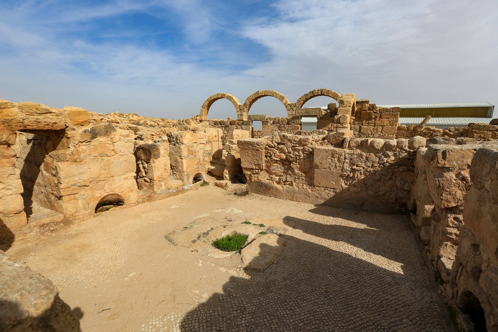
A Roman military camp turned Byzantine and early Islamic town in the Jordanian steppe, harbouring the world’s largest surviving late antique mosaic map and one of the last intact Stylite columns on Earth.
At a glance
Some 30 kilometres southeast of Madaba, the site of Umm ar-Rasas — identified with the biblical Mephaath and known in Byzantine times as Kastron Mefa’a — preserves a concentration of floor mosaics unmatched outside Ravenna. A series of churches, mostly dating from the 5th to 8th centuries CE, retain polychrome pavement tessellation depicting birds, fish, hunting scenes, and entire cities in miniature. The crown of the site, the Church of Saint Stephen (c. 718 CE), contains a complete mosaic floor map of 28 cities of the Nile Delta, the Dead Sea region, and Transjordan — each labelled in Greek — making it the largest and most detailed late antique decorative map in the world. Beyond the walled camp (the kastron) stands a 15-metre free-standing stone column that served as the platform for a Stylite monk, one of only three or four such structures surviving intact worldwide and the only one in Jordan.
Key facts
- UNESCO inscription: 2004 (World Heritage Site)
- Period: c. 1st century CE – 9th century CE (Roman through Abbasid)
- Location: Madaba Governorate, central Jordan
- Key monument: Church of Saint Stephen and its regional mosaic map (c. 718 CE)
- Mosaic map: 28 cities depicted; largest surviving late antique map in the world
- Stylite column: 15 metres high; platform intact; one of three or four surviving worldwide
- Excavation status: Largely unexcavated
History
The site’s continuous occupation spans roughly a millennium. Under Rome, Kastron Mefa’a was a military post along the eastern limes, the frontier road system protecting the province of Arabia. Byzantine Christian communities transformed the camp into a religious centre, constructing at least seven churches between the 5th and 8th centuries CE. The site flourished under early Islamic rule — the Saint Stephen mosaic was laid in 718 CE, during the Umayyad period — demonstrating an unexpected continuity of Christian artistic patronage immediately after the Islamic conquest. Occupation tapered off by the late 9th century, leaving structures partly buried beneath desert sediment that, paradoxically, preserved the mosaics in extraordinary condition.
What you see
The site divides into two areas. Inside the rectangular kastron walls stand the main churches, including the Church of Saint Stephen. Its mosaic floor frames a landscape panorama: Nile Delta cities along the bottom edge, identified with Greek labels, are shown as walled towns with towers; Dead Sea cities and Transjordanian settlements fill the centre. The level of topographical detail suggests the mosaic served as a working geographical reference as much as a decorative scheme.
Outside the walls, the Stylite column rises in open desert. The shaft is constructed from fitted sandstone blocks tapering toward a flat summit platform. No fixed ladder exists — the monk ascended by rope. The original wooden or woven dwelling atop the platform is gone, but the stone base of a possible railing is still faintly visible.
The mosaics in detail
The Saint Stephen mosaic is the centrepiece, but not the only significant pavement. The churches of Bishop Sergius and of the Lions retain floor sections with hunting and pastoral imagery. A recurring motif is the personification of cities as architectural silhouettes topped by crenellated towers with figures emerging from gates — a classical convention adapted to Christian iconography. The tesserae are predominantly limestone, with glass and stone inserts providing colour. Conservation work since the 1980s under the Department of Antiquities of Jordan has stabilised most surviving surfaces.
Practical information
- Opening hours: Daily, approximately 08:00–17:00 (hours vary seasonally)
- Entry: Fee applies; combined ticket with Madaba Archaeological Park available
- Facilities: Visitor centre, basic shelters; no food vendor — bring water
- Photography: Permitted; flash prohibited inside mosaic shelters
- Accessibility: Unpaved paths; limited wheelchair access
Getting there
Umm ar-Rasas lies approximately 30 km southeast of Madaba and 60 km south of Amman. The practical approach is by private car or taxi from Madaba — the road is paved and signed. No regular public bus runs to the site. A combined visit with the Church of Saint George in Madaba (30 km north) and the Memorial of Moses on Mount Nebo (20 km northwest of Madaba) forms a coherent half-day circuit.
Nearby
- Madaba — the “City of Mosaics”, 30 km north; Church of Saint George with the Madaba Map
- Mount Nebo — biblical viewpoint where Moses saw the Promised Land; 20 km northwest of Madaba
- Machaerus (Mukawir) — Herodian fortress; approximately 40 km west
- Baptism Site of Jesus (Al-Maghtas) — UNESCO WHS on the Jordan River; approximately 50 km northwest
Sources
- UNESCO World Heritage List, “Umm er-Rasas (Kastrom Mefa’a)” — whc.unesco.org/en/list/1093
- Wikipedia, “Umm ar-Rasas” — en.wikipedia.org/wiki/Umm_ar-Rasas
- Piccirillo, M. The Mosaics of Jordan. American Center of Oriental Research, 1993.
Find it on the map
See this place and what’s around it →📷 Become a Cultural Heritage Online photographer
Share your photos of places: they stay published under your name as the author. The more they're seen, the more you get noticed — and soon a contest will reward the most appreciated photos.
Log in or sign up free to add a photo