
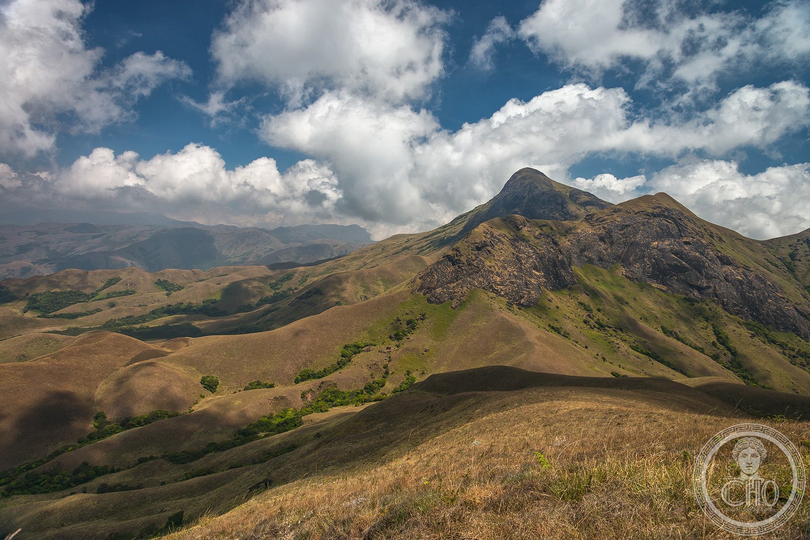
A 1,600-kilometre mountain range along India’s western coast, formed during the break-up of Gondwana and now recognized as a UNESCO World Heritage Site for its unparalleled biodiversity.
At a glance
The Western Ghats—known locally as the Sahyadri—stretch along the western edge of the Deccan Plateau from the Tapti River in the north to Kanyakumari in the south, spanning six Indian states. Covering 160,000 square kilometres, the range varies dramatically in elevation across three distinct sections. Anamudi, at 2,695 metres, crowns the highest peaks, while the average elevation reaches 1,200 metres.
History
Geologic evidence reveals that the Western Ghats formed during the break-up of the supercontinent Gondwana. The mountains rose along India’s west coast during the late Jurassic and early Cretaceous periods as India separated from the African continent. This tectonic event shaped not only the landscape but the hydrology and climate of the entire Indian subcontinent.
What you see
The range comprises three geological sections with distinct characters. The northern section rises 900–1,500 metres above the plateau; the middle section, beginning south of Goa, dips below 900 metres; the southern peaks rise again. The western slopes, facing the Arabian Sea, are characteristically steep, while eastern slopes descend more gradually toward the Bay of Bengal. This topography creates dramatic contrasts in rainfall and vegetation.
Cultural significance
The Western Ghats function as one of India’s major watersheds, feeding perennial river systems that drain nearly 40 per cent of the country’s land area. They govern India’s climate and monsoon patterns, blocking rain-bearing winds from the Arabian Sea and creating a pronounced rain shadow across the interior plateau. The range is a biodiversity hotspot of global importance, harbouring at least 325 threatened species, most found nowhere else on earth.
Key facts
- Country: India
- States traversed: Gujarat, Maharashtra, Goa, Karnataka, Kerala, Tamil Nadu
- Length: 1,600 kilometres
- Area: 160,000 square kilometres
- Highest peak: Anamudi, 2,695 metres
- Average elevation: 1,200 metres
- UNESCO World Heritage Site: 2012
- Coordinates: 10.17°N, 77.06°E
Practical information & getting there
The Western Ghats are accessible throughout their length via major roads and regional airports in Gujarat, Maharashtra, Karnataka, and Kerala. The range traverses six states, offering multiple entry points and trekking routes. Many sections are protected; check local regulations before visiting remote areas. The region receives significant monsoon rainfall, particularly on western slopes during June to September.
Sources & resources
- Western Ghats – Wikipedia
- Cultural Heritage Online
Find it on the map
See this place and what’s around it →📷 Become a Cultural Heritage Online photographer
Share your photos of places: they stay published under your name as the author. The more they're seen, the more you get noticed — and soon a contest will reward the most appreciated photos.
Log in or sign up free to add a photo