
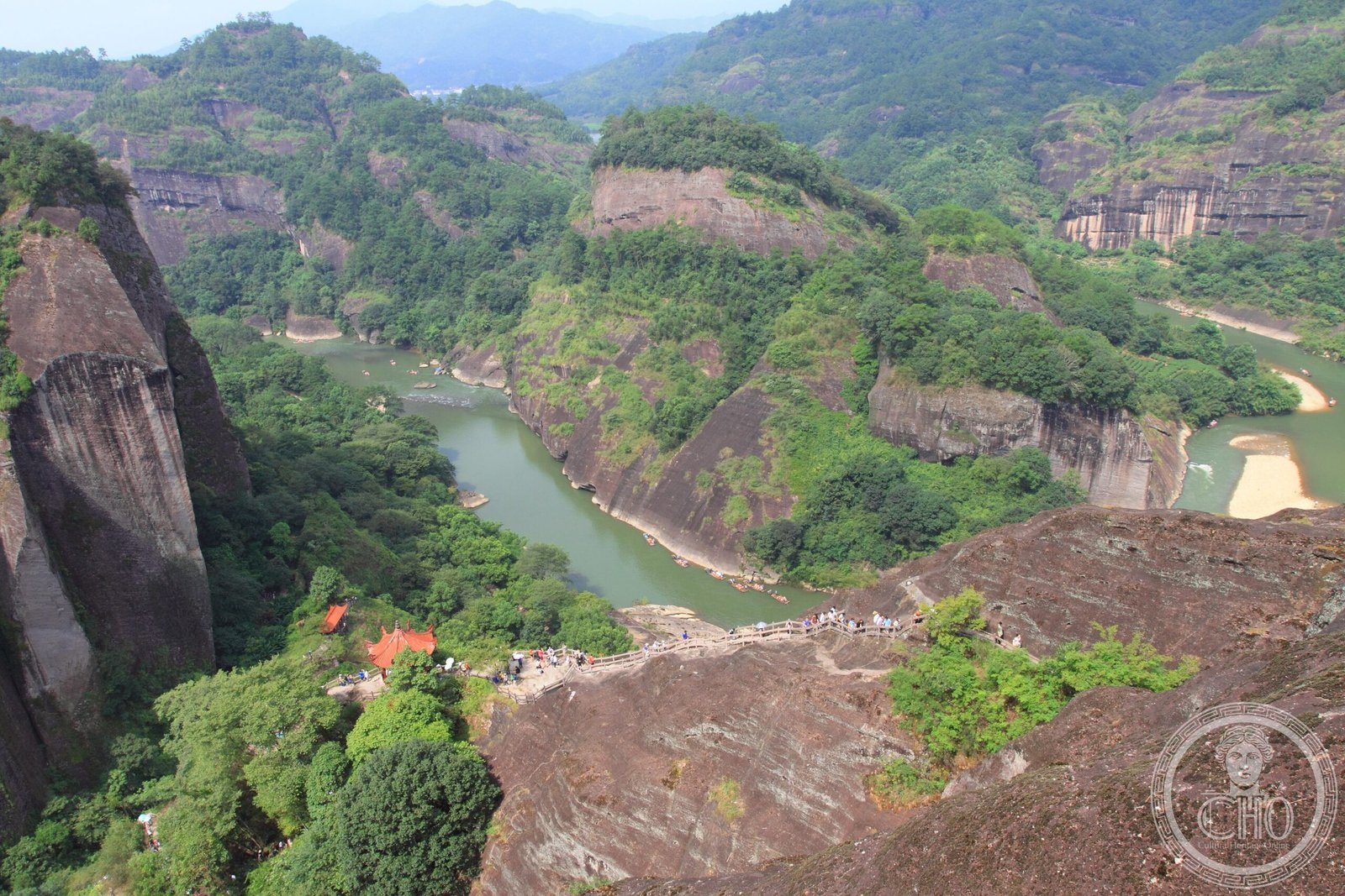
A distinctive geomorphological landscape of red sandstone cliffs and towers, formed across multiple provinces in China and recognized as a UNESCO World Heritage Site.
At a glance
Danxia represents a unique type of petrographic formation found in southeast, southwest and northwest China. Composed of red-coloured sandstones and conglomerates, these landscapes resemble karst topography but are classified as “pseudo-karst” due to their different rock composition. Six major danxia areas across six provinces were inscribed together as a World Heritage Site in 2010, covering a combined core area of 73,945 hectares.
History
Systematic study of danxia formations began in the 1920s and 1930s when Chinese geologists investigated these striking geomorphic structures. The name derives from Mount Danxia near Shaoguan, which became the most famous example and gave its name to the entire landform type. In 2010, the collective designation “China Danxia” brought together six significant sites across Hunan, Guangdong, Fujian, Jiangxi, Zhejiang and Guizhou provinces as a single World Heritage inscription.
What you see
Danxia landscapes display dramatic red cliffs, steep scarps and layered rock formations created by uplift, faulting and erosion. Younger formations like those in Taining County feature deep, narrow valleys. As danxia matures, valleys widen, revealing isolated towers and ridges. A distinctive feature across all danxia sites is the prevalence of shallow, isolated caves—unlike the deep, interconnecting networks typical of true karst terrain. The six World Heritage sites include Mount Danxia in Guangdong, Mount Langshan and Mount Wanfo in Hunan, Taining and Mount Guanzhi in Fujian, Mount Longhu and Guifeng in Jiangxi, Mount Jianglang and Fangyan in Zhejiang, and Mount Chishui in Guizhou.
Cultural significance
Danxia landforms represent a globally significant geological phenomenon, offering distinctive evidence of continental crustal uplift and erosional processes. The 2010 World Heritage inscription recognizes these landscapes as outstanding examples of geomorphological diversity and aesthetic value. Other notable danxia areas, such as Zhangye Danxia National Geological Park, remain important geological sites outside the Heritage designation.
Key facts
- Country: China
- Inscribed as World Heritage Site: 2010
- Core area of six sites: 73,945 hectares (182,720 acres)
- Buffer area: 65,446 hectares (161,720 acres)
- Rock composition: Cretaceous-age red sandstones and conglomerates
- Formation type: “Pseudo-karst” landforms
Practical information & getting there
The six World Heritage danxia sites are distributed across central and southern China. Mount Danxia near Shaoguan in Guangdong Province remains the most accessible and famous location. Zhangye Danxia in Gansu Province, though not part of the Heritage Site, is also well-developed for visitors and noted for its colourful striations.
Sources & resources
Find it on the map
See this place and what’s around it →📷 Become a Cultural Heritage Online photographer
Share your photos of places: they stay published under your name as the author. The more they're seen, the more you get noticed — and soon a contest will reward the most appreciated photos.
Log in or sign up free to add a photo