
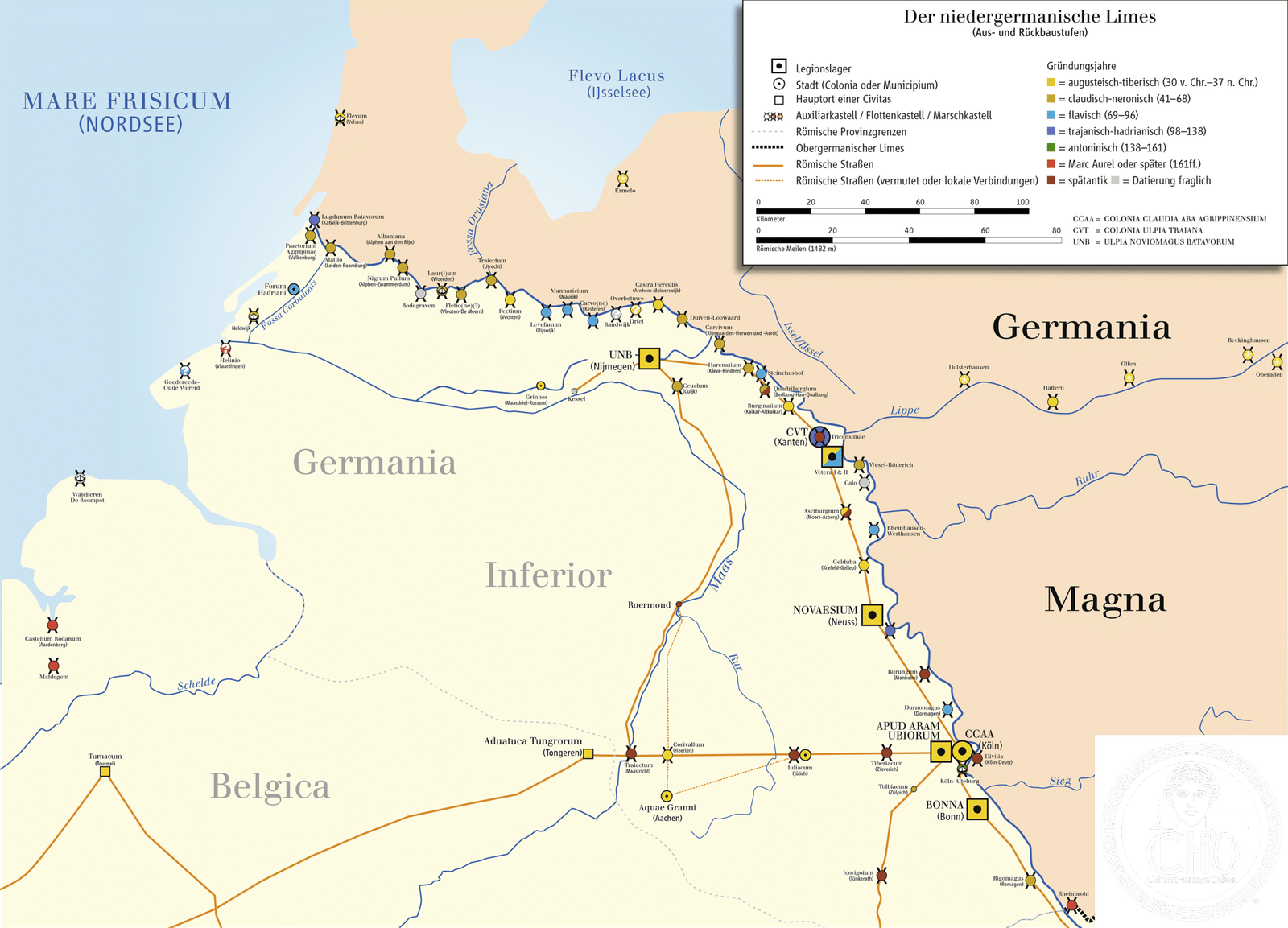
Two successive Roman legionary camps on the Lower Rhine, Vetera was among the empire’s most critical northern garrisons and a springboard for expansion beyond the river.
At a glance
Vetera comprises two distinct fort sites separated by roughly 1,500 metres. The older camp, Vetera I, operated from 13/12 BCE to 70 CE. The younger camp, Vetera II, succeeded it from 71 CE and endured until at least the 3rd century. Both were integral to the Lower Germanic Limes—the Roman frontier system—and earned UNESCO World Heritage status in 2021.
History
Vetera I served as a vital base during Rome’s initial military campaigns across the Rhine’s right bank, supporting the empire’s expansion northward. The fort’s strategic importance lay in its position controlling river traffic and movements along the frontier. After the Batavian Revolt and internal conflicts of 70 CE, the Romans relocated and rebuilt, establishing Vetera II on a nearby site. This younger fortress continued as a major garrison through subsequent centuries, maintaining Rome’s grip on this volatile border region.
What you see
Vetera I remains visible today as archaeological features within Xanten’s urban landscape, preserved on undeveloped ground. Vetera II presents a more challenging case for visitors: much of the site lies submerged ten metres below the surface of a quarry pond, accessible primarily through excavation and scholarly documentation rather than direct observation.
Cultural significance
Vetera exemplifies Rome’s military strategy on the northern frontier. Its continuous occupation across four centuries illustrates the empire’s sustained effort to dominate and control the Rhine boundary. The site’s inclusion in the UNESCO-designated Lower Germanic Limes recognizes its importance to understanding Roman frontier infrastructure and the challenges Rome faced maintaining northern European territories.
Key facts
- Country: Germany
- Location: Near Xanten, Lower Rhine
- Coordinates: 51.64639°N, 6.47°E
- UNESCO World Heritage Site: 2021 (as part of Lower Germanic Limes)
- Period: 13 BCE–3rd century CE
- Distance between Vetera I and II: approximately 1,500 metres
Practical information & getting there
Xanten lies in North Rhine-Westphalia, readily accessible by rail and road from Cologne and the Rhineland. Vetera I’s remains are visible within the town itself. Vetera II, largely submerged, requires consultation with local museums or archaeological guides to appreciate. The nearby Xanten Archaeological Park offers context and exhibits related to Roman frontier life.
Sources & resources
Find it on the map
See this place and what’s around it →📷 Become a Cultural Heritage Online photographer
Share your photos of places: they stay published under your name as the author. The more they're seen, the more you get noticed — and soon a contest will reward the most appreciated photos.
Log in or sign up free to add a photoIs this page about you?
This page is read by travellers and heritage enthusiasts who find it on Google. Tell us how you are connected to this place and we will take it from there.