
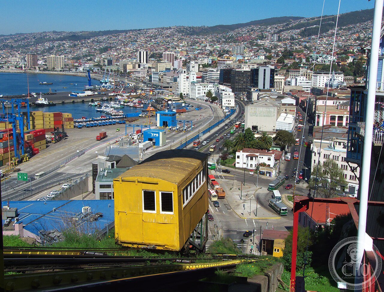
The wooden elevators of the Pacific’s amphitheatre – centenarian funiculars stitching port to painted hills in the UNESCO city of stairways.
At a glance
- Type
- Historic funicular network (16 surviving)
- Period
- 1883-1932
- Style
- Industrial timber and iron
- Location
- Valparaiso hills, Chile
- Coordinates
- -33.0400, -71.6270
- Oldest
- Ascensor Concepcion, 1883
Overview
Valparaiso’s ascensores – wooden funicular cabins hauled up ravine-side rails since 1883 – are the city’s circulatory folklore: of thirty built in the nitrate port’s heyday, sixteen survive, half a dozen running daily between the flat comercio and the cerros’ painted labyrinth. UNESCO’s 2003 listing of the historic quarter names them among its essential values.
History
The Pacific’s great port before Panama, Valparaiso terraced its amphitheatre hills with immigrant neighbourhoods the elevators served – Concepcion (1883) first, hydraulically; Artilleria carrying naval cadets to the academy; Polanco rising vertically through rock like a mine shaft. Decline, earthquakes, and neglect closed most; national monument status (1998) and restorations are returning them line by line to clattering service.
Architecture and Design
Station huts of corrugated romance, cable drums older than the century, and cabins of worn varnish compose moving heritage; Polanco’s tower-and-tunnel oddity and Reina Victoria’s steep glide are connoisseurs’ rides. The system’s engineering vernacular – British ironmongery, local carpentry – mirrors the port’s hybrid soul.
Cultural significance
The ascensores carry Valparaiso’s identity – Neruda’s odes, muralists’ canvases, the bohemia of the hills – and exemplify living industrial heritage: transport, monument, and neighbourhood bond at one peso fare.
Visiting today
Ride Concepcion to the Gervasoni promenade, El Peral to Palacio Baburizza, Artilleria for the harbour panorama; operating lines vary – check locally. Combine with the open-air museum’s murals.
Getting there
Valparaiso lies 90 minutes by bus from Santiago; the lower stations dot the plan between Sotomayor and Echaurren squares.
Sources and resources
Find it on the map
See this place and what’s around it →Record researched and written by Luigi De Marchi for Cultural Heritage Online, 2026.
📷 Become a Cultural Heritage Online photographer
Share your photos of places: they stay published under your name as the author. The more they're seen, the more you get noticed — and soon a contest will reward the most appreciated photos.
Log in or sign up free to add a photo