
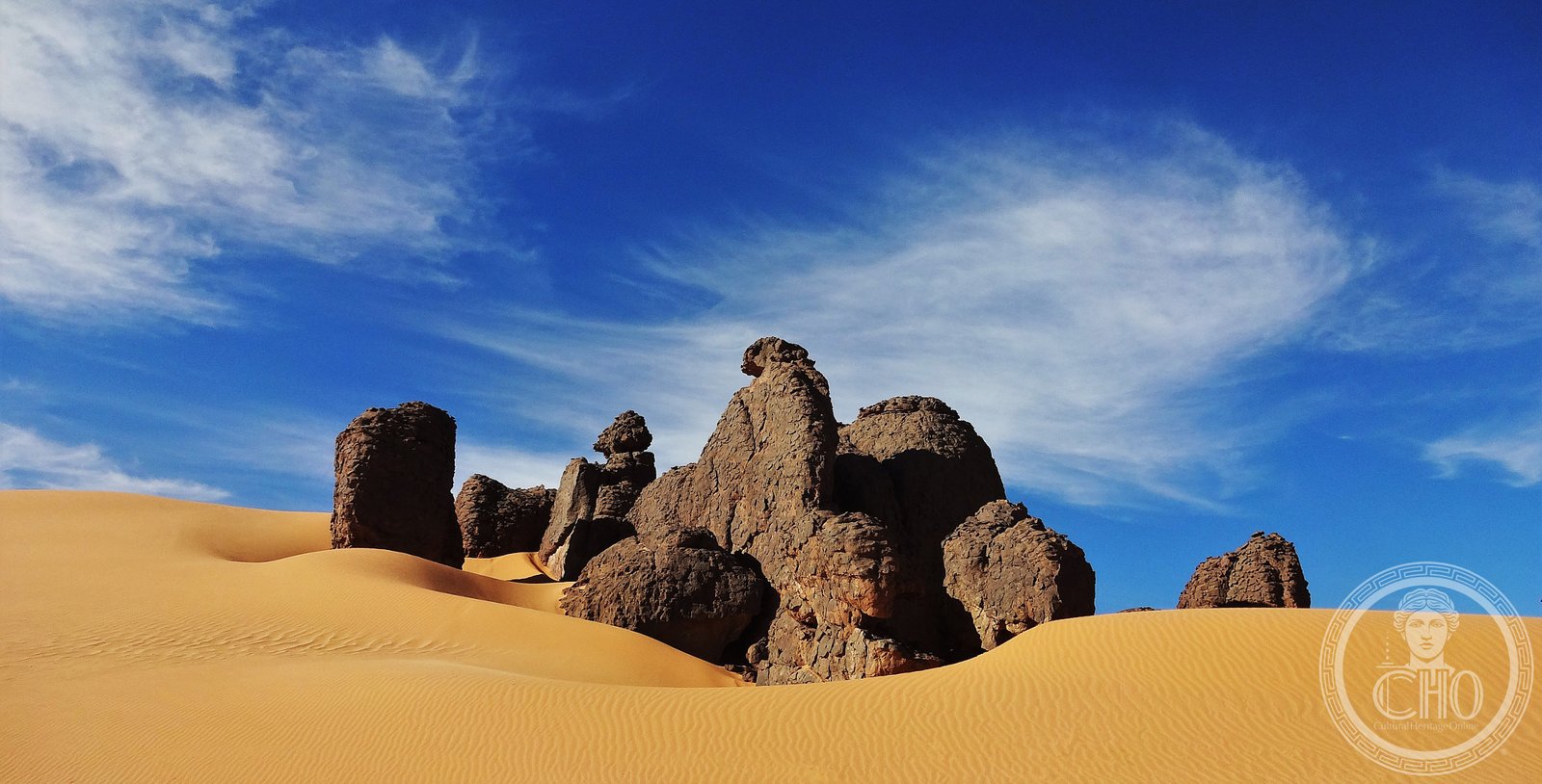
At the heart of the Algerian Sahara rises a sandstone plateau of lunar appearance, where gorges and rock formations hold one of the most extraordinary figurative heritages of humankind: more than 10,000 rock engravings and paintings that show how the Sahara, once green and inhabited, turned into the largest desert in the world. Tassili n’Ajjer has been a UNESCO World Heritage site since 1982, as a mixed natural and cultural property.
At a glance
Tassili n’Ajjer (“Plateau of the rivers” in Tuareg) is a vast mountain range of sandstone in south-eastern Algeria, covering more than 72,000 km². It contains one of the world’s most important concentrations of prehistoric rock art: over 10,000 identified engravings and paintings, dating from approximately 10,000 BC to the first centuries AD. The art documents the “Green Sahara” period — when the region was wetter, forested and populated by elephants, rhinoceroses, hippopotamuses and cattle herders — before the progressive desiccation of the last 4,000 years. UNESCO inscribed it in 1982 as a mixed natural and cultural site.
Key facts
- UNESCO: World Heritage since 1982 (Tassili n’Ajjer, ref. 179)
- Area: over 72,000 km² in south-eastern Algeria
- Rock art: more than 10,000 paintings and engravings, dating from 10,000 BC to c. AD 100
- Green Sahara: depicts elephants, rhinos, hippos, cattle — evidence of a wetter past
- Mixed site: inscribed for both cultural (rock art) and natural (unique geological formations) value
- Tuareg: the plateau is the homeland of the Tuareg people; the name means “plateau of the rivers”
History
During the African Humid Period (roughly 11,000 to 4,000 years ago), the Sahara was a fertile landscape of lakes, rivers and savannah. The people who lived in the Tassili plateau left one of the world’s greatest archives of rock art: paintings and engravings showing round-headed figures (the oldest, circa 10,000 BC), cattle herders with their animals, hunters with bows, horses and chariots, and finally camels — documenting millennia of changing life and climate in the Sahara.
French ethnographer and explorer Henri Lhote first systematically recorded the art in 1956–1957, tracing and photographing thousands of images that had been unknown to the outside world. The scale and quality of the finds astonished the archaeological community. UNESCO inscribed Tassili n’Ajjer in 1982 as a site of outstanding universal value for both its rock art and its remarkable geology — an eroded sandstone landscape of natural arches, towers and forests of stone.
What you see
The Tassili plateau is a labyrinth of eroded sandstone formations: natural arches, isolated pinnacles, deep gorges and flat-topped mesas in shades of ochre, orange and deep red. Among the rocks, hidden in sheltered locations, are the paintings and engravings: some nearly life-size figures of animals long gone from the Sahara; cattle and herders; running figures; abstract symbols.
The landscape itself is spectacular even without the art — a high-altitude desert of surreal geological forms. Some cypress trees (Cupressus dupreziana), relics of the Sahara’s wetter past and among the world’s most endangered trees, survive in isolated groves on the plateau.
Practical information
- Base: Djanet, a town in south-eastern Algeria (served by flights from Algiers)
- Guides: visits require an authorised guide and 4WD transport; Tuareg guides are the most knowledgeable
- Best time: October to April; summers are dangerously hot (above 50°C)
- Caution: remote area; requires advance planning, permits and logistics
Getting there
The gateway is Djanet in south-eastern Algeria (IATA: DJG), reached by domestic flights from Algiers. From Djanet, excursions into the Tassili plateau require 4WD vehicles and a registered Tuareg guide. Advance permits from the Algerian authorities are required. GPS (centre): 25.50° N, 9.00° E.
Nearby
- Hoggar Mountains — another dramatic Saharan highland, home of the Tuareg and the Tamanrasset oasis
- Ahaggar National Park — adjacent protected area with volcanic landscapes
- Tin Hinan tomb — 4th-century Tuareg queen’s burial near Abalessa, legendary ancestor of the Tuareg
Sources
- UNESCO World Heritage Centre — “Tassili n’Ajjer” (ref. 179)
- Lhote, Henri — “The Search for the Tassili Frescoes” (1959)
- Encyclopaedia Britannica — Tassili n’Ajjer
Find it on the map
See this place and what’s around it →📷 Become a Cultural Heritage Online photographer
Share your photos of places: they stay published under your name as the author. The more they're seen, the more you get noticed — and soon a contest will reward the most appreciated photos.
Log in or sign up free to add a photo