
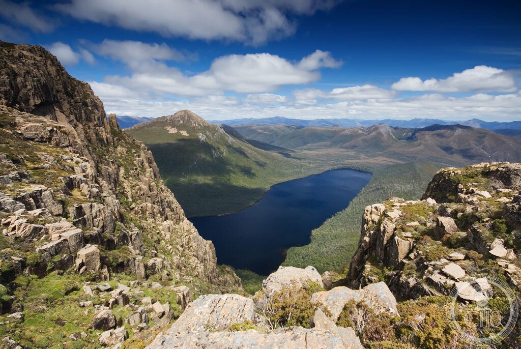
It covers almost a fifth of Tasmania: an immense wilderness of mountains carved by glaciers, rushing rivers, temperate rainforest and plants inherited from Gondwana. Among these valleys, caves inhabited by Aboriginal people during the ice age make this one of the rare UNESCO sites that are both natural and cultural.
At a glance
The Tasmanian Wilderness, covering nearly a fifth of the island state of Tasmania, is one of the last great temperate wilderness areas on Earth. Glaciated mountains, wild rivers, deep gorges and ancient temperate rainforest shelter plants and animals descended from the supercontinent Gondwana. Limestone caves within it preserve traces of Aboriginal people who lived here through the last ice age, making it one of the rare World Heritage sites recognised for both natural and cultural values. It was inscribed by UNESCO in 1982 and extended since.
Key facts
- UNESCO: World Heritage since 1982 (mixed cultural and natural; later extended)
- Vast wilderness: covers nearly 20% of Tasmania
- Glaciated landscape: peaks, lakes and gorges shaped by ice
- Gondwanan life: ancient rainforest and relict species
- Ice-age caves: Aboriginal occupation through the last glaciation
- Wild rivers: including the Franklin, saved from damming
History
Aboriginal Tasmanians lived in this country for tens of thousands of years, sheltering in limestone caves during the last ice age and leaving art and tools that make the wilderness a cultural landscape of deep antiquity. After European settlement much of the rugged south-west remained little touched.
In the late 20th century a campaign to stop the damming of the wild Franklin River became a landmark of the Australian conservation movement; the dam was halted and the rivers protected. The area was inscribed by UNESCO in 1982 and enlarged in later years, safeguarding its glaciated mountains, Gondwanan forests and ice-age heritage together.
What you see
Walking tracks and roads reach parts of the wilderness — the peaks and lakes of Cradle Mountain–Lake St Clair, the gorges of the Franklin and Gordon rivers, glacial lakes such as Lake Judd beneath rocky ridges, and rainforest of myrtle and ancient pines. Much of the interior is trackless and remote.
The scale and emptiness of the wild country, with its sculpted mountains and dark forests, define the Tasmanian Wilderness.
Practical information
- Area: several national parks; some accessible, much remote
- Best time: summer (December–March) for walking
- Time needed: a day to multi-day treks
- Note: weather is changeable even in summer; prepare well
Getting there
The Tasmanian Wilderness spreads across western and south-western Tasmania, Australia. Gateways include Cradle Mountain, Lake St Clair and Strahan, reached by road from Hobart and Launceston. GPS: 42.70° S, 146.30° E.
Nearby
- Cradle Mountain — the famous peak and Overland Track
- Strahan — the harbour town and gateway to the Gordon River
- Hobart — the Tasmanian capital, to the east
Sources
- UNESCO World Heritage Centre — “Tasmanian Wilderness” (ref. 181)
- Tasmania Parks and Wildlife Service — official body
- Encyclopaedia Britannica — Tasmania
Find it on the map
See this place and what’s around it →📷 Become a Cultural Heritage Online photographer
Share your photos of places: they stay published under your name as the author. The more they're seen, the more you get noticed — and soon a contest will reward the most appreciated photos.
Log in or sign up free to add a photo