
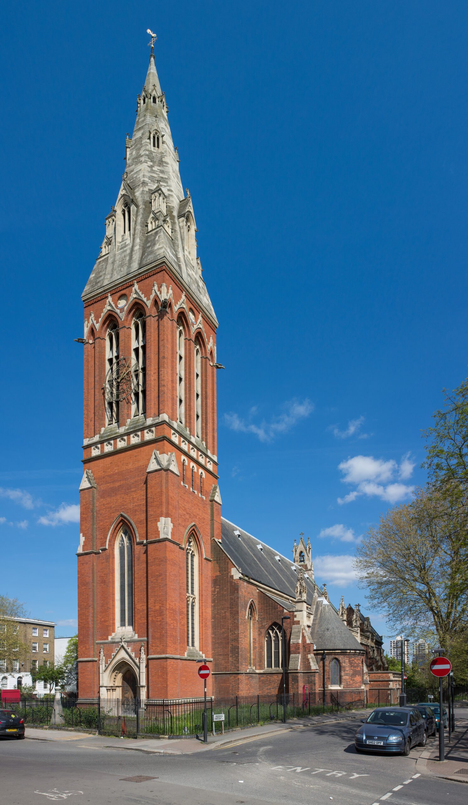
An exuberant Victorian Gothic church designed by George Edmund Street, whose soaring spire dominates the South London skyline above Kennington’s residential streets.
At a glance
A Grade I listed Anglican parish church in the Diocese of Southwark, built to embody the aspirations of High Victorian Anglicanism. The structure rises prominently on Vassall Road, near Oval tube station and the Oval Cricket Ground, its distinctive spire visible across miles of the capital.
History
Constructed between 1871 and 1874, St John the Divine was designed by George Edmund Street, the architect responsible for the Royal Courts of Justice on Strand. The church served the expanding parish of Kennington during a period of rapid suburban growth in South London.
What you see
The church exemplifies the Decorated Gothic style favoured in Victorian ecclesiastical architecture. Street’s design emphasizes verticality through pointed arches, intricate tracery, and the dominant spire that functions as a landmark visible from considerable distances, a hallmark of his carefully considered urban presence.
Cultural significance
St John the Divine represents a pinnacle of Victorian Gothic revival ecclesiastical design. As the work of one of the era’s most distinguished architects, it demonstrates the period’s commitment to reviving medieval architectural principles while incorporating contemporary construction techniques and spatial ambitions.
Key facts
- Architect: George Edmund Street
- Built: 1871–1874
- Style: Decorated Gothic
- Listed status: Grade I
- Location: Vassall Road, Myatt’s Fields Ward, London Borough of Lambeth
- Coordinates: 51.4776, -0.1063
- Diocese: Southwark
Practical information & getting there
The church stands on Vassall Road in Kennington, easily reached by Oval tube station on the Northern Line. Its prominent spire serves as an effective navigation landmark across South London’s street grid.
Sources & resources
Find it on the map
See this place and what’s around it →📷 Become a Cultural Heritage Online photographer
Share your photos of places: they stay published under your name as the author. The more they're seen, the more you get noticed — and soon a contest will reward the most appreciated photos.
Log in or sign up free to add a photoIs this page about you?
This page is read by travellers and heritage enthusiasts who find it on Google. Tell us how you are connected to this place and we will take it from there.