

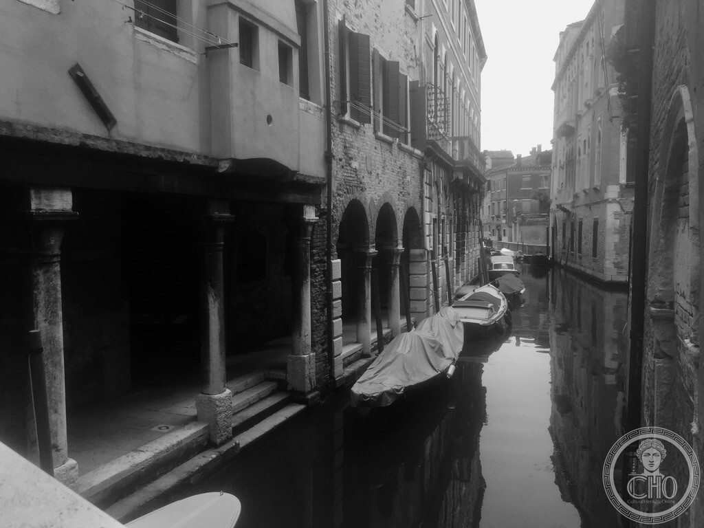
Among the most evocative and rare architectural survivals in Venice, the covered water colonnades of Cannaregio along Rio di Santa Sofia feature ancient Istrian stone pillars submerged directly into the canal, allowing boats to load cargo beneath sheltering palaces while pedestrians walk protected above the tides.
At a glance
- Typology
- Historic water colonnade, sotoportego d’acqua, and canal portico
- Period
- 14th–16th century Venetian Gothic and Renaissance commercial architecture
- Location
- Rio di Santa Sofia / Calle Priuli, Sestiere di Cannaregio, Venice
- Viewpoints
- Canal perspective from Ponte Priuli; interior pedestrian colonnade along the water
- Structural elements
- Square and rounded Istrian stone pillars, heavy timber ceiling beams, water-level mooring steps (rive d’acqua)
- Coordinates
- 45.44144° N, 12.33513° E · Open in Google Maps
The Architecture of the Sotoportego d’Acqua
In the hyper-dense urban fabric of Venice, land was perpetually scarce. To expand habitable space without obstructing vital water arteries, medieval builders and noble families projected the upper storeys of palaces outwards over the canal or public walkways, supported by robust stone porticoes. While common dry sotoporteghi link calle to calle beneath private residences, sotoporteghi d’acqua or canal porticoes were engineered specifically for maritime commerce.
Along Rio di Santa Sofia near Calle Priuli, the ground-floor colonnade stands on the water’s edge. Heavy square and cylindrical pillars cut from dense Istrian stone — renowned for its impermeability to salt water and marine organisms — support thick wooden ceiling beams. This sheltered waterway colonnade functioned as an all-weather private harbour (riva coperta), allowing merchandise, timber, grain, and textile barrels to be unloaded directly from lagoon barges (burchielli and topi) into palace storerooms (magazzini) shielded from driving rain and high water.
The Dual Perspective: From Bridge to Vaulted Walkway
Standing on the crown of Ponte Priuli, the viewer commands a striking axial panorama down the Rio di Santa Sofia. The dark openings of the colonnade contrast with the shimmering water reflections and the variegated brickwork of opposite houses. Moored boats bob beneath protective canopies, sheltered by the overhang.
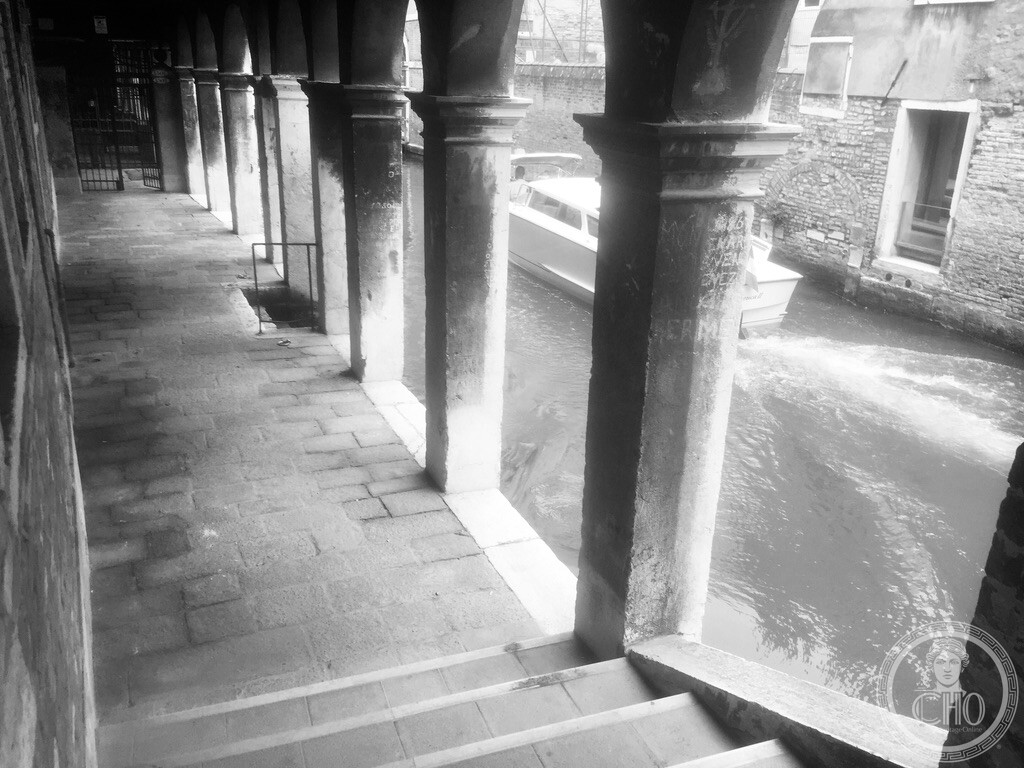
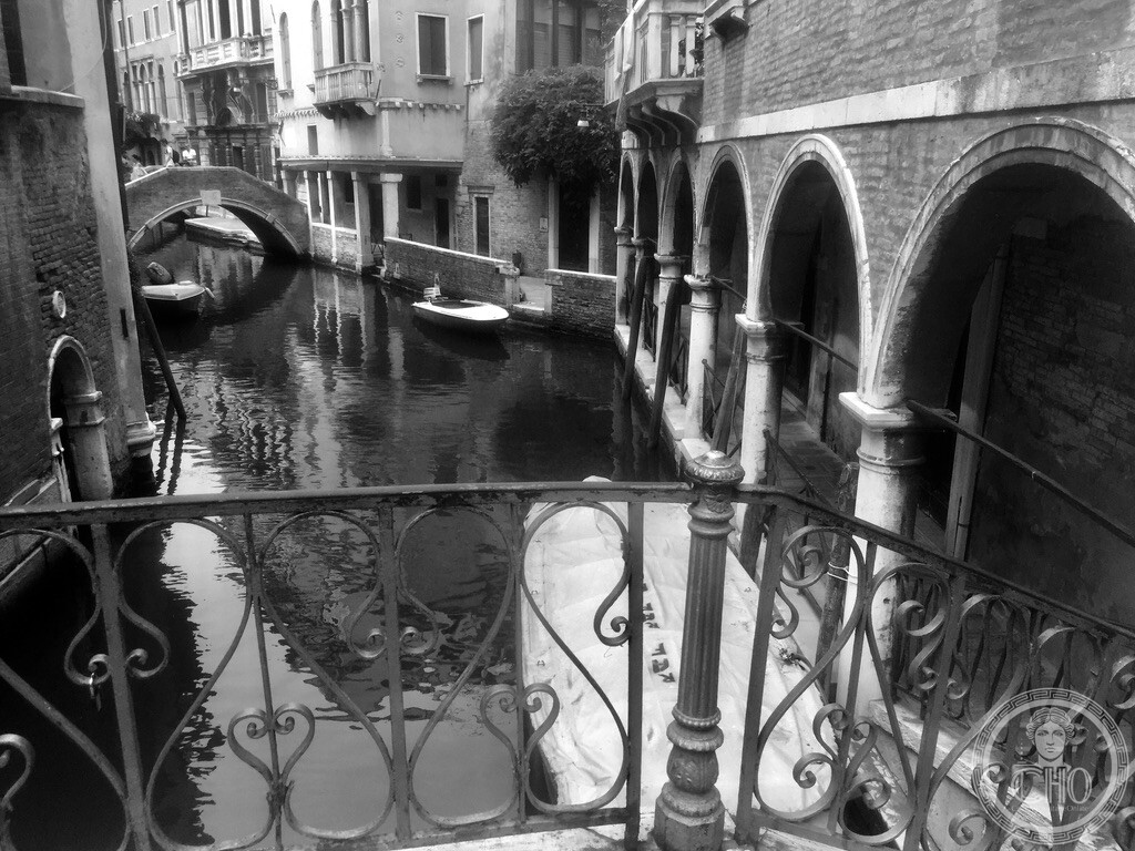
Descending the steps into the portico reveals an entirely different spatial intimacy. The paved walkway runs parallel to the water just above sea level, separated only by stone kerbs and occasional iron guardrails. Through the rhythm of the stone columns, the pulse of lagoon traffic unfolds: delivery skiffs, water taxis, and small rowing craft produce gentle wakes that lap against the stone steps, echoing softly beneath the beamed ceiling.
Practical information
- Access: Publicly accessible 24 hours a day with free access
- Atmosphere: Exceptionally quiet and atmospheric, away from mass tourism routes
- Photography: Black-and-white and long-exposure photography excel here due to strong architectural lines, water reflections, and natural chiaroscuro
- High tides (Acqua Alta): During tides above +100 cm, the lower steps of the portico may be washed over by lagoon water
Getting there
From the Strada Nova pedestrian thoroughfare near Ca’ d’Oro, turn north into Calle Priuli. Follow the calle until it reaches Ponte Priuli crossing Rio di Santa Sofia (approx. 3 minutes’ walk from the Ca’ d’Oro vaporetto landing stage on Line 1). The colonnade extends along the western embankment directly north of the bridge.
Nearby
- Chiesa dei Santi Apostoli — Historic parish church and Andrea Tirali’s campanile, 220 m southeast
- Ca’ d’Oro (Galleria Giorgio Franchetti) — Masterpiece of Venetian Floral Gothic architecture, 180 m southwest
- Campo Santa Sofia — Historic square with gondola traghetto crossing to the Rialto Fish Market, 200 m south
- Chiesa di Santa Caterina — Former convent complex and historic cloister, 250 m northeast
Sources & References
- Concina, Ennio. Venezia nell’età moderna: Struttura e funzioni di una capitale. Marsilio.
- Maretto, Paolo. L’edilizia gotica veneziana. Cassa di Risparmio di Venezia.
- Tassini, Giuseppe. Curiosità Veneziane: note sui ponti e sotoporteghi di Cannaregio.
- Geographical coordinates: 45.44144, 12.33513.
Find it on the map
See this place and what’s around it →Record researched and written by Carla Szathvary for Cultural Heritage Online, 2026.
📷 Become a Cultural Heritage Online photographer
Share your photos of places: they stay published under your name as the author. The more they're seen, the more you get noticed — and soon a contest will reward the most appreciated photos.
Log in or sign up free to add a photo