
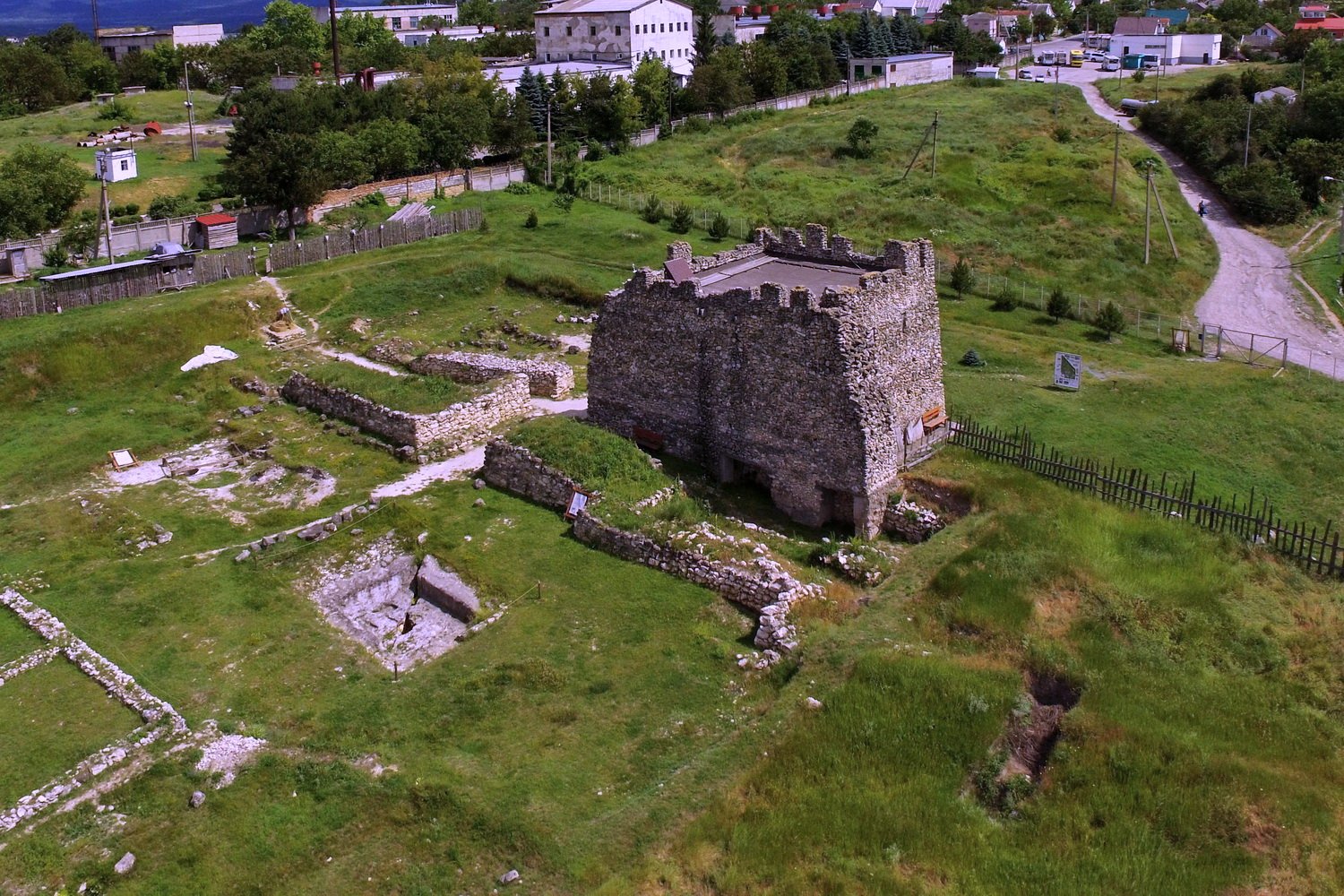
The fortress and palace capital of the Late Scythian Kingdom, where nomadic rulers held court over the tribes of Crimea until Gothic invasion brought its fall in the mid-3rd century.
At a glance
Scythian Neapolis—also known as Kermenchik—was an Iranic settlement that served as the political and military centre of Crimea’s Scythian peoples. Founded at the end of the 3rd century BC, it remained a seat of power for nearly five centuries. The ruins lie on the outskirts of modern Simferopol, offering archaeological insight into nomadic governance and settlement in the classical world.
History
The site’s occupation predates the Scythian settlement itself. Between the end of the 4th century BC and the beginning of the 3rd century BC, the Kizil-Koba culture inhabited the area before Scythian populations established their capital there. Under the leadership of kings Skilurus and Palacus, Scythian Neapolis became the hub of a small kingdom controlling territories between the lower Dnieper River and Crimea. The settlement thrived as a centre of political authority and cultural identity until the Goths destroyed it halfway through the 3rd century AD, ending two centuries of Scythian dominance in the region.
What you see
The archaeological remains reveal a fortified settlement with palace structures befitting a royal residence. Ancient coins, pottery, and building foundations testify to sustained occupation and craft activity. The layout reflects a blend of nomadic and settled traditions—defensive walls protecting administrative and domestic quarters where Scythian aristocracy conducted affairs of state.
Cultural significance
Scythian Neapolis stands as rare material evidence of Late Scythian political organisation. Classical geographer Strabo recorded the site as a fortress and palace, confirming its importance in contemporary accounts. The city represents a crucial moment when nomadic peoples established fixed territorial capitals, reshaping steppe-Mediterranean relations and demonstrating sophisticated governance in Iron Age Crimea.
Key facts
- Country: Ukraine
- Location: Outskirts of Simferopol, Crimea
- Coordinates: 44.94°N, 34.12°E
- Period: Late 3rd century BC to mid-3rd century AD
- First excavated: 1945 by Schultz and Golovkina
Practical information & getting there
The archaeological site remains on the periphery of Simferopol. Access and visiting conditions should be verified locally, as the region’s political situation may affect availability. Finds from excavations are housed in regional museums, providing further context for understanding the settlement’s material culture.
Sources & resources
Find it on the map
See this place and what’s around it →📷 Become a Cultural Heritage Online photographer
Share your photos of places: they stay published under your name as the author. The more they're seen, the more you get noticed — and soon a contest will reward the most appreciated photos.
Log in or sign up free to add a photoIs this page about you?
This page is read by travellers and heritage enthusiasts who find it on Google. Tell us how you are connected to this place and we will take it from there.