

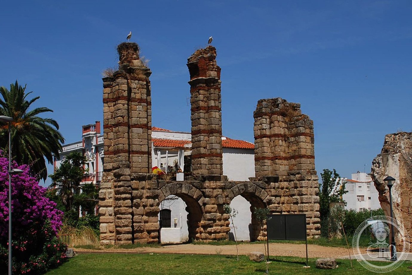
A first-century Roman aqueduct built to supply water to Emerita Augusta, now Mérida, the capital of the province of Lusitania.
At a glance
The San Lázaro aqueduct is one of the surviving water-supply systems of a major Roman provincial city. Built during the first century, it demonstrates the engineering infrastructure essential to maintaining Emerita Augusta’s role as Lusitania’s administrative and commercial hub. The structure is part of the broader Archaeological Ensemble of Mérida, one of Spain’s most significant Roman sites.
History
The aqueduct was constructed in the first century to serve the expanding colonia of Emerita Augusta. In 1912, it received designation as a Bien de Interés Cultural (cultural heritage site of national interest). The aqueduct later became a component of the Archaeological Ensemble of Mérida, which UNESCO inscribed as a World Heritage Site in 1993 in recognition of its exceptional concentration of Roman remains.
What you see
The surviving sections reveal Roman hydraulic engineering typical of the imperial period. The structure carried water across terrain to reach the city’s distribution network and public fountains.
Cultural significance
The San Lázaro aqueduct exemplifies the infrastructure investments Rome made in its provincial cities. Mérida’s ensemble of aqueducts, theaters, bridges, and temples represents one of the most complete pictures of Roman urban life in Hispania outside Rome itself. The site remains crucial for understanding daily life, water management, and urban planning in the ancient Roman world.
Key facts
- Country: Spain
- City: Mérida
- Period: 1st century CE
- Designation: Bien de Interés Cultural (1912)
- UNESCO World Heritage Site: Archaeological Ensemble of Mérida (1993)
- Coordinates: 38.9201, -6.3353
Practical information & getting there
The aqueduct remains visible as part of Mérida’s open-air archaeological ensemble. The city is easily reached by road and rail from Madrid and other major Spanish centers. Most remains are accessible to visitors; consult local tourism offices for current site conditions and opening hours.
Sources & resources
Find it on the map
See this place and what’s around it →📷 Become a Cultural Heritage Online photographer
Share your photos of places: they stay published under your name as the author. The more they're seen, the more you get noticed — and soon a contest will reward the most appreciated photos.
Log in or sign up free to add a photo