
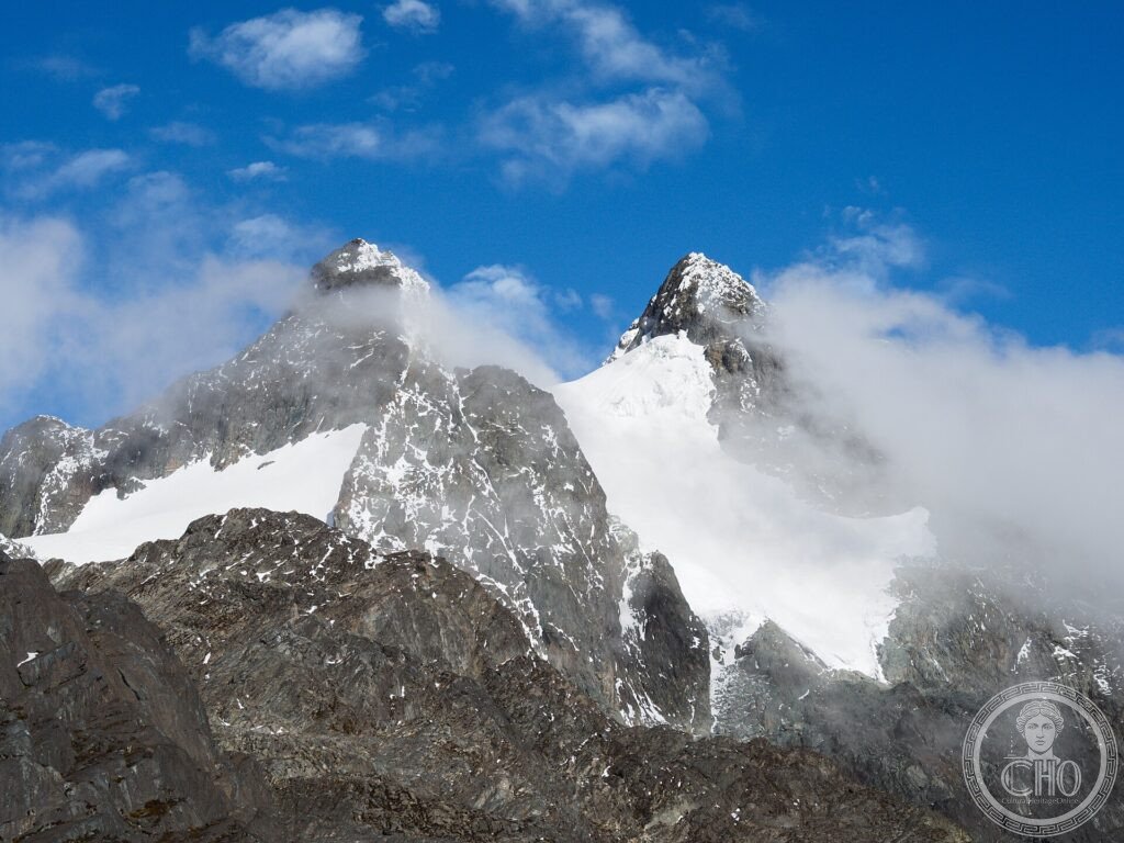
Sul confine fra Uganda e Congo si innalza una catena leggendaria: il Rwenzori, identificato con le “Montagne della Luna” da cui gli antichi credevano nascesse il Nilo. Coronate di ghiacciai a pochi chilometri dall’equatore, le sue vette si elevano sopra una vegetazione afro-alpina fantastica, di lobelie e seneci giganti.
At a glance
The Rwenzori Mountains, on the border between Uganda and the Democratic Republic of the Congo, are one of the few places in Africa with permanent glaciers, here only a few kilometres from the equator. Rising to Margherita Peak at 5,109 m, the third-highest summit in Africa, they were identified in antiquity with the fabled “Mountains of the Moon”, thought to be the source of the Nile. Their misty slopes carry a strange and beautiful afro-alpine vegetation of giant lobelias and groundsels. The Ugandan national park was inscribed by UNESCO in 1994.
Key facts
- UNESCO: World Heritage since 1994 (Rwenzori Mountains National Park)
- Equatorial glaciers: rare permanent ice near the equator
- Margherita Peak: at 5,109 m, the third-highest in Africa
- “Mountains of the Moon”: the ancient name for these peaks
- Afro-alpine flora: giant lobelias and groundsels
- Glaciers retreating: the ice is shrinking with the climate
History
Ancient geographers, including Ptolemy, spoke of snowy “Mountains of the Moon” in the heart of Africa from which the Nile flowed, and the Rwenzori — their glaciers feeding rivers toward the Nile system — are the likely source of the legend, though they were unknown to the outside world until the late 19th century and not climbed to their summit until 1906.
The mountains rise steeply through forest, bamboo and the misty zone of giant afro-alpine plants to rock and ice. Protected as a national park and inscribed by UNESCO in 1994, the Rwenzori draw trekkers to one of Africa’s great mountain challenges, even as their famous glaciers steadily retreat.
What you see
Multi-day treks climb through dense montane forest and bamboo, across boggy moorland studded with giant lobelias and groundsels straight out of a fairy tale, to the snow, glaciers and rocky summits crowned by Margherita Peak. Rivers, lakes and waterfalls thread the valleys, and chameleons and rare birds inhabit the slopes.
The vision of glaciers and weird giant plants beneath the equatorial sky is the magic of the Rwenzori.
Practical information
- Park: reached on guided multi-day treks
- Best time: the drier spells (December–February, June–August)
- Time needed: 7–9 days for the Margherita climb
- Note: wet and demanding; go with registered operators
Getting there
Rwenzori Mountains National Park is in western Uganda, near the town of Kasese, on the border with the Democratic Republic of the Congo. GPS: 0.38° N, 29.87° E.
Nearby
- Kasese — the town at the foot of the mountains
- Queen Elizabeth National Park — the savanna park nearby
- Lake Edward — the great rift-valley lake
Sources
- UNESCO World Heritage Centre — “Rwenzori Mountains National Park” (ref. 684)
- Uganda Wildlife Authority — official body
- Encyclopaedia Britannica — Ruwenzori Range
Find it on the map
See this place and what’s around it →📷 Become a Cultural Heritage Online photographer
Share your photos of places: they stay published under your name as the author. The more they're seen, the more you get noticed — and soon a contest will reward the most appreciated photos.
Log in or sign up free to add a photo