
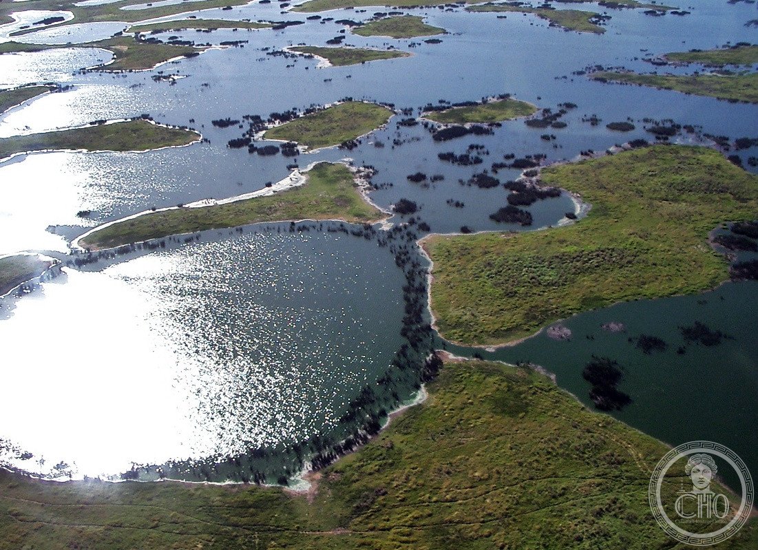
The world’s largest tropical wetland and flooded grassland ecosystem, where seasonal inundation sustains extraordinary biodiversity across a vast landscape spanning multiple countries.
At a glance
The Pantanal is a natural region of staggering scale. Estimated between 140,000 and 195,000 square kilometres, it encompasses the planet’s largest tropical wetland area and flooded grasslands. The ecosystem extends across four nations: Brazil (primarily Mato Grosso do Sul, with portions in Mato Grosso), Bolivia, and Paraguay.
History
The Pantanal has existed as a dynamic hydrological system for millennia, shaped by seasonal flood cycles that define its character. Its formation reflects the interplay of climate, geology, and water systems across the South American landscape.
What you see
The Pantanal comprises up to 12 distinct subregional ecosystems, each with its own hydrological, geological, and ecological characteristics. During rainy seasons, roughly 80% of the floodplains submerge beneath water, creating a dynamic landscape of channels, lagoons, and seasonally flooded forests. The terrain transforms with the seasons—dry in winter, transformed into an aquatic mosaic when floods arrive.
Cultural significance
This wetland supports one of Earth’s densest concentrations of animal species. The seasonal flooding nurtures a biologically diverse collection of aquatic plants that form the foundation of a complex food web. The Pantanal represents a globally irreplaceable ecosystem and a UNESCO World Heritage site.
Key facts
- Location: Brazil (Mato Grosso do Sul and Mato Grosso), with extensions into Bolivia and Paraguay
- Area: 140,000–195,000 km²
- Coordinates: -17.4°, -57.5°
- UNESCO World Heritage Site: Yes
- Seasonal submersion: Approximately 80% of floodplains during rainy season
Practical information & getting there
The Pantanal is most accessible from cities in Mato Grosso do Sul such as Cuiabá. Access is best during the dry season (May to September) when roads are passable and wildlife viewing is optimal. Guided tours and eco-lodges operate throughout the region.
Sources & resources
Find it on the map
See this place and what’s around it →📷 Become a Cultural Heritage Online photographer
Share your photos of places: they stay published under your name as the author. The more they're seen, the more you get noticed — and soon a contest will reward the most appreciated photos.
Log in or sign up free to add a photo