
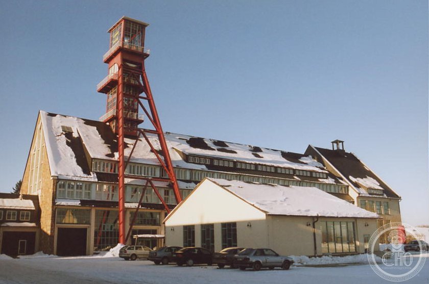
A landscape of eight centuries—where mines, mills, and monuments chart the relentless advancement of extraction technology across the German-Czech border.
At a glance
The Erzgebirge/Krušnohoří Mining Region encompasses an industrial heritage landscape spanning over 800 years of continuous mining activity. Straddling Saxony and North Bohemia, it preserves an exceptional collection of working mines, technical monuments, and related structures that document the evolution of mining methods from medieval times to the modern era. UNESCO recognised this achievement in 2019.
History
Mining in the Ore Mountains began in the medieval period and expanded dramatically during the 16th and 17th centuries, transforming the region into one of Europe’s most productive mining districts. Successive waves of technological innovation—from simple hand tools to mechanised pumping systems and industrial processing—left indelible marks across the landscape. The region’s mines produced tin, silver, copper, iron, and other metals essential to European industry and trade.
What you see
The region is characterised by a remarkable array of historic monuments to mining technology. These include original mine shafts, drainage and processing installations, foundries, smelters, and the domestic and administrative structures that grew around them. Many remain substantially unchanged, offering authentic evidence of how mining shaped both the technical and social fabric of border communities.
Cultural significance
The Ore Mountain Mining Region stands as exceptional testimony to eight centuries of technological advancement in extraction and processing. It documents the evolution of mining practices across distinct historical periods—medieval, early modern, and industrial—making it invaluable to understanding European industrial development. The region also exemplifies how mining shaped settlement patterns, labour systems, and regional identity across a multinational landscape.
Key facts
- Location: Saxony (Germany) and North Bohemia (Czech Republic)
- Coordinates: 50.4065°N, 12.8372°E
- UNESCO World Heritage Site: Inscribed 6 July 2019
- Heritage span: Over 800 years of continuous mining activity
Practical information & getting there
The mining region straddles two countries and multiple towns. Access varies by location; major routes connect through Saxony’s historic mining towns and North Bohemian centres. Many individual monuments and mining museums throughout the region welcome visitors. Check locally for opening hours, guided tours, and accessibility details at specific sites.
Sources & resources
Find it on the map
See this place and what’s around it →📷 Become a Cultural Heritage Online photographer
Share your photos of places: they stay published under your name as the author. The more they're seen, the more you get noticed — and soon a contest will reward the most appreciated photos.
Log in or sign up free to add a photo