
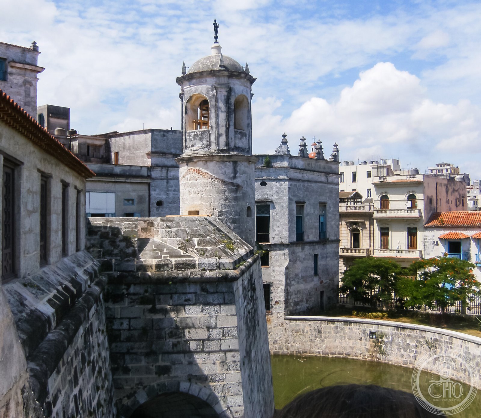
Old Havana holds the most complete surviving ensemble of Spanish colonial architecture in the Americas, raised on the wealth of the annual treasure fleets that gathered in its harbour before crossing the Atlantic. Five colonial plazas, a ring of stone fortresses guarding the bay, and the long curve of the Malecón still trace the shape of the city that once controlled Spain’s American trade.
At a glance
Havana was founded in 1519 to replace an earlier settlement on Cuba’s south coast, chosen for its deep, narrow-mouthed harbour, one of the best natural anchorages in the Caribbean. The Gulf Stream, sweeping past the harbour entrance on its way north and east, made the bay the natural assembly point for the Flota de Indias, the convoy system by which Spain shipped silver, gold and goods from its American colonies to Seville. Ships waited here for the fleet to form before the Atlantic crossing, and for two centuries the resulting traffic made Havana one of the richest cities in the hemisphere.
That wealth financed the city’s Baroque churches, palaces and plazas, and it also had to be defended. Havana’s fortifications, among the most elaborate built anywhere in Spanish America, were designed to keep English, Dutch and French privateers away from the treasure passing through the port.
Key facts
- Founded: 1519, by the governor Diego Velázquez de Cuéllar.
- Castillo de la Real Fuerza: begun 1558, completed 1577; a square fort with four corner bastions, generally considered the oldest surviving stone fortification in the Americas.
- La Giraldilla: the copper weathervane on the fort’s tower, cast around 1632 by the Cuban metalsmith Jerónimo Martínez Pinzón and among the earliest known sculptures produced in Cuba; the original is kept in the Museo de la Ciudad, a replica stands on the tower.
- 1762 siege: a British force besieged and captured Havana during the Seven Years’ War; the city was returned to Spain the following year under the Peace of Paris, in exchange for Florida.
- Coordinates: 23.1359° N, 82.3590° W.
History
Havana’s early years were bound up with the Spanish conquest of the mainland: Hernán Cortés set out from here for Mexico in 1519, Pánfilo de Narváez for Florida in 1528, and Hernando de Soto assembled his North American expedition here in 1538. From around 1560 to 1790 the city’s fortunes turned on the Flota de Indias, with the crews of dozens of ships waiting in Havana for weeks or months at a time. The resulting population and commercial boom paid for the golden age of construction that produced the city’s five great plazas, Armas, Vieja, de la Catedral, de San Francisco and del Cristo, together with the colonial buildings that still enclose them.
In 1898 the American battleship USS Maine exploded in Havana harbour; the cause remains disputed, but the incident helped trigger the Spanish-American War and, with it, Cuba’s eventual independence from Spain. Fidel Castro’s rebel army entered the city on 1 January 1959, and the revolutionary government has controlled Cuba since. The economic embargo imposed by the United States from 1962 has shaped Old Havana profoundly: the absence of large-scale investment has left much of the colonial fabric intact even as it has allowed parts of it to decay.
What you see
The Plaza de Armas is the oldest and most formal of Havana’s colonial squares, dominated by the Palacio de los Capitanes Generales, built between 1776 and 1792 as the residence of the Spanish governor and now the Museo de la Ciudad. Its inner courtyard holds a nineteenth-century statue of Christopher Columbus, replacing an earlier figure from 1636 that was moved indoors. The Plaza de la Catedral is the most ornamented of the five squares, built around the Cathedral of Havana, completed between 1748 and 1777, whose Jesuit Baroque facade is famously asymmetrical, its left tower noticeably wider than the right. Columbus’s remains were interred in the cathedral from 1796 until 1898, when they were returned to Spain.
At the mouth of the bay stands the Castillo del Morro, built between 1589 and 1630 on the eastern cliff, with a lighthouse added in 1844 whose beam is still visible far out to sea. Each evening a cannon is fired from the fort in a re-enactment of the colonial signal that the city gates were closing, a tradition kept alive since independence largely for visitors. Along the seafront runs the Malecón, an eight-kilometre promenade of Baroque and Art Deco facades that remains one of the city’s principal gathering points, especially at sunset. Seen from the bay, the colonial skyline of Old Havana sits alongside later landmarks such as the domed Capitolio Nacional of 1929, modelled on the United States Capitol, and the Art Deco Bacardi Building of 1930, with its terracotta and granite facade and bat motifs.
Practical information
- Getting around: the Old Havana UNESCO zone covers roughly two kilometres by one and is best explored on foot.
- Currency: Cuba operates a multi-currency system, with the MLC used by tourists and Cuban pesos used by locals; visitors should check current arrangements before travelling.
- Access: the five main plazas and the Castillo de la Real Fuerza are open to the public without charge; most museums and the Castillo del Morro charge an entry fee, and current rates are best checked with the relevant institutions.
- Travel documentation: US citizens require a specific travel licence, or must travel via an approved cruise, under the ongoing US embargo.
Getting there
Havana is served by José Martí International Airport, with direct connections from Madrid, Paris, Toronto, Mexico City and several Caribbean hubs; travellers should check current routes with airlines directly. Once in the city, Old Havana’s colonial core is compact and walkable, and the classic American cars used as tourist taxis remain a familiar sight on its streets.
Nearby
- Viñales Valley — around 180 km west, in Pinar del Río Province; a karst landscape of mogotes, dome-shaped limestone hills rising some 300 metres from the valley floor, with traditional thatched bohíos still used for drying tobacco. Inscribed as a UNESCO World Heritage Site in 1999.
Sources
- UNESCO
Find it on the map
See this place and what’s around it →📷 Become a Cultural Heritage Online photographer
Share your photos of places: they stay published under your name as the author. The more they're seen, the more you get noticed — and soon a contest will reward the most appreciated photos.
Log in or sign up free to add a photo