
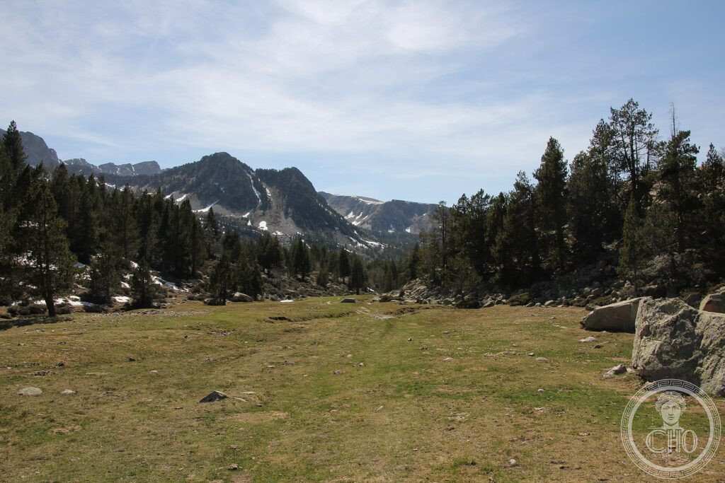
At the heart of the Pyrenees, the only valley in Andorra left without roads tells how for centuries people lived in harmony with the mountain. High pastures, paths, stone huts and old iron forges bear witness to a pastoral and rural culture that shaped this harsh glacial landscape gently.
At a glance
The Madriu-Perafita-Claror Valley, in the south-east of the tiny Pyrenean state of Andorra, is a glacial valley that has kept its traditional character: the only part of Andorra without roads, it is a microcosm of how people have lived in these mountains for a thousand years. Its high summer pastures, dry-stone shepherds’ huts and shelters, terraced fields, paths and the remains of old iron-working forges show a sustainable pastoral and rural way of life shaped by the seasons. This cultural landscape was inscribed by UNESCO in 2004.
Key facts
- UNESCO: World Heritage since 2004 (Madriu-Perafita-Claror Valley)
- Roadless valley: the only part of Andorra without roads
- Pastoral landscape: high summer pastures and shepherds’ huts
- Iron-working: remains of old forges that used mountain ore
- Glacial scenery: a U-shaped valley, lakes and peaks
- Living tradition: a thousand years of mountain life
History
For around a thousand years the people of Andorra have used these high valleys in the traditional Pyrenean way: driving livestock up to the summer pastures, building dry-stone huts and pens, terracing the lower slopes for crops, and, in past centuries, smelting iron from local ore in mountain forges powered by water and charcoal. This careful, seasonal use shaped the landscape without destroying it.
Unlike most of Andorra, which has developed rapidly, the Madriu-Perafita-Claror valley remained roadless and little changed, preserving this record of a sustainable mountain culture. Recognised as an outstanding example of how human society and a harsh mountain environment have long coexisted, it was inscribed by UNESCO in 2004.
What you see
The valley is explored only on foot, by paths climbing from the towns below into a landscape of glacial valleys, streams and lakes, pine and birch woods, and open high pastures dotted with stone huts (bordes and orris) and the traces of old terraces and forges. Peaks rise around the valley heads, with marmots and birds of prey.
The quiet of the roadless valley, shaped gently by centuries of herding, is the meaning of the Madriu.
Practical information
- Valley: reached and crossed only on foot, by mountain paths
- Best time: summer to early autumn for walking
- Time needed: a day to multi-day hikes
- Setting: in south-eastern Andorra
Getting there
The Madriu-Perafita-Claror Valley is in the south-east of Andorra, reached on foot from Escaldes-Engordany or the Vall d’Incles and other access points. GPS: 42.48° N, 1.60° E.
Nearby
- Escaldes-Engordany — the town at one entrance to the valley
- Andorra la Vella — the Andorran capital nearby
- The high Pyrenees — the peaks around the valley
Sources
- UNESCO World Heritage Centre — “Madriu-Perafita-Claror Valley” (ref. 1160)
- Government of Andorra — official body
- Encyclopaedia Britannica — Andorra
Find it on the map
See this place and what’s around it →📷 Become a Cultural Heritage Online photographer
Share your photos of places: they stay published under your name as the author. The more they're seen, the more you get noticed — and soon a contest will reward the most appreciated photos.
Log in or sign up free to add a photo