
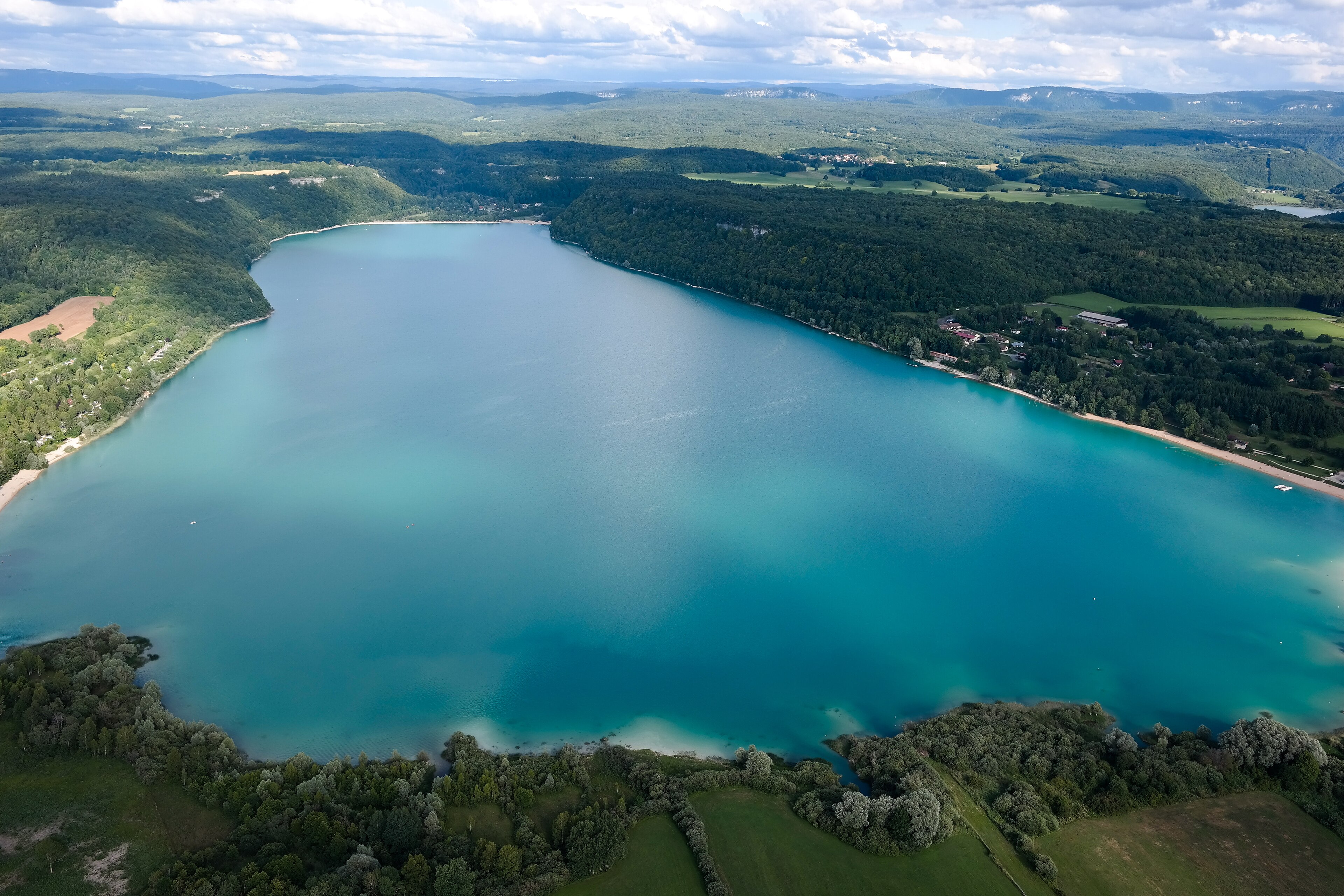
A glacial lake in the Jura preserves exceptional remains of prehistoric pile-dwelling communities, now recognized as a UNESCO World Heritage site for their archaeological significance.
At a glance
Lac de Chalain is a glacial lake located entirely within the commune of Fontenu, in France’s Jura department. The lake’s western shore holds one of Europe’s most important prehistoric archaeological sites, offering rare insight into Neolithic and Bronze Age settlement patterns.
History
Prehistoric pile-dwelling settlements flourished at the lake’s western end between approximately 4000 and 750 BC. These communities built structures directly in or beside the water, leaving behind remarkably preserved organic materials. Similar contemporary settlements exist nearby at Grand Lac de Clairvaux. The site’s archaeological importance was formally recognized when it was designated a French historical monument in 1911, and it gained international recognition when added to the UNESCO World Heritage List in 2011.
What you see
Visitors encounter a natural glacial landscape shaped by prehistoric human occupation. The archaeological remains—largely submerged or buried—are not visibly prominent; the site’s significance lies in what excavation and analysis have revealed rather than in standing structures. The surrounding Jura terrain reflects the environment these ancient communities navigated.
Cultural significance
Lac de Chalain represents an extraordinary window into European prehistory. The waterlogged conditions at the lake’s edge have preserved wood, textiles, and organic materials that normally decompose, allowing archaeologists to understand daily life, technology, and social organization of early agricultural societies. The site contributes to our knowledge of the transition from hunter-gatherer to settled communities across a millennium and a half.
Key facts
- Location: Fontenu, Jura department, France
- Coordinates: 46.67°N, 5.79°E
- Period: c. 4000–750 BC
- Designation: French historical monument (1911)
- UNESCO World Heritage status: 2011
Practical information & getting there
The lake lies near the villages of Marigny and Doucier in the Bourgogne-Franche-Comté region. Most archaeological materials remain in situ or have been transferred to research institutions; visitor facilities and access details are best confirmed through local tourism offices or the UNESCO World Heritage site resources.
Sources & resources
Find it on the map
See this place and what’s around it →
📷 Become a Cultural Heritage Online photographer
Share your photos of places: they stay published under your name as the author. The more they're seen, the more you get noticed — and soon a contest will reward the most appreciated photos.
Log in or sign up free to add a photo