
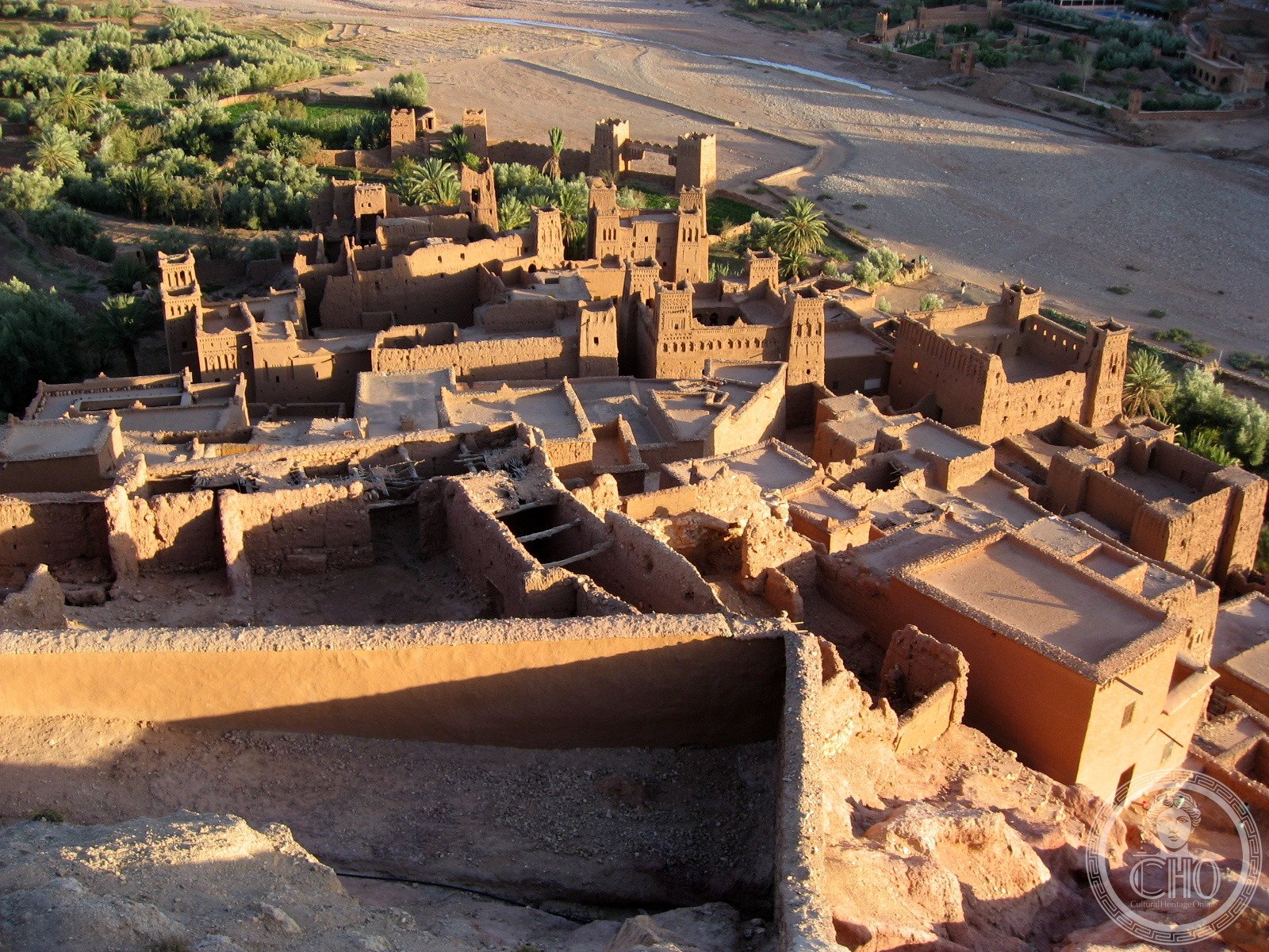
A fortified ksar that once served as a vital trading post on the caravan route between the Sahara and Marrakech, now a UNESCO World Heritage Site perched on a hillside above the Ouarzazate River.
At a glance
Ksar Ait Ben Haddou is a fortified settlement, or ksar, that developed as a crucial waystation along the ancient caravan routes connecting the Sahara desert to Marrakech. Built on a hillside overlooking the Ouarzazate River, it represents a distinctive form of urban architecture adapted to the Moroccan landscape. UNESCO recognizes it as a World Heritage Site.
History
The ksar was founded as a fortified city to serve merchants and traders traversing the Sahara. Its strategic location on the caravan route between the desert and Marrakech made it an essential stopping point for commerce and cultural exchange. Today, the settlement has expanded beyond the original fortified walls, with only a small population remaining in the ancient town itself.
What you see
The ksar exemplifies traditional Moroccan defensive architecture, with fortified structures arranged on the hillside. Earthen buildings cluster together along the slopes, their design reflecting both practical defense requirements and adaptation to the local environment and climate.
Cultural significance
Ait Ben Haddou stands as a testimony to the historic caravan trade that shaped North African commerce and culture. Its UNESCO World Heritage designation recognizes its outstanding universal value as an example of pre-Saharan earthen architecture and urban planning.
Key facts
- Address: Ait Ben Haddo, Morocco
- Coordinates: 31.0468621, -7.127339
- Official website: https://www.marocco.org/ait-benhaddou/
- UNESCO World Heritage Site
Practical information
Opening hours and ticket prices change through the year, so we do not republish them here: the current ones are on marocco.org. What does not change is where it is: Ait Ben Haddo, at 31.0468621, -7.127339.
Getting there
Ait Ben Haddou is located in the Estero region of Morocco. The site sits on a hillside above the Ouarzazate River. For detailed directions and transportation options, consult the official website or contact local tourism authorities.
See the place
Sources & resources
Find it on the map
See this place and what’s around it →📷 Become a Cultural Heritage Online photographer
Share your photos of places: they stay published under your name as the author. The more they're seen, the more you get noticed — and soon a contest will reward the most appreciated photos.
Log in or sign up free to add a photoIs this page about you?
This page is read by travellers and heritage enthusiasts who find it on Google. Tell us how you are connected to this place and we will take it from there.