
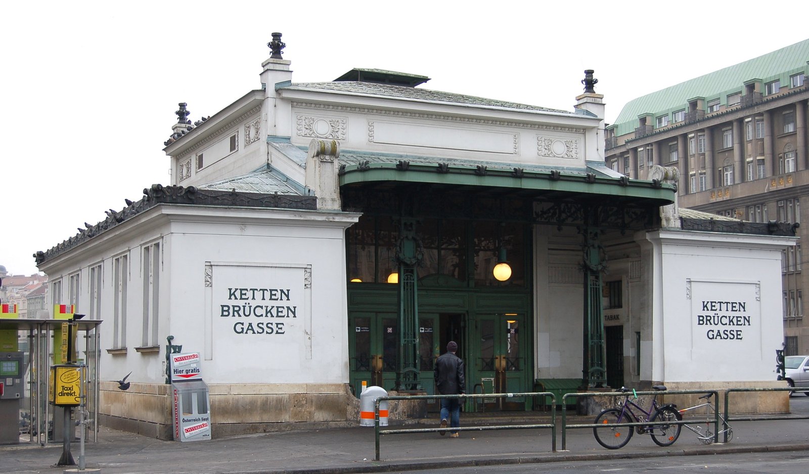
A century-old Vienna transport hub, Kettenbrückengasse bridges the city’s rail heritage from the imperial Stadtbahn era to its modern U-Bahn network.
At a glance
Kettenbrückengasse station serves the Margareten District, one of Vienna’s central neighbourhoods. The station represents a living document of Vienna’s evolving transport infrastructure—originally part of the grand Wiener Stadtbahn, it was integrated into the U4 line of the contemporary U-Bahn system.
History
The station opened in 1899 as part of the Wiener Stadtbahn, the elevated and underground railway network conceived at the height of the Austro-Hungarian Empire. In 1980, it transitioned to U-Bahn operation when the Vienna U-Bahn’s U4 line was established, modernising service while preserving its historical role in the district’s transport network.
What you see
The station reflects the hybrid character of Vienna’s transport transformation. Original Stadtbahn design elements coexist with U-Bahn-era infrastructure and finishes, creating a palimpsest of late-19th and late-20th-century construction methods and aesthetic choices.
Cultural significance
Kettenbrückengasse exemplifies Vienna’s ability to absorb and modernise historic infrastructure. The station connects residents and visitors to the Margareten District, a neighbourhood historically characterised by working-class and bohemian culture, making it more than a transit point—a marker of urban continuity.
Key facts
- Country: Austria
- City: Vienna, Margareten District
- Coordinates: 48.1966°N, 16.358°E
- Opened: 1899 (Wiener Stadtbahn)
- U-Bahn service began: 1980 (U4 line)
Practical information & getting there
Kettenbrückengasse station is accessible via the U4 line of Vienna’s U-Bahn metro system. The station serves the Margareten District and connects to the wider public transport network. Service information and journey planning are available through Vienna Public Transport (Wiener Linien) and the Oepnv journey planner.
Sources & resources
Find it on the map
See this place and what’s around it →📷 Become a Cultural Heritage Online photographer
Share your photos of places: they stay published under your name as the author. The more they're seen, the more you get noticed — and soon a contest will reward the most appreciated photos.
Log in or sign up free to add a photoIs this page about you?
This page is read by travellers and heritage enthusiasts who find it on Google. Tell us how you are connected to this place and we will take it from there.