

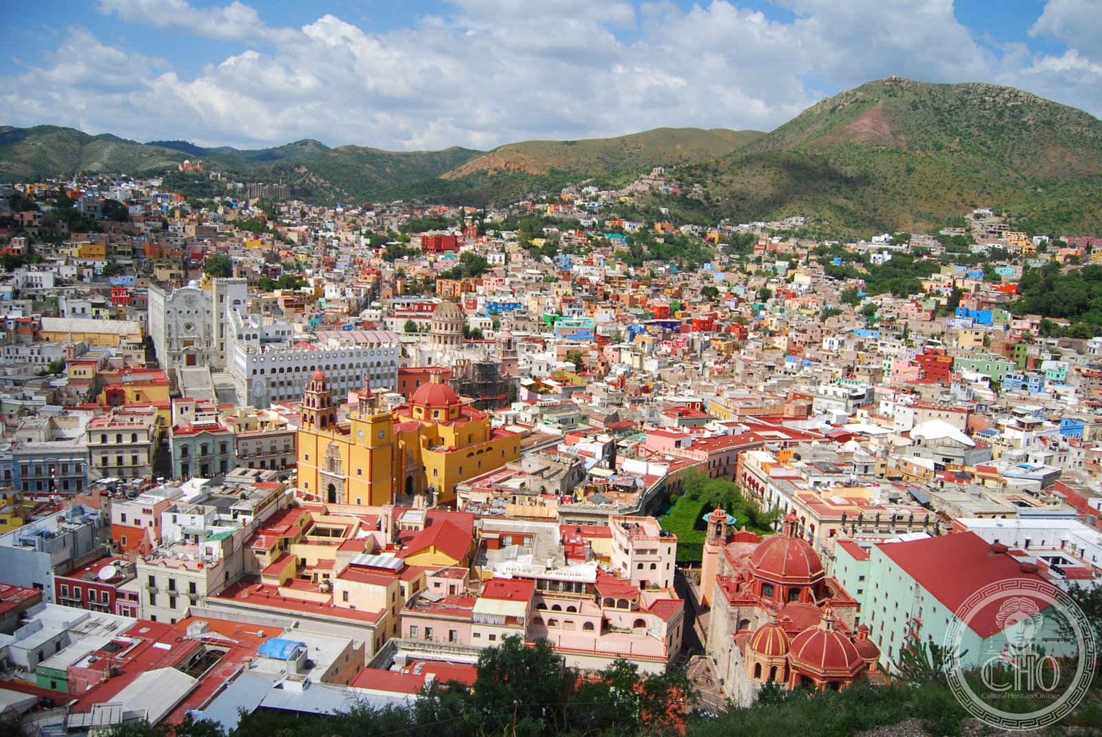
A colonial mining city built into a narrow valley, Guanajuato rose to global prominence through silver extraction and retains a labyrinthine streetscape of plazas, mansions, and underground passages.
At a glance
Guanajuato’s distinctive topography—a city compressed into a steep-sided valley—produced streets that wind upward in staircases and descend into tunnels. Its historic core assembles colonial architecture in pink and green sandstone around intimate plazas, creating an urban fabric unlike any other in Mexico. The city remains a vital cultural center, home to one of Latin America’s premier arts festivals.
History
The city’s fortune was built on mineral wealth. During the colonial period, Guanajuato’s mines ranked among the richest in the Americas, competing with Zacatecas (Mexico), Potosí (Bolivia), and Ouro Preto (Brazil). The Valenciana Mine alone accounted for two-thirds of the world’s silver production at its peak, transforming the city into a center of colonial power and prosperity.
Guanajuato played a pivotal role in Mexican independence. In 1810, the city witnessed the Alhóndiga de Granaditas, the first major battle of the Mexican War of Independence, where insurgent forces clashed with royalist troops.
What you see
The urban design reflects topographical constraint as aesthetic principle. Narrow alleys wind between buildings; many streets are closed to vehicle traffic entirely. Others ascend the mountainsides as monumental staircases. A remarkable network of underground passages—carved partly for water management and partly for commerce—runs beneath the city streets.
Colonial mansions and civic structures in pale sandstone define the historic center. Churches and plazas occupy key positions, their architecture ranging from the restrained to the ornate, marking centuries of accumulated wealth and religious devotion.
Cultural significance
UNESCO recognized Guanajuato’s historic town and adjacent mines as a World Heritage Site in 1988, acknowledging both its architectural heritage and its role in global economic history. The city hosts the Festival Internacional Cervantino, an international performing arts event attracting musicians, dancers, and theater companies worldwide.
The Mummy Museum—displaying naturally mummified bodies exhumed from the municipal cemetery—represents a unique intersection of archaeological preservation and local memory, drawing visitors to contemplate Guanajuato’s layered past.
Key facts
- Country: Mexico (capital of Guanajuato state)
- Coordinates: 21.02°N, 101.26°W
- UNESCO World Heritage Site: designated 1988
- Historic designation: Historic Town and Adjacent Mines
Practical information & getting there
Guanajuato is located in central Mexico, part of the Bajío macroregion. The city’s steep terrain and narrow passages make it best explored on foot. The underground streets offer relief from weather and provide shortcuts through the historic center. Visitors should allow time to adjust to the winding layout.
Sources & resources
Find it on the map
See this place and what’s around it →📷 Become a Cultural Heritage Online photographer
Share your photos of places: they stay published under your name as the author. The more they're seen, the more you get noticed — and soon a contest will reward the most appreciated photos.
Log in or sign up free to add a photoIs this page about you?
This page is read by travellers and heritage enthusiasts who find it on Google. Tell us how you are connected to this place and we will take it from there.