
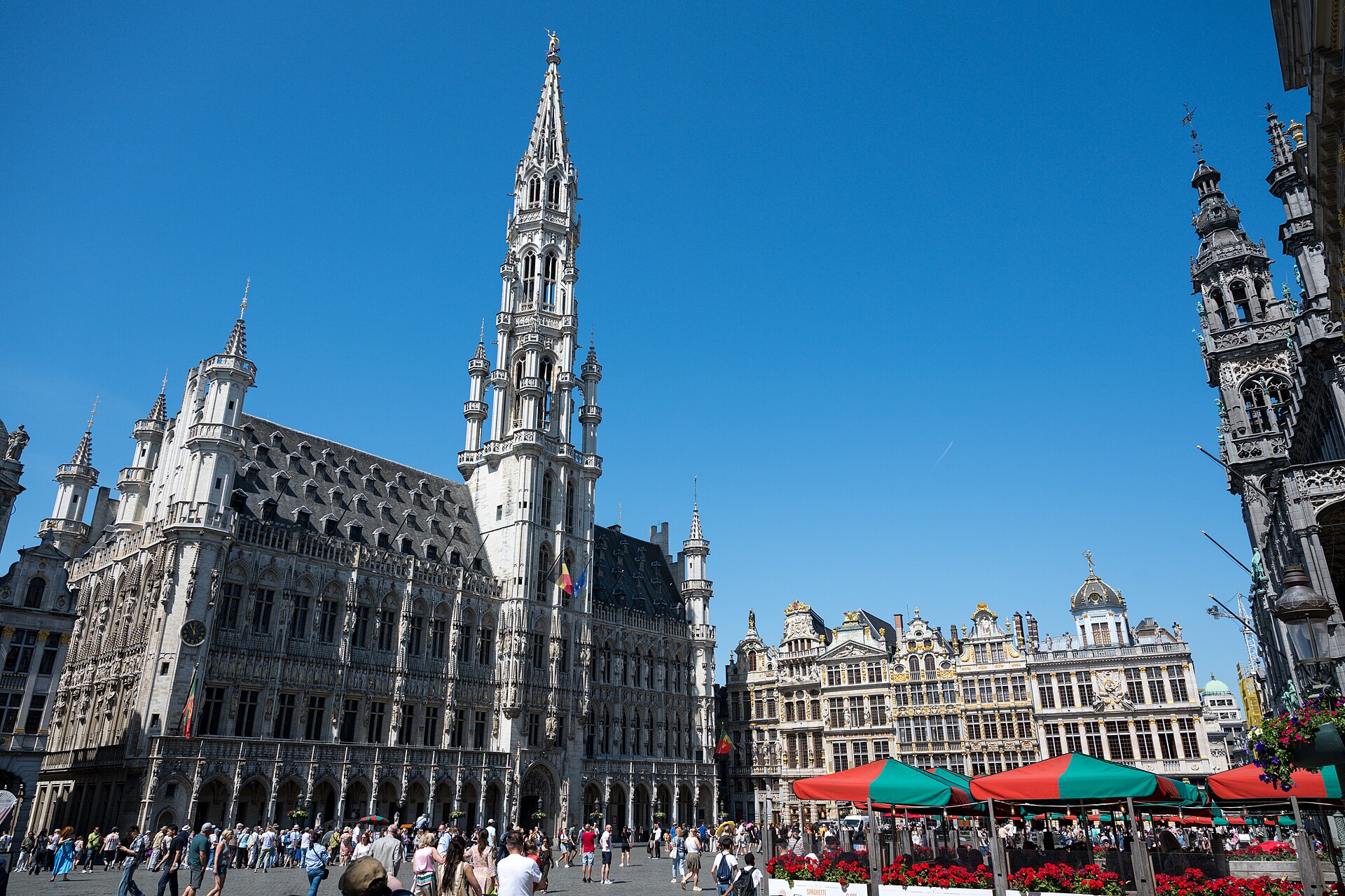
Brussels, Belgium · 68 × 110 metres, entirely paved · UNESCO World Heritage since 1998
At a glance
Almost everything you see on the Grand-Place was built after the square was destroyed. In August 1695, during the Nine Years’ War, French artillery under Marshal de Villeroy fired on Brussels for three days. The gunners aimed at the Town Hall tower because it was the tallest thing in the city, and that is precisely why the Town Hall survived: shells aimed at a landmark tend to fall around it. The guild houses that ringed the square did not survive. The merchants rebuilt them within a few years, in stone, taller and far more ornate than what had burned — which is how a bombardment produced one of the most theatrical squares in Europe.
Key facts
- Dimensions: 68 by 110 metres, entirely paved
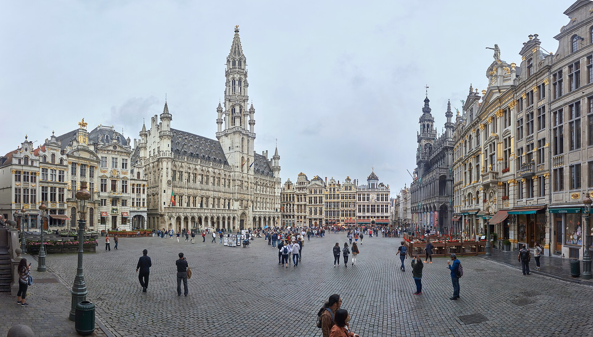
- Town Hall (Hôtel de Ville / Stadhuis): built in stages between 1401 and 1455; the square’s only surviving medieval building
- Tower: 96 metres, Brabantine Gothic, by Jan van Ruysbroek, court architect to Philip the Good
- On the spire: a gilded Saint Michael, 2.7 metres tall, by Michel de Martin Van Rode, set in place in 1454 or 1455
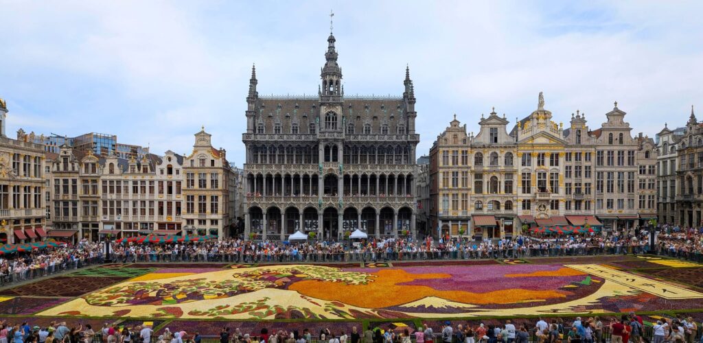
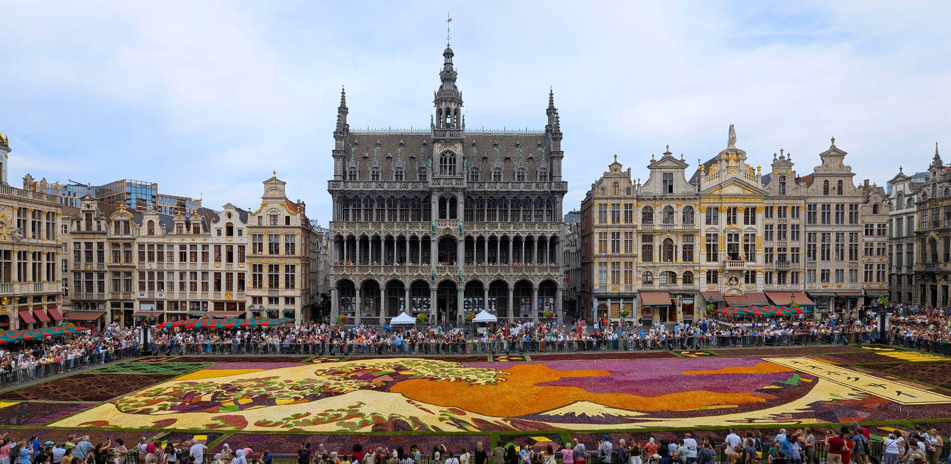
- King’s House (Maison du Roi / Broodhuis): rebuilt in neo-Gothic form 1874–1896 by Victor Jamaer; houses the Brussels City Museum
- Bombarded 13–15 August 1695 by the troops of Marshal de Villeroy, on the order of Louis XIV
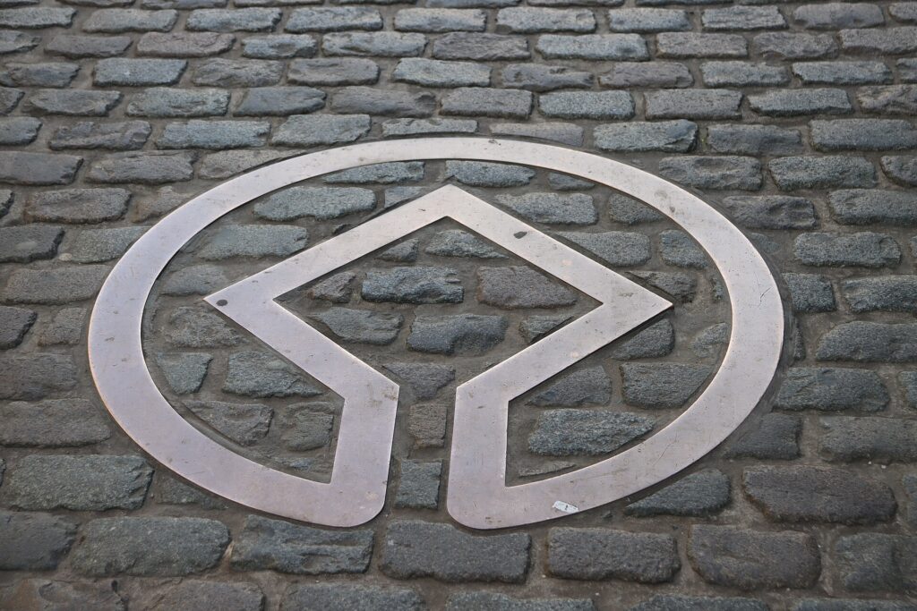
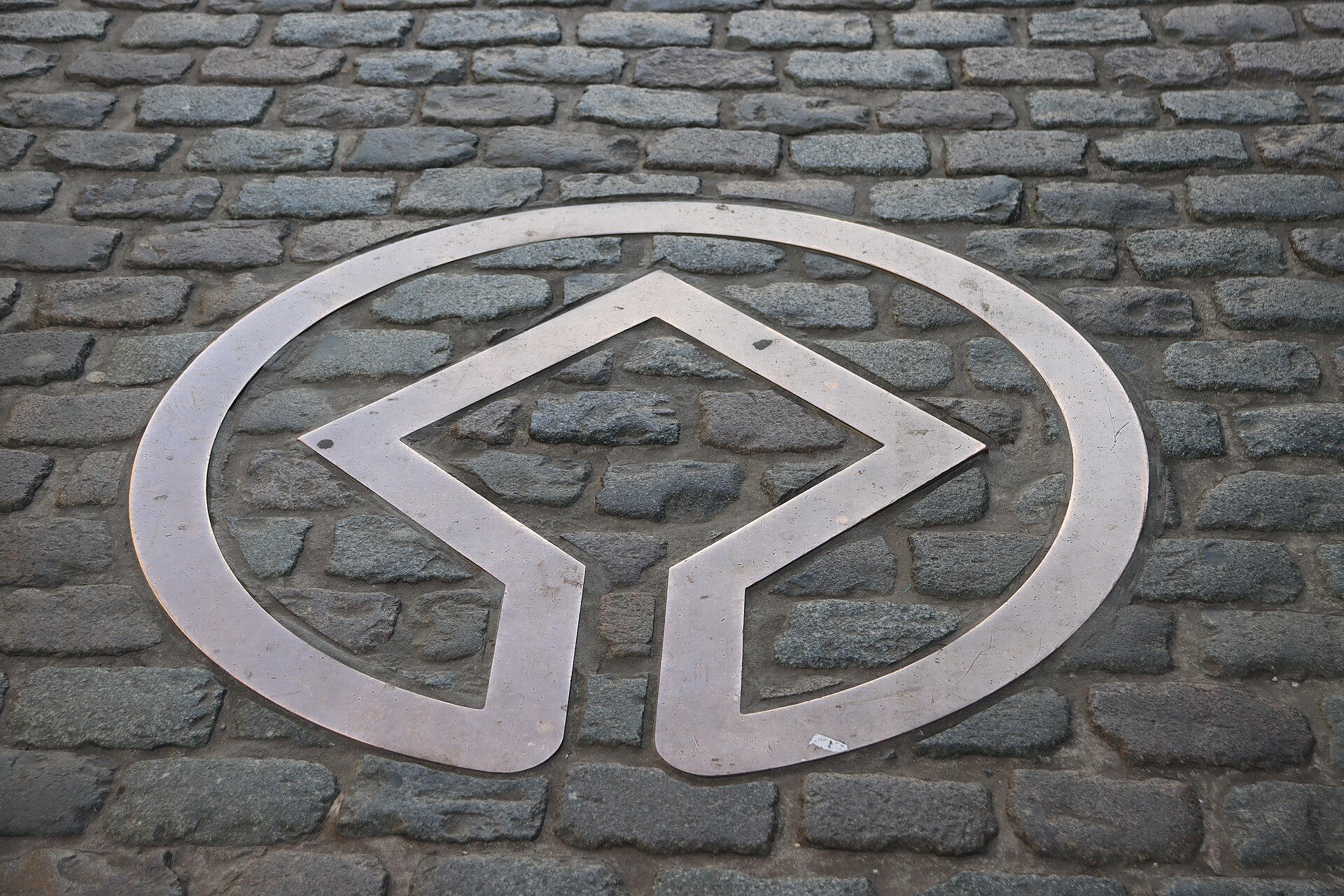
- Inscribed on the UNESCO World Heritage List in 1998
History
The square began as a marketplace on drained marshland in the eleventh century and was largely complete by the seventeenth. Its two great buildings tell opposite stories. The Town Hall was raised by the city itself: the east wing and a shorter tower went up between 1401 and 1421, probably to designs by Jacob van Thienen working with Jean Bornoy. The first stone of the west wing was laid in 1444 by the young Charles the Bold. Until 1795 the building housed not only the city magistrate but the States of Brabant, the assembly of nobility, clergy and commoners; in 1830 the Provisional Government of the Belgian Revolution worked from these rooms.
Across the square, the King’s House began as something far humbler: a wooden hall where bread was sold, which is why the Dutch name is still Broodhuis, the Bread House. In the fifteenth century a stone building replaced it and took over the administrative services of the Duke of Brabant, so it became the Duke’s House; when that same duke became King of Spain, the name changed again. No king has ever lived there. Charles V had his court architect Antoon II Keldermans rebuild it in late Gothic; the 1695 shells wrecked it; a neoclassical portal arrived in 1767; and between 1874 and 1896 Victor Jamaer demolished and rebuilt the whole thing in the neo-Gothic manner of his master, Viollet-le-Duc, adding two galleries and a central tower. The building inaugurated in 1896 is the one in the photographs — a nineteenth-century idea of what a sixteenth-century bread hall ought to have looked like.
What you see
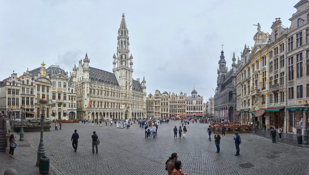
Stand with your back to the King’s House and the asymmetry of the Town Hall becomes obvious: the tower is not in the middle, and the two halves of the facade are not the same length, though at first glance they seem to be. A legend says the architect, discovering the error, threw himself from the tower. The tower is the reason to look up anyway. Above the roofline the square shaft narrows into an openwork octagon bristling with pinnacles, and at the very top Saint Michael, patron saint of the city, drives his lance into a demon while turning in the wind.
The guild houses are a different kind of pleasure, and a quick lesson in who paid for what. Each facade advertises its trade in gilded relief: the brewers’ house, which today holds the Brewers’ Museum, the bakers, the tallow merchants, the boatmen. Gold leaf catches the late sun on the eastern side of the square, and that is when the Grand-Place looks least like a museum and most like what it was — a place where money was made and displayed.
Photographs
Practical information
- The square is public and open at all hours; it is at its emptiest early in the morning
- The Brussels City Museum occupies the King’s House and holds the wardrobe of the Manneken Pis; the Brewers’ Museum is in the brewers’ guild house
- Every two years in mid-August a flower carpet of more than 500,000 begonias covers 77 by 24 metres of the paving, for three to four days. The first was laid in 1971 by the Ghent landscape architect Etienne Stautemans; the event has been biennial since 1986
- The Ommegang procession ends on the square at the turn of June and July, re-enacting since 1930 the entry of Charles V and his son Philip into the city in 1549
- A Christmas tree has stood on the square every winter since the mid-twentieth century
Getting there
The Grand-Place sits at the centre of the Pentagon, the old walled city. It is a five-minute walk from Brussels-Central station, and the nearest metro stops are Bourse/Beurs and Gare Centrale. Every street approaching it is narrow, so the square arrives suddenly — which is, and always was, the point.
Nearby
- King’s House — the Bread House itself, on the north side of the square
- Galeries Royales Saint-Hubert — the 1847 shopping arcade, 200 metres north
- The Manneken Pis, five minutes south-west down Rue de l’Étuve
Sources
- Ville de Bruxelles — Stad Brussel, Grand-Place of Brussels: UNESCO inscription in 1998; the August 1695 bombardment by the French troops of Marshal de Villeroy during the War of the League of Augsburg; the flower carpet of 77 × 24 m and more than 500,000 begonias, every two years in mid-August; the brewers’ guild house and its museum.
- Région de Bruxelles-Capitale, Inventaire du patrimoine architectural, entries for the Hôtel de ville and the Maison du Roi (architects recorded: Jacques van Thienen, Jehan Bornoy, Pierre Victor Jamaer).
- Wikipedia, Grand-Place (English), for the dimensions of the square, the building phases of 1401–1455, the 96-metre tower by Jan van Ruysbroek, the Saint Michael of 1454–1455 by Michel de Martin Van Rode, the successive names and rebuildings of the King’s House, and the history of the flower carpet and the Ommegang.
Gallery
Find it on the map
See this place and what’s around it →📷 Become a Cultural Heritage Online photographer
Share your photos of places: they stay published under your name as the author. The more they're seen, the more you get noticed — and soon a contest will reward the most appreciated photos.
Log in or sign up free to add a photoIs this page about you?
This page is read by travellers and heritage enthusiasts who find it on Google. Tell us how you are connected to this place and we will take it from there.