
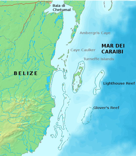
A partially submerged atoll marking the outermost edge of the Belize Barrier Reef, where coral rings enclose lagoons of extraordinary marine biodiversity.
At a glance
Glover’s Reef sits approximately 45 km (28 miles) offshore from mainland Belize. This atoll is one of three that compose the Belize Barrier Reef system, alongside Turneffe Atoll and Lighthouse Reef, forming its seaward boundary.
History
The atoll takes its name from the pirate John Glover, who reportedly used these waters as a base. The reef remains a significant ecological and maritime landmark in the Caribbean.
What you see
Glover’s Reef is a classic atoll formation—a ring of coral with islands and cays surrounding a shallow lagoon. The partially submerged structure creates distinctive landforms and underwater topography. Coral gardens, channels, and deep walls characterize the marine environment.
Cultural significance
The atoll represents one of the world’s most pristine coral reef systems. It holds immense ecological importance as habitat for fish, sea turtles, rays, and other marine species. The Belize Barrier Reef, of which Glover’s Reef forms the outermost section, is recognized globally as a marine biodiversity hotspot.
Key facts
- Country: Belize
- Location: Southern coast, approximately 45 km offshore
- Coordinates: 16.823°N, 87.791°W
- Type: Partially submerged atoll
- Part of: Belize Barrier Reef system (one of three atolls)
Practical information & getting there
Glover’s Reef is accessible by boat from coastal towns such as Dangriga or Hopkins. The atoll is a destination for diving, snorkeling, and marine research. Check local operators for current access, weather conditions, and marine regulations before visiting.
Sources & resources
Find it on the map
See this place and what’s around it →📷 Become a Cultural Heritage Online photographer
Share your photos of places: they stay published under your name as the author. The more they're seen, the more you get noticed — and soon a contest will reward the most appreciated photos.
Log in or sign up free to add a photoIs this page about you?
This page is read by travellers and heritage enthusiasts who find it on Google. Tell us how you are connected to this place and we will take it from there.