
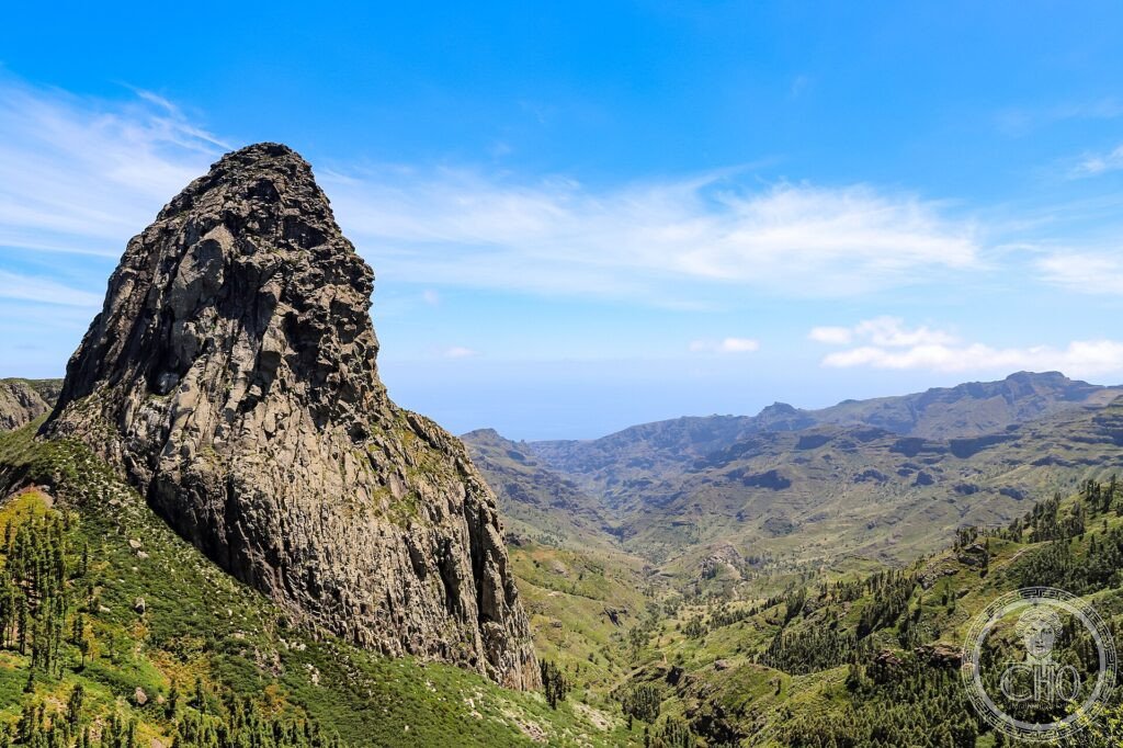
On the summit of the island of La Gomera, almost always wrapped in the mist carried by the trade winds, survives a laurel forest like those that covered Europe millions of years ago. The laurisilva of Garajonay is a living relic of the Tertiary era, vanished almost everywhere except on a few Atlantic islands.
At a glance
Garajonay National Park crowns the island of La Gomera in the Canaries with a dense, ancient laurel forest — the laurisilva — a relic of the subtropical woodland that covered much of Europe and North Africa in the Tertiary era, millions of years ago. Almost permanently bathed in the mist brought by the trade winds, this lush, mossy forest of laurels, tree heaths and ferns survives here as one of the finest examples of a vanished world. It was inscribed by UNESCO in 1986.
Key facts
- UNESCO: World Heritage since 1986 (Garajonay National Park)
- Laurisilva: a relic laurel forest of the Tertiary era
- Living fossil: woodland type long vanished from continental Europe
- Trade-wind mist: the forest is fed by near-constant cloud
- Roque de Agando: the striking volcanic plug on the park’s edge
- Island summit: covers the high central plateau of La Gomera
History
Forests of laurel once spread across the warm, humid lands of the Mediterranean and beyond, but as the climate changed over millions of years they died out almost everywhere on the continents. On a few Atlantic islands — the Canaries, Madeira, the Azores — the mild, moist climate allowed them to survive, and Garajonay on La Gomera preserves one of the largest and best-conserved tracts.
The forest, named after a legendary local princess and her lover, was used for centuries by the Gomerans for water, wood and grazing, but its core was protected as a national park in 1981 and inscribed by UNESCO in 1986. A serious fire in 2012 damaged part of the park, from which the resilient laurisilva is recovering.
What you see
Trails wind through the dim, green forest, where gnarled laurels and tree heaths drip with moss and lichen in the constant mist, ferns crowd the floor, and springs trickle through the gloom. Above the trees rise viewpoints and volcanic rocks such as the Roque de Agando, with vistas over the island and, on clear days, neighbouring Tenerife and its Teide.
The hush and humidity of the cloud forest, so unlike the dry Canary coast below, is the magic of Garajonay.
Practical information
- Park: free access; a network of walking trails and viewpoints
- Best time: year-round; expect mist and cool, damp air
- Time needed: half a day to a day of walking
- Note: bring layers and grip; weather changes quickly in the cloud
Getting there
Garajonay covers the central highlands of La Gomera, in the Canary Islands, Spain. La Gomera is reached by ferry from Tenerife; the park is crossed by road from San Sebastián de La Gomera. GPS: 28.13° N, 17.24° W.
Nearby
- San Sebastián de La Gomera — the island capital and Columbus port
- Valle Gran Rey — a dramatic valley to the sea
- Tenerife and Teide — the neighbouring island and volcano
Sources
- UNESCO World Heritage Centre — “Garajonay National Park” (ref. 380)
- Organismo Autónomo Parques Nacionales (Spain) — official body
- Encyclopaedia Britannica — La Gomera; laurisilva
Find it on the map
See this place and what’s around it →📷 Become a Cultural Heritage Online photographer
Share your photos of places: they stay published under your name as the author. The more they're seen, the more you get noticed — and soon a contest will reward the most appreciated photos.
Log in or sign up free to add a photo