

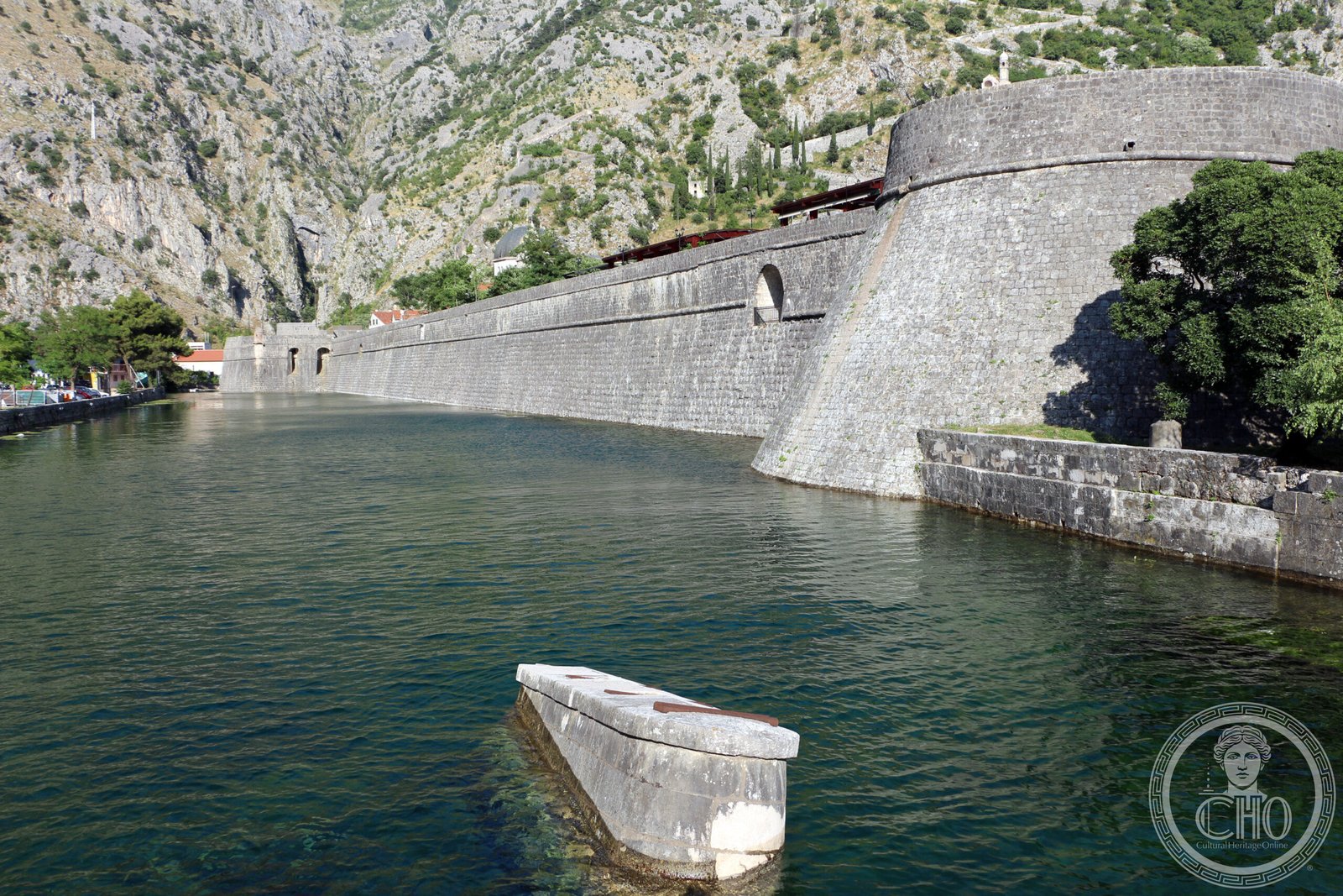
A monumental defensive system layered with centuries of military innovation, Kotor’s ramparts, towers, and citadels synthesize Illyrian, Byzantine, Venetian, and Austrian architecture into a unified fortress that guards one of Europe’s most dramatic coastal towns.
At a glance
The fortifications of Kotor form an integrated historical system protecting the medieval town, encompassing ramparts, towers, citadels, gates, bastions, forts, cisterns, a castle, and supporting structures. This layered defense reflects multiple imperial powers and architectural traditions spanning more than a millennium.
History
Kotor’s fortifications accumulated defensive strategies across centuries of occupation and trade. Illyrian, Byzantine, Venetian, and Austrian military engineers each left their mark, adapting structures to local terrain and emerging siege technologies. Venice’s long dominion shaped the 15th–17th-century additions, while Austrian rule left its own architectural signature. The integrated system preserves this archaeological palimpsest, revealing how successive powers reimagined defense.
What you see
The fortification complex combines diverse military elements: crenellated ramparts trace the hillsides above town, bastions command the harbor approaches, and towers punctuate the defensive perimeter. A castle crowns the system, while cisterns, gates, and ancillary structures demonstrate the logistical demands of sustained siege defense. Venetian masonry and Austrian renovations coexist with earlier stonework, creating a visible timeline of military engineering.
Cultural significance
Kotor’s fortifications represent the only UNESCO World Heritage Site of cultural significance in Montenegro. In 2017, they were recognized as part of the broader UNESCO inscription “Venetian Works of Defence between 15th and 17th centuries: Stato da Terra – western Stato da Mar,” acknowledging their importance within the Venetian defensive network. Combined with the old town’s natural Bay of Kotor setting, the fortifications embody how geography, architecture, and history converge.
Key facts
- Country: Montenegro
- City: Kotor
- Coordinates: 42.42°N, 18.77°E
- UNESCO status: World Heritage Site (1979, expanded 2017)
- Inscription titles: Natural and Culturo-Historical Region of Kotor (1979); Venetian Works of Defence (2017)
Practical information & getting there
Kotor lies on Montenegro’s Adriatic coast, approximately 20 km south of the capital Podgorica. The town and its fortifications are accessible year-round. The fortification walls and citadel offer views across the Bay of Kotor and invite walkers to explore medieval gateways and defensive structures at their own pace. Full opening hours and current visitor facilities should be confirmed with local tourism information.
Sources & resources
Find it on the map
See this place and what’s around it →
📷 Become a Cultural Heritage Online photographer
Share your photos of places: they stay published under your name as the author. The more they're seen, the more you get noticed — and soon a contest will reward the most appreciated photos.
Log in or sign up free to add a photoIs this page about you?
This page is read by travellers and heritage enthusiasts who find it on Google. Tell us how you are connected to this place and we will take it from there.