
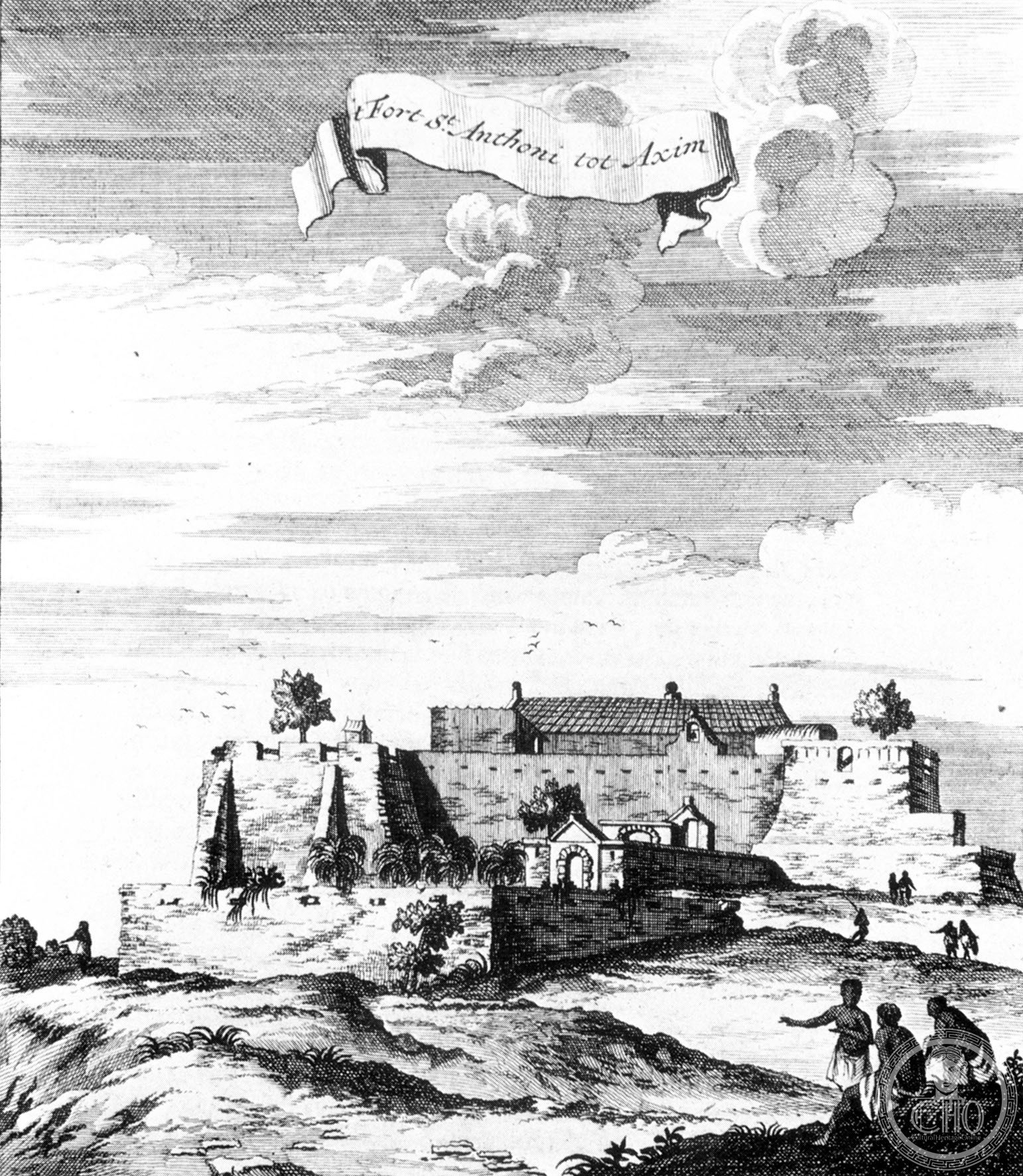
A Portuguese fortress on Ghana’s coast, built in 1515 and later a vital Dutch trading post—now a UNESCO-listed monument to centuries of European commerce and colonial presence in West Africa.
At a glance
Fort Saint Anthony stands near Axim as a stone testament to early modern Atlantic trade networks. Established by the Portuguese and expanded by the Dutch, it served as a supply station and administrative hub for three and a half centuries before passing to British control and finally to the modern Ghanaian state.
History
The Portuguese built Fort Saint Anthony in 1515 as an outpost for their Gold Coast trade. In 1642, Dutch forces captured the fort and incorporated it into the Dutch Gold Coast, their expanding West African territory. The Dutch substantially enlarged the structure to accommodate their growing commercial operations and administrative needs.
As the westernmost fort in Dutch possessions, Fort Saint Anthony held strategic importance—the first point of call for Dutch traders, where ships took on provisions and fresh water. The fort’s commandant served as senior commissioner in the Colonial Council at Elmina, wielding significant authority alongside commanders at other major posts. Unlike many Dutch Gold Coast forts, Fort Saint Anthony remained continuously occupied throughout the 19th century until the British took possession in 1872. The Ghanaian state now owns and maintains it as a public monument.
What you see
The architectural details reflect its dual heritage. Portuguese foundations and Dutch expansions are evident in the fort’s fortified structure, designed to withstand Atlantic weather and serve defensive and commercial functions simultaneously.
Cultural significance
Fort Saint Anthony embodies the material legacy of European pre-colonial and colonial exploitation in West Africa. Its continuous occupation distinguishes it from many contemporaneous fortifications that were abandoned or destroyed. In recognition of its historical value, UNESCO inscribed Fort Saint Anthony on the World Heritage List in 1979 alongside other castles and forts across Ghana, affirming its importance to understanding trans-Atlantic trade and colonialism.
Key facts
- Built by the Portuguese in 1515
- Captured by the Dutch in 1642
- Transferred to British control in 1872
- UNESCO World Heritage site (inscribed 1979)
- Located near Axim, Ghana
- Coordinates: 4.868°N, 2.2444°W
Practical information & getting there
The fort is now the property of the Ghanaian state and open to the public. For current visiting hours, admission fees, and travel directions to Axim, consult local tourism resources before planning your visit.
Sources & resources
Find it on the map
See this place and what’s around it →📷 Become a Cultural Heritage Online photographer
Share your photos of places: they stay published under your name as the author. The more they're seen, the more you get noticed — and soon a contest will reward the most appreciated photos.
Log in or sign up free to add a photoIs this page about you?
This page is read by travellers and heritage enthusiasts who find it on Google. Tell us how you are connected to this place and we will take it from there.