

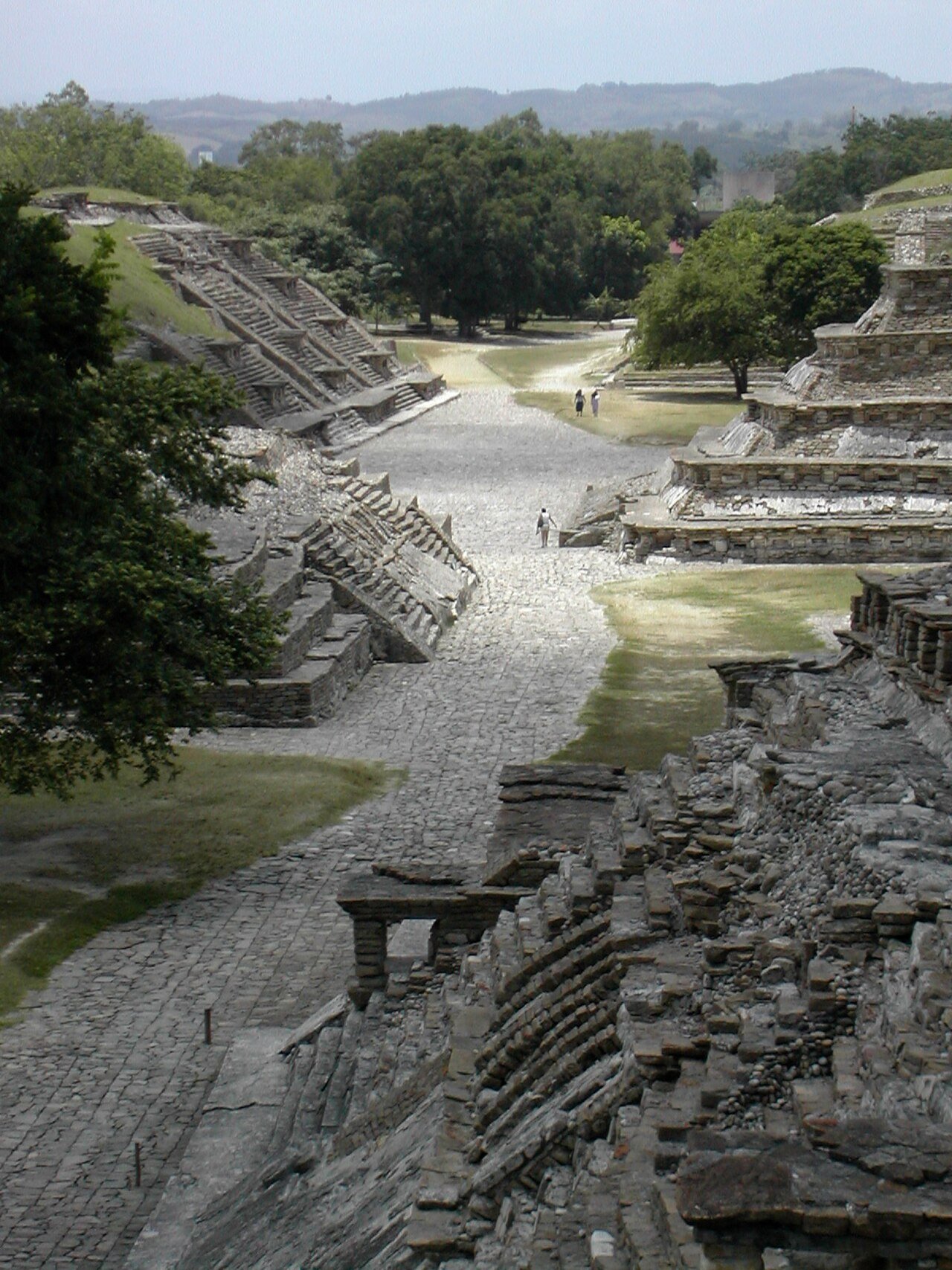
El Tajín was the ceremonial and political capital of Mexico’s Gulf Coast, its stepped Pyramid of the Niches carved with 365 alcoves marking the solar year. The city also holds more excavated ball courts than any other Mesoamerican site, where the rubber ball game carried the weight of theology rather than sport.
At a glance
El Tajín stands just outside Papantla in northern Veracruz. Built and inhabited chiefly by the Totonac and their predecessors, the city flourished during the Classic and Epiclassic periods, reaching an estimated population of 20,000 at its height. Its excavated zone covers roughly 10.5 hectares, though lidar surveys indicate the wider urban area was considerably larger.
Key facts
- Location: Papantla, Veracruz, Mexico
- Culture: Totonac and predecessor peoples
- Period: flourished c. 800–1200 AD
- Estimated peak population: around 20,000
- Ball courts excavated: 17, more than any other known Mesoamerican site
- Signature monument: Pyramid of the Niches, with 365 niches representing the days of the solar year
History
El Tajín was the dominant urban centre of Mexico’s Gulf Coast through the Classic and Epiclassic periods, roughly 600 to 1200 AD. Around 1200 AD the city was conquered and largely destroyed by Chichimec peoples moving south from northern Mexico, and it was subsequently abandoned to the jungle. Because neither the Aztecs nor the Spanish later built over the site, El Tajín preserves a single-period archaeological record without the later overlays seen at places such as Teotihuacan or Chichén Itzá.
The site was officially rediscovered in 1785, when the soldier Diego Ruiz came across the Pyramid of the Niches while searching the jungle for illegal tobacco cultivation. Systematic archaeological work began in 1938 under José García Payón and continued through the twentieth century. El Tajín was inscribed as a UNESCO World Heritage Site in 1992.
What you see
The Pyramid of the Niches dominates the site, a seven-tiered structure rising 18 metres from a 25 by 25-metre base. Every tier is carved with deep rectangular niches, 365 in total plus 12 more set into the main staircase cornice, framed by a step-and-fret motif identified as the glyph of the Storm God Tajín. The niches would once have held painted stucco figurines, though the pigment has not survived.
Across the city, 17 excavated ball courts attest to El Tajín’s standing as the centre of the Mesoamerican ball game. The South Ball Court and Ball Court No. 11 carry carved stone friezes depicting the ritual climax of the game, including a decapitation scene in which blood is shown transforming into serpents. The courts were built with drainage channels to keep their I-shaped playing fields clear of water in the region’s heavy rains. A site museum displays original ball-court friezes alongside a scale model of the city.
Practical information
- Opening days: the site is open Tuesday to Sunday; check the official channel for current times
- Museum: the Museo de Sitio holds original ball-court friezes and a scale model of El Tajín
- Conditions: the site is largely unshaded, so sun protection and water are advisable
- Festival: the Festival Cumbre Tajín takes place annually around the spring equinox, featuring Totonac performers, Voladores, and artisans
Getting there
El Tajín lies just outside Papantla, in northern Veracruz, around 250 km north of the city of Veracruz. The nearest airport is Poza Rica, about 45 km away.
Nearby
- Papantla — the nearby town from which the site takes its regional name, home to Totonac descendants who still perform the Danza de los Voladores
- Poza Rica — around 45 km away, the nearest airport for reaching the site
Sources
- UNESCO
Find it on the map
See this place and what’s around it →📷 Become a Cultural Heritage Online photographer
Share your photos of places: they stay published under your name as the author. The more they're seen, the more you get noticed — and soon a contest will reward the most appreciated photos.
Log in or sign up free to add a photo