
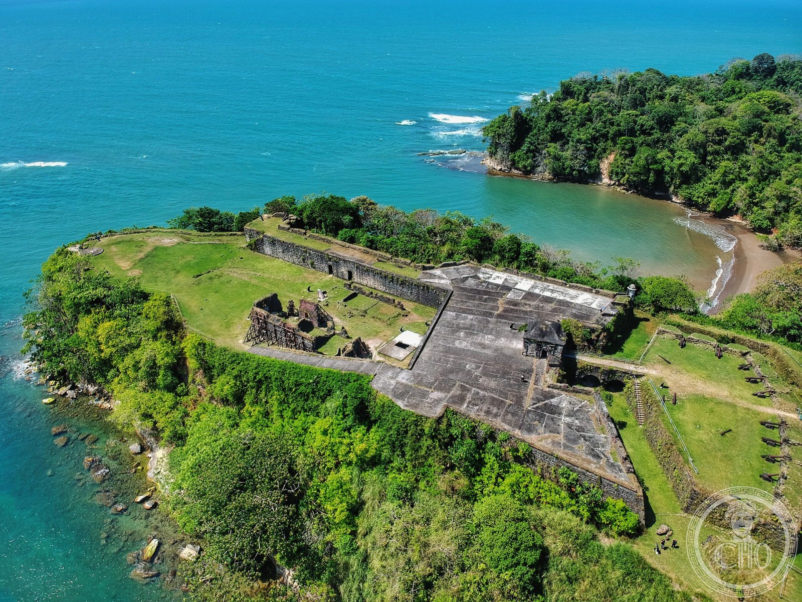
Once Panama’s principal Atlantic port, Chagres is now an abandoned village anchoring the ruins of Fort San Lorenzo, a strategic colonial stronghold overlooking the Chagres River mouth.
At a glance
The site comprises two layers of historical significance: the fortified settlement of Chagres, which dominated Atlantic trade on the isthmus, and the military fortress built to protect it. Today, visitors encounter archaeological remains set on a river promontory, roughly 8 miles west of Colón.
History
Chagres emerged as the chief Atlantic port facilitating commerce across the isthmus of Panama during the colonial period. Fort San Lorenzo was constructed to defend this vital trading hub and the wealth flowing through it. The fort’s strategic position at the river mouth made it a contested location throughout the centuries of European colonial competition in Central America.
What you see
Fort San Lorenzo survives as ruins on a commanding promontory. The abandoned village of Chagres lies adjacent to the fortification. The site’s geography—overlooking the Chagres River mouth on the Caribbean coast—remains the dominant architectural feature, explaining why Europeans chose this location for control of the isthmus.
Cultural significance
Chagres represents a crucial node in the history of American colonial trade networks. The fort embodies centuries of European imperial rivalry in the Western Hemisphere, while the abandoned village testifies to the shifting economic and political forces that rendered such settlements obsolete as colonial systems evolved.
Key facts
- Location: 8 miles (13 km) west of Colón, Panama
- Coordinates: 9.32°N, 80.00°W
- Historical function: Atlantic port and colonial fortress
- Current status: Archaeological site with ruined fort and abandoned village
Practical information & getting there
The site is accessible from Colón, located about 8 miles to the east. The ruins occupy a promontory on the Caribbean coast where the Chagres River meets the sea. You should verify current access conditions and local safety information before visiting, as infrastructure in this region is limited.
Sources & resources
Find it on the map
See this place and what’s around it →📷 Become a Cultural Heritage Online photographer
Share your photos of places: they stay published under your name as the author. The more they're seen, the more you get noticed — and soon a contest will reward the most appreciated photos.
Log in or sign up free to add a photoIs this page about you?
This page is read by travellers and heritage enthusiasts who find it on Google. Tell us how you are connected to this place and we will take it from there.