

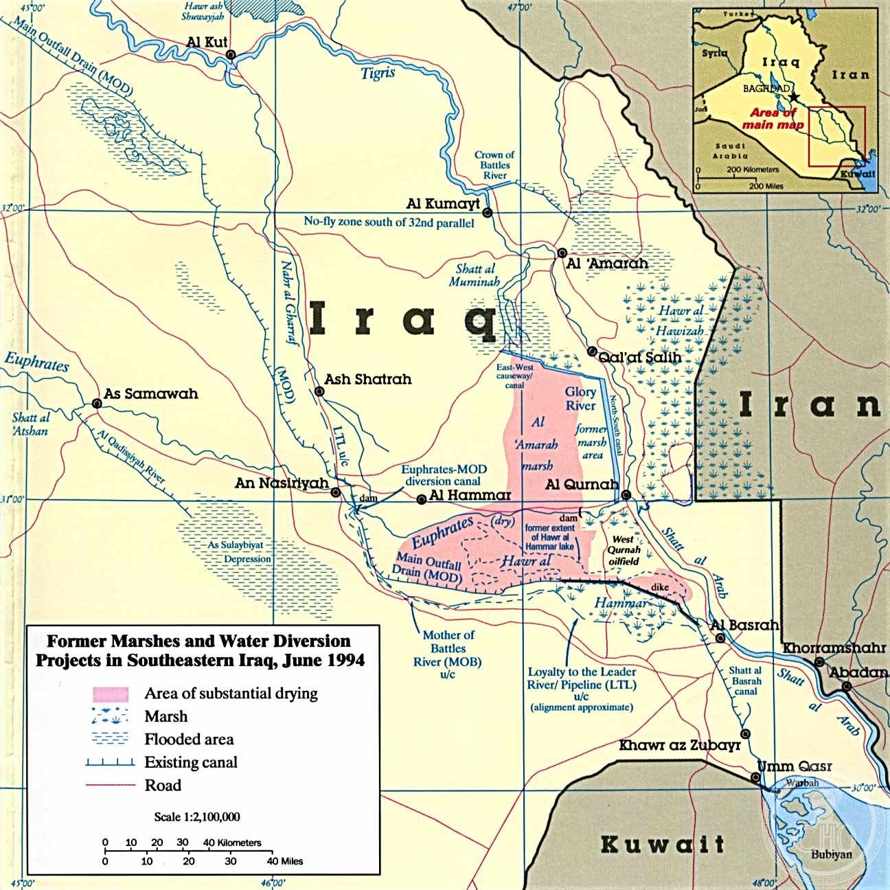
A vast wetland complex in southern Iraq, the Central Marshes form part of the Mesopotamian Marshes—one of the world’s largest and most ecologically significant freshwater ecosystems, shaped by millennia of human settlement and recent ecological restoration.
At a glance
The Central Marshes, also known as the Qurna Marshes, constitute a major wetland complex within the Tigris–Euphrates river system. Once covering approximately 3,000 square kilometres, they form part of a larger marsh ecosystem alongside the Hawizeh and Hammar marshes. This region represents a landscape of profound ecological and cultural importance to Iraq and the wider Middle East.
History
The marshes have sustained human civilisation for thousands of years, supporting the Marsh Arabs and providing critical habitat for migratory birds and aquatic life. Following the 1991 uprisings in Iraq, the marshes were almost completely drained—a process that devastated the ecosystem and displaced communities. In recent years, major reflooding efforts have begun to restore these vital wetlands, marking a significant shift toward ecological recovery and cultural preservation.
What you see
The landscape consists of shallow water channels, reed beds, and islands created by accumulated sediment. Water levels fluctuate seasonally, shaping the habitat for abundant wildlife. The marshes support traditional reed houses built by local inhabitants, reflecting centuries of adaptation to this aquatic environment.
Cultural significance
The Central Marshes hold profound meaning for Iraq’s heritage and biodiversity. They are home to the Marsh Arabs, whose distinctive culture has persisted for millennia. The wetlands provide crucial stopover habitat for migratory birds crossing between Africa and Central Asia, making them globally significant for conservation.
Key facts
- Country: Iraq
- Coordinates: 31.04°N, 47.025°E
- Former extent: approximately 3,000 square kilometres
- Part of the Mesopotamian Marshes alongside the Hawizeh and Hammar marshes
Practical information & getting there
Access to the Central Marshes requires travel to southern Iraq. Current political conditions and security concerns should be assessed before planning a visit. Local guides familiar with waterways and seasonal water levels are essential for navigation and cultural context.
Sources & resources
- Central Marshes (Wikipedia)
- Cultural Heritage Online
Find it on the map
See this place and what’s around it →📷 Become a Cultural Heritage Online photographer
Share your photos of places: they stay published under your name as the author. The more they're seen, the more you get noticed — and soon a contest will reward the most appreciated photos.
Log in or sign up free to add a photoIs this page about you?
This page is read by travellers and heritage enthusiasts who find it on Google. Tell us how you are connected to this place and we will take it from there.