
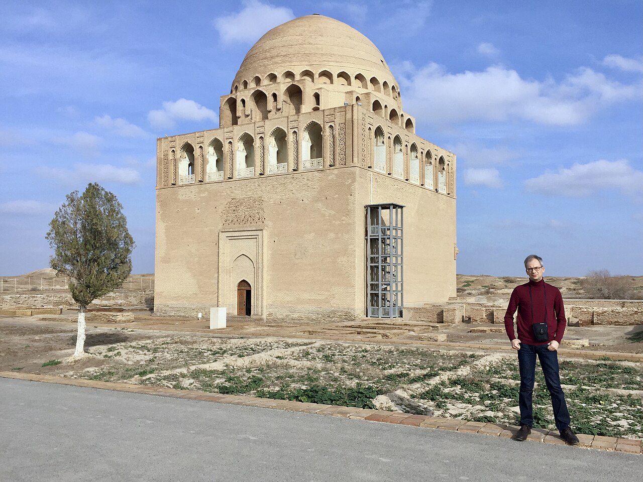
Turkmenistan holds two of Central Asia’s most significant UNESCO World Heritage Sites within reach of its capital: the Parthian Fortresses of Nisa, a short drive from Ashgabat, and Ancient Merv, the great Silk Road metropolis that once claimed the title of the world’s largest city. From Cultural Heritage Online.
Parthian Fortresses of Nisa 18 km southwest — 30 min by taxi
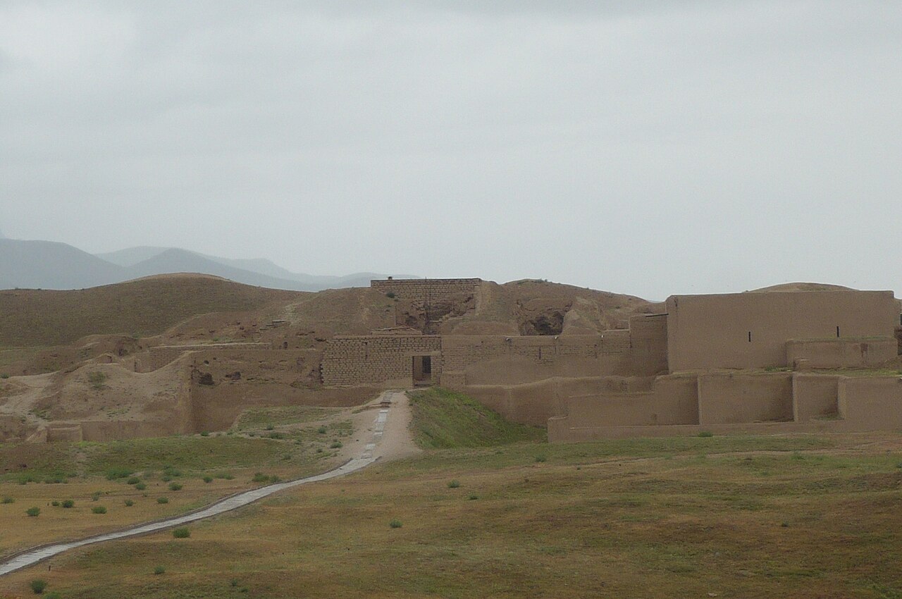
Old Nisa sits on a low earthen mound rising from the Kopet Dag foothills, its eroded mud-brick ramparts enclosing roughly 14 hectares. The site divides into two components inscribed together in 2007: Old Nisa (the royal ceremonial compound) and New Nisa (the administrative town). What draws archaeologists and visitors is not the visible architecture alone — much has returned to earth — but the quality of what was found inside. The Round Hall, interpreted as a throne room, and the Square Hall, possibly a dynastic mausoleum, were among the most elaborately decorated spaces in the ancient Iranian world.
The Parthian Empire established its first capital here in the 3rd century BC, and Nisa remained a seat of royal power for roughly five centuries until the 3rd century AD. The empire at its height stretched from the Euphrates to eastern Iran, acting as the principal intermediary between Rome and China on the Silk Road. Nisa’s cultural signature — visible most vividly in the 40 ivory rhyta (drinking vessels) recovered from the treasury — blends Hellenistic imagery with Iranian iconography: centaurs, griffins, and scenes from Greek mythology rendered on objects unmistakably shaped by Persian court ritual. The rhyta are now in the National Museum of Turkmenistan in Ashgabat, a natural complement to any visit to the site.
The ruins themselves require some imagination to read. Archaeologists from the Italian Turin University have worked the site for decades, and signage has improved, but visitors expecting standing architecture will find instead exposed wall foundations, deep excavation trenches, and the satisfying silence of a place that has not been reconstructed for tourism. The hilltop position gives a clear view across the flatlands toward Ashgabat’s white marble skyline — an accidental juxtaposition that makes the timescales involved feel very concrete.
Getting there: Taxi from Ashgabat city centre, approximately 30 minutes; agree the fare in advance. The site lies just outside the village of Bagir. Allow: 2–3 hours including travel. Combine with the National Museum of Turkmenistan (Nisa rhyta collection) on the same day. Best for: Travellers with a specific interest in Achaemenid and Parthian archaeology, Silk Road history, or the Iranian world before Islam.
State Historical and Cultural Park ‘Ancient Merv’ 350 km east — 4 hr by road or 1 hr domestic flight
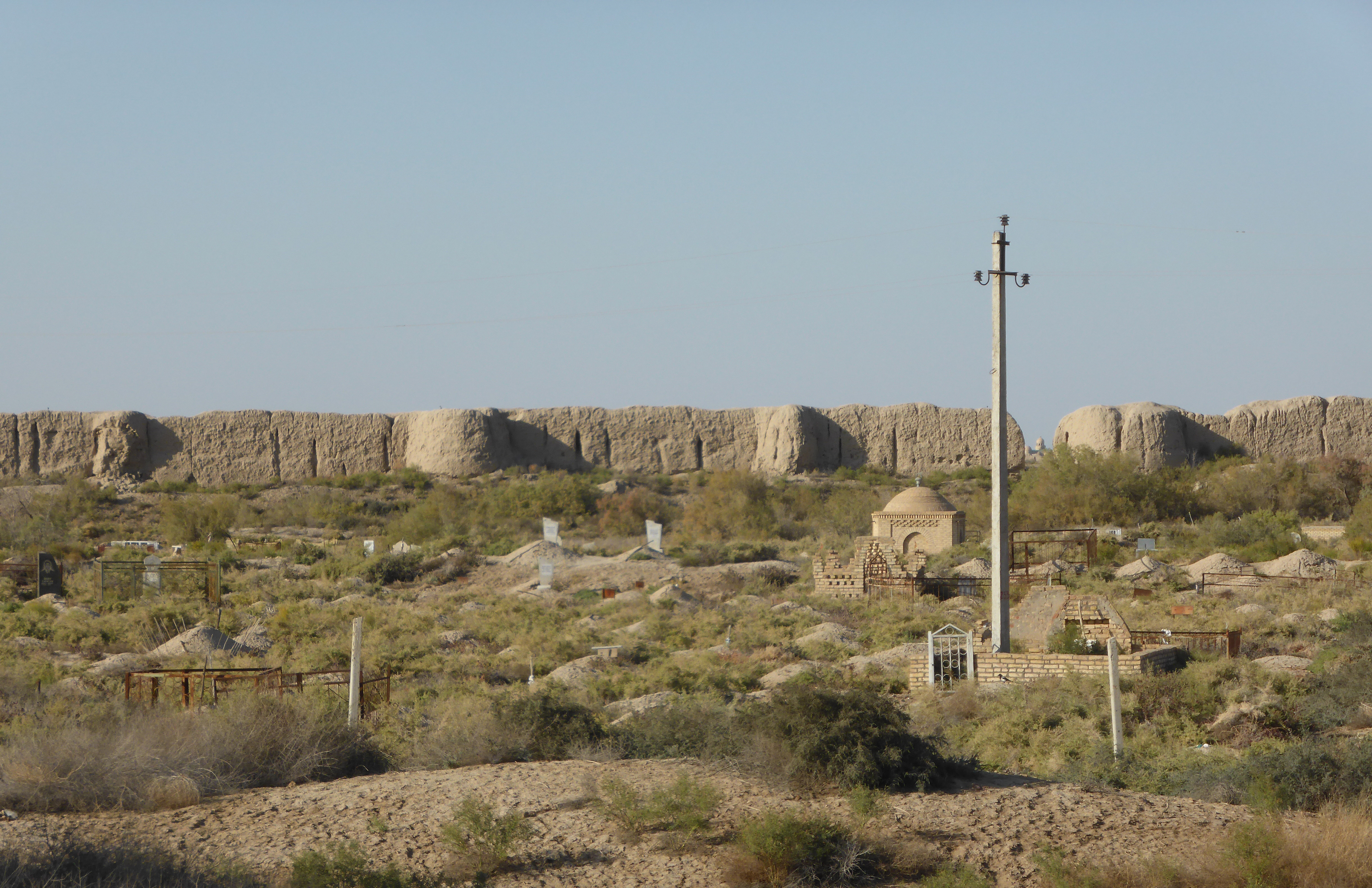
Ancient Merv is not a single city but five, each walled, each representing a distinct civilisation that chose the same oasis on the Murghab River delta to build on. The earliest, Erk-kala, dates to the 6th century BC. The most recent, Bayramali-khan-kala, was abandoned only in the 19th century. Together they form the largest and best-preserved ancient oasis city in Central Asia — inscribed on the UNESCO World Heritage List in 1999 — and the sheer scale of the site requires some orientation before entering. The outer walls of the medieval city of Sultan-kala alone enclose an area of roughly 1,000 hectares.
At its 11th-century peak under the Seljuk Turks, Merv’s population reached approximately 200,000, placing it among the largest urban centres on earth. It was simultaneously a centre of Islamic scholarship, a transit hub for caravans moving between China, Persia, and the Mediterranean, and the seat of Khorasan province — one of the most productive regions of the medieval Islamic world. The Mongol campaigns of 1221 and 1222 brought that era to an end with catastrophic violence; the city was razed and never fully recovered. What survives above ground from the medieval period is dominated by the Mausoleum of Sultan Sanjar, the last of the great Seljuk rulers, whose turquoise-tiled dome — 27 metres high and still structurally intact — stands in isolation on the flat plain of Sultan-kala. It is one of the finest surviving examples of 12th-century Islamic architecture anywhere.
The earlier layers are equally compelling for those willing to walk. Giaur-kala, the Hellenistic and Sassanid city active from the 3rd century BC to the 4th century AD, contains the eroded remains of Buddhist monasteries, temples, and a city grid that once held tens of thousands of residents. Erk-kala’s ancient citadel mound rises visibly within it. The Mary Regional Museum, a short drive from the site, holds finds from across the excavation history, including ceramics, coins, and architectural fragments spanning two and a half millennia.
Getting there: Domestic flight Ashgabat–Mary (approximately 1 hour, check Turkmenistan Airlines schedules) followed by a 30-minute taxi to the site; alternatively, hire a car with driver in Ashgabat for a full-day road trip (4 hours each way, feasible as an overnight). Allow: A full day minimum on site; two days if combining with Mary Regional Museum and Giaur-kala’s western sections. Best for: Travellers focused on Silk Road history, Islamic architecture, or layered archaeological landscapes. A private guide with site-specific knowledge is strongly recommended.
Frequently Asked Questions
How many UNESCO World Heritage Sites are near Ashgabat?
Turkmenistan has three UNESCO World Heritage Sites in total. Two are accessible from Ashgabat: the Parthian Fortresses of Nisa (inscribed 2007), located 18 km southwest of the city, and the State Historical and Cultural Park ‘Ancient Merv’ (inscribed 1999), situated 350 km east near the city of Mary. The third Turkmenistan site, Kunya-Urgench, lies in the north of the country near the Uzbek border and requires a separate trip.
Do I need a guide to visit Nisa and Merv?
For Nisa, a guide is helpful but not strictly necessary — the site has English signage and is compact enough to navigate independently. For Ancient Merv, a knowledgeable guide makes a significant difference. The site covers several square kilometres of largely undifferentiated earthen remains, and understanding what you are looking at across five distinct walled cities spanning 2,500 years requires contextual explanation that signage alone does not fully provide. Most Ashgabat-based tour operators offer day-trip packages to both sites.
What is the best time of year to visit these sites?
April, May, and October are the most comfortable months. Summers in the Karakum desert region are extreme — temperatures at Merv regularly exceed 40°C between June and August, and afternoon visits become genuinely taxing. Spring brings wildflowers to the Kopet Dag foothills around Nisa and mild temperatures at Merv. Winter visits are possible but require checking transport connections to Mary, which can be disrupted by cold spells. Early morning departures are recommended year-round to reach Merv before midday heat builds.
What was the historical significance of the Parthian Empire based at Nisa?
The Parthians emerged in the 3rd century BC to fill the power vacuum left by Alexander the Great’s successors in the Iranian world. At their height, the Parthian Empire controlled territory stretching from the Euphrates River in modern Iraq to eastern Iran — placing them directly between the Roman Empire to the west and the Han Chinese to the east. For centuries they acted as the essential middlemen of Silk Road trade. The fortress at Nisa served as the dynastic capital and treasury, and the ivory rhyta recovered there — decorated with Greek mythological scenes but shaped in Iranian ceremonial tradition — are among the most eloquent material expressions of the cultural synthesis that defined Parthian civilisation.


_(44747335984).jpg)