
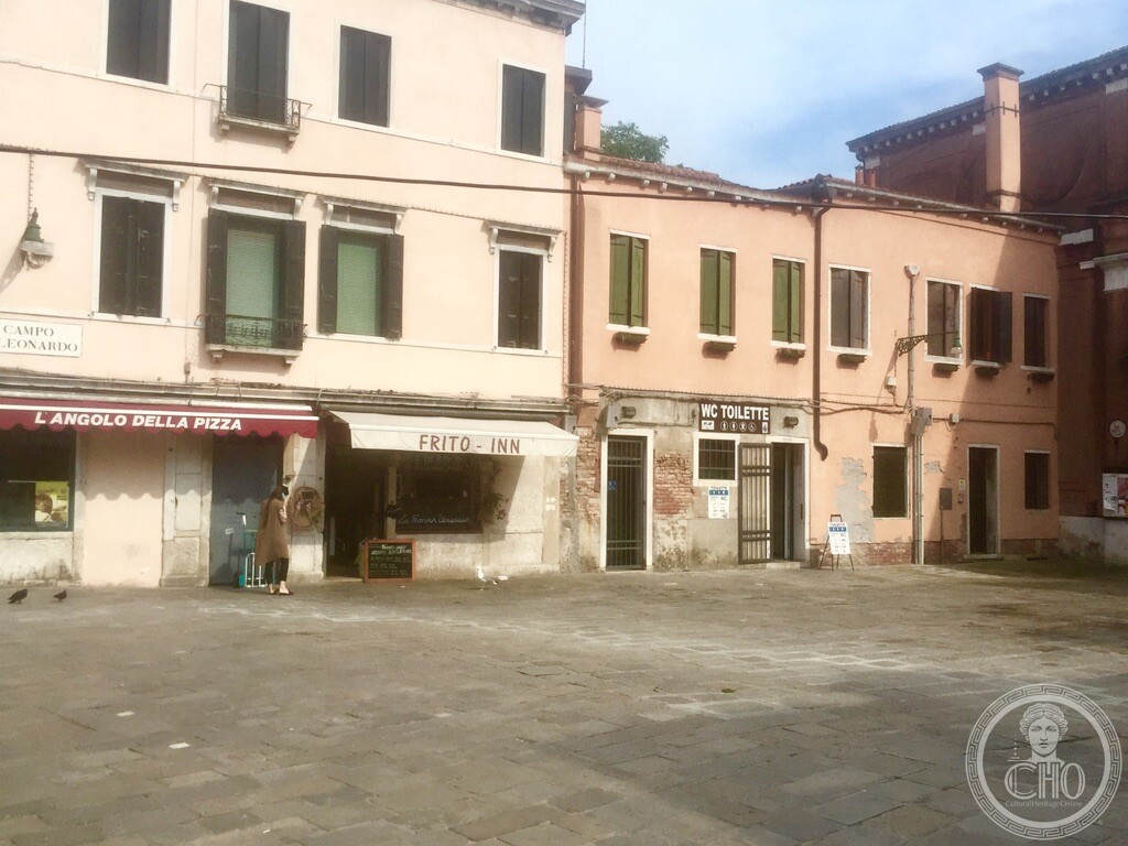
Anchoring the busy pedestrian artery of Rio Terà San Leonardo in central Cannaregio, Campo San Leonardo blends the centuries-old legacy of an 11th-century parish church with a vibrant daily open-air market and authentic Venetian seafood street-food traditions.
At a glance
Positioned along the main overland walking route connecting Venezia Santa Lucia train station with the Strada Nova and Rialto, Campo San Leonardo is one of the most animated public squares in Cannaregio. Named after the ancient Church of San Leonardo that once dominated its eastern flank, the campo was enlarged when the adjoining canal was filled and paved over (creating a rio terà). Today it operates as a vibrant community hub where residents gather for morning market shopping, coffee at outdoor terraces, and traditional quick bites.
Key facts
- Urban origin: Expanded in the late 18th and early 19th centuries when the original Rio San Leonardo was filled to create modern overland pedestrian routes
- Church history: Chiesa di San Leonardo, founded c. 1025; rebuilt in 1785 by Bernardino Maccaruzzi; deconsecrated under Napoleonic decree in 1810
- Current role of church: Restored as a municipal civic hall and social center, with its brick flank facing the campo
- Market life: Daily morning open-air market with stalls offering seasonal vegetables from lagoon islands, fresh fruit, fish, and cut flowers
- Culinary tradition: A favorite local stop for traditional scartosso de fritto—fresh fried calamari, shrimp, and seasonal seafood eaten on the go
- GPS: 45.44373, 12.32696 · Open in Google Maps
History
For centuries, the parish of San Leonardo was reached predominantly by boat. Founded in 1025 by the noble Celsi family, the church underwent numerous transformations, reaching its final architectural form in 1785 under the supervision of state architect Bernardino Maccaruzzi. In 1810, Napoleon’s general suppression of Venetian religious corporations stripped the church of its altars and artwork, truncating its campanile and ending its sacramental life.
In roughly the same period, Venetian engineers executed one of the city’s earliest major urban land reclamation projects: filling the canal in front of the church to produce Rio Terà San Leonardo. This newly paved thoroughfare revolutionized local transit, establishing a continuous land connection from the train station through the Jewish Ghetto and into the heart of the city, converting Campo San Leonardo into a flourishing commercial crossroads.
What you see
Opening out unexpectedly between high residential blocks, the broad paving of Campo San Leonardo welcomes natural sunlight into what would otherwise be a narrow alley system. To the east stands the severe neoclassical brick envelope of the former church, while the facing buildings feature warm Venetian plaster, wooden roll-up blinds, and welcoming commercial ground floors.
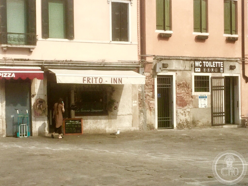
Among the square’s most beloved modern traditions is the enjoyment of freshly fried seafood. Establishments such as Frito-Inn continue the longstanding lagoon custom of serving piping hot fried fish in rustic paper cones (scartosso), drawing both neighborhood regulars and passing travelers who pause to eat in the open air.
Practical information
- Square access: Public urban space, accessible 24/7 at no cost
- Best visiting hours: Between 08:30 and 13:00 to experience the lively morning produce and flower stalls
- Street food etiquette: When enjoying fried seafood on the square, remain mindful of local lagoon gulls that frequently keep a sharp watch for dropped treats
- Recommended duration: 15 to 20 minutes for a market stroll or street food lunch
Getting there
Situated directly along Rio Terà San Leonardo in Cannaregio, halfway between the Guglie Bridge and the San Marcuola district. The nearest vaporetto stop is Ponte Guglie (Lines 4.1, 4.2, 5.1, 5.2) or San Marcuola on the Grand Canal (Lines 1 and 2), each about three minutes’ walk away.
Nearby
- Ponte delle Guglie — three minutes west along Rio Terà San Leonardo
- The Jewish Ghetto of Venice (Ghetto Nuovo) — four minutes northwest via Calle del Forno
- Chiesa di San Marcuola — three minutes east towards the Grand Canal
Sources
- Tassini, Giuseppe. Curiosità Veneziane. Historical notes on Rio Terà and Campo San Leonardo.
- Lorenzetti, Giulio. Venice and Its Lagoon. Architectural documentation of the former Church of San Leonardo.
- Geographical coordinates: 45.44373, 12.32696.
Find it on the map
See this place and what’s around it →Record researched and written by Carla Szathvary for Cultural Heritage Online, 2026.
📷 Become a Cultural Heritage Online photographer
Share your photos of places: they stay published under your name as the author. The more they're seen, the more you get noticed — and soon a contest will reward the most appreciated photos.
Log in or sign up free to add a photoIs this page about you?
This page is read by travellers and heritage enthusiasts who find it on Google. Tell us how you are connected to this place and we will take it from there.