
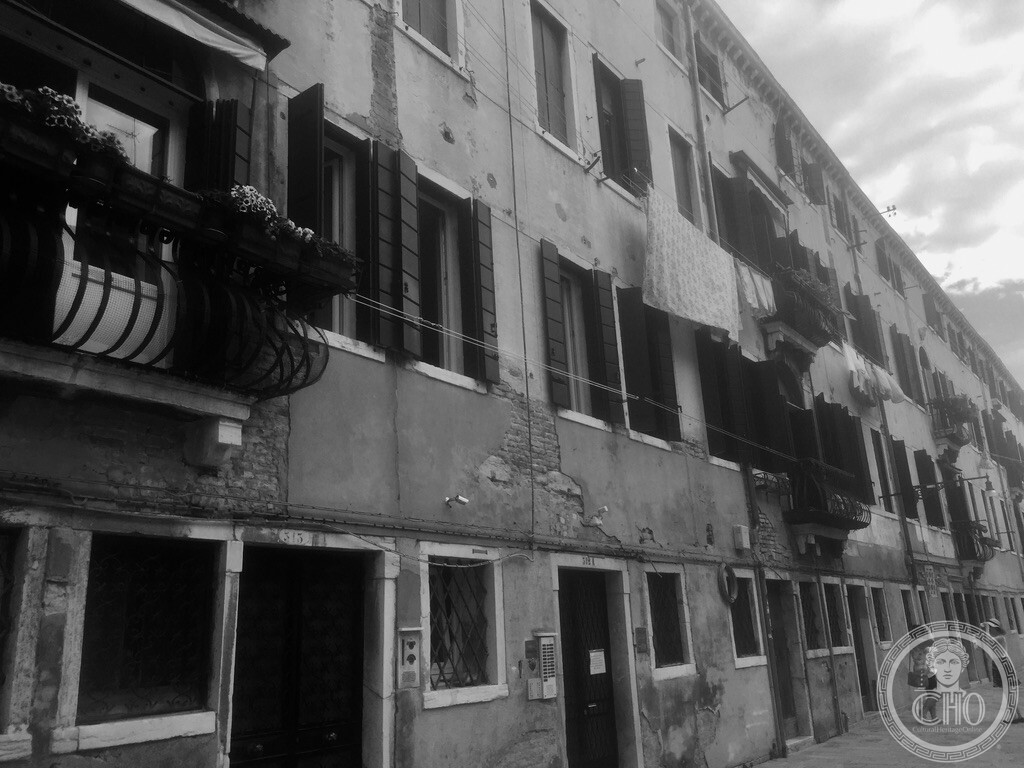
Flanking the quiet waters of the Rio de Santa Maria Maggiore in western Santa Croce, Fondamenta Rizzi offers an intimate glimpse into everyday residential Venice, where laundry flutters high above the quay from curved wrought-iron balconies and rooftop altane.
At a glance
A fondamenta is a street that directly borders a canal on one side while facing buildings on the other. Running along the southern bank of the Rio de Santa Maria Maggiore in the quiet southwestern pocket of Santa Croce, Fondamenta Rizzi remains one of the most authentic residential corridors in the historic city. Here, away from the well-trodden souvenir trails of San Marco and Rialto, ordinary Venetian life carries on in vernacular four-storey apartment buildings defined by sun-faded lime plaster, exposed red clay brickwork, and classic domestic details.
Key facts
- Urban type: Fondamenta (a paved waterside quay flanking an open canal)
- Canal: Rio de Santa Maria Maggiore (also known as Rio de le Burchielle)
- Sestiere: Santa Croce, near the border with Dorsoduro
- Architectural elements: Curved wrought-iron balconies (pergoli), wooden rooftop sun decks (altane), traditional green wooden shutters (scuri)
- Atmosphere: Predominantly local and residential, lined with family homes, artisan workshops, and neighborhood grocery stores
- GPS: 45.43525, 12.31889 · Open in Google Maps
History
The western section of Santa Croce developed in the late Middle Ages and early modern era as a neighborhood of working craftsmen, boat builders, and transport workers. The Rio de Santa Maria Maggiore was a vital freight corridor where wide transport barges (burchielle) carried agricultural produce, building materials, and barrels arriving from the mainland estuary into central Venice.
Over the centuries, patrician palazzi gave way to high-density residential housing where multiple families occupied apartments stacked above ground-floor boat storage and warehouses (magazzini). To combat the humidity of lagoon living and capture fresh breezes, residents erected wooden rooftop terraces called altane—platforms elevated above tiled roofs where women dried laundry, aerated wool, and famously bleached their hair golden-red (the historic “Venetian blonde”) using scented mixtures and brimless straw hats.
What you see
Strolling along the quay, the facades display a rich layering of time and maritime exposure: centuries-old clay bricks emerge from beneath crumbling coats of ochre and cream render, washed by humidity and salt. Curved wrought-iron railings swell outwards from tall French doors to accommodate flower planters, while clotheslines stretch between upper windows, displaying sheets and garments that billow in the wind like colorful nautical pennants.
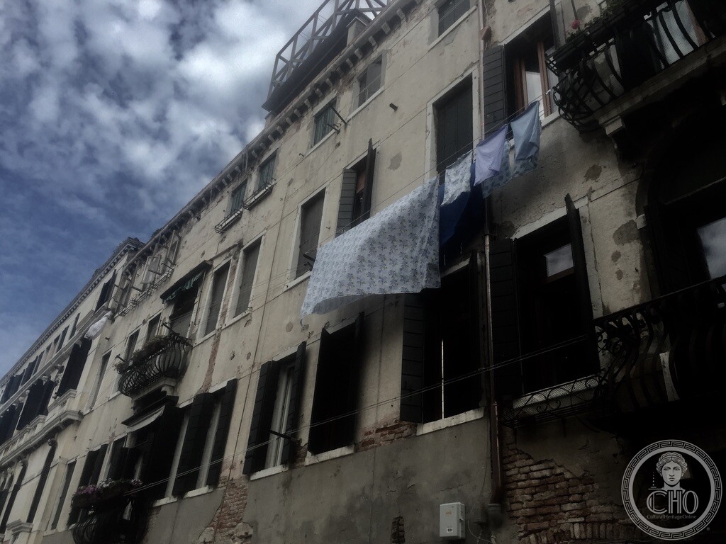
High above the eaves, timber framework altane stand silhouetted against the open sky, providing private sanctuaries of light and breeze in a dense urban archipelago without private gardens.
Practical information
- Access: Public quay, accessible 24/7 at no cost
- Walking experience: Ideal for a peaceful stroll far from tourist crowds; flat, wide paving makes it easy to walk along the water
- Photography tip: Early morning and late afternoon light catches the canal reflections and illuminates the laundry lines against the rustic plaster facades
- Recommended duration: 15 to 20 minutes as part of a wider walking route through Santa Croce and Dorsoduro
Getting there
Located five minutes’ walk south of Piazzale Roma and ten minutes from Venezia Santa Lucia railway station via the Ponte dei Tre Ponti. The nearest vaporetto stop is Piazzale Roma or San Basilio (Line 2).
Nearby
- Campo San Pantalon — six minutes east across Rio de le Muneghette
- Scuola Grande di San Rocco — eight minutes northeast
- Campo Santa Margherita — seven minutes southeast in Dorsoduro
Sources
- Tassini, Giuseppe. Curiosità Veneziane. Notes on Santa Croce fondamenta, Venetian altane, and residential life.
- Zulian, Gianfranco. Venezia Scomparsa: I canali e le fondamenta. Historical evolution of Venetian quays and domestic architecture.
- Geographical coordinates: 45.43525, 12.31889.
Find it on the map
See this place and what’s around it →Record researched and written by Carla Szathvary for Cultural Heritage Online, 2026.
📷 Become a Cultural Heritage Online photographer
Share your photos of places: they stay published under your name as the author. The more they're seen, the more you get noticed — and soon a contest will reward the most appreciated photos.
Log in or sign up free to add a photo