
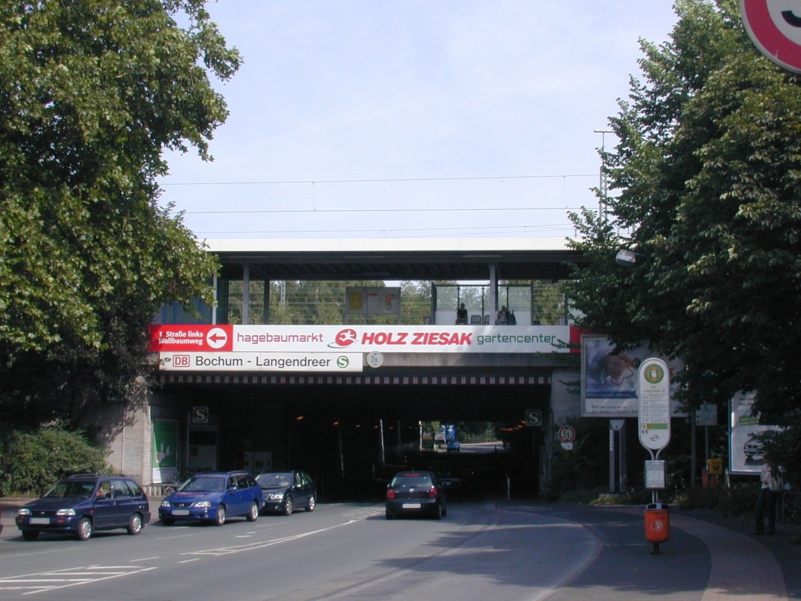
A working railway station and historic depot in eastern Bochum, marking the site of a once-significant marshalling yard and passenger terminus.
At a glance
Bochum-Langendreer station serves the Langendreer district as a modern stop on the Rhine-Ruhr S-Bahn rapid transit network. The site encompasses both an active passenger platform and a substantial rail depot, revealing layers of industrial railway history.
History
The location developed as a major railway hub, anchored by a 40-hectare marshalling yard that coordinated freight operations across the Ruhr valley’s industrial network. Until the 1980s, the yard supported a dedicated passenger station served by express trains—a testament to Langendreer’s significance during the region’s coal and steel boom. The marshalling yard has since been repurposed as a modern depot, preserving the site’s railway function while adapting to contemporary transport needs.
What you see
The station reflects mid-20th-century German railway infrastructure design. Visitors encounter a functional modern platform integrated with historic rail structures, including depot facilities that occupy the footprint of the former marshalling yard.
Cultural significance
Bochum-Langendreer represents the industrial railway heritage of the Ruhr region. The transformation of its marshalling yard from passenger and freight hub to depot illustrates the shift in German transport infrastructure over recent decades, while maintaining active connections to regional rail networks.
Key facts
- Location: Langendreer district, eastern Bochum, North Rhine-Westphalia, Germany
- Coordinates: 51.477623, 7.322028
- Current service: Rhine-Ruhr S-Bahn
- Historic depot code: EBLA
- Former marshalling yard: 40 hectares
Practical information & getting there
The station is accessible via the Rhine-Ruhr S-Bahn network, which connects Bochum to surrounding Ruhr valley cities. The site remains an active railway facility; visitor access to depot areas is restricted. For detailed travel schedules and current service information, consult local transit authorities.
Sources & resources
Find it on the map
See this place and what’s around it →📷 Become a Cultural Heritage Online photographer
Share your photos of places: they stay published under your name as the author. The more they're seen, the more you get noticed — and soon a contest will reward the most appreciated photos.
Log in or sign up free to add a photoIs this page about you?
This page is read by travellers and heritage enthusiasts who find it on Google. Tell us how you are connected to this place and we will take it from there.