
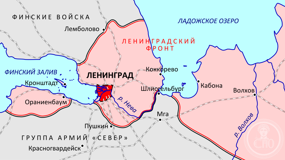
An isolated Soviet stronghold on the Gulf of Finland, the Oranienbaum Bridgehead remained under Red Army control throughout the 900-day siege of Leningrad, serving as a critical bulwark against Nazi encirclement.
At a glance
During World War II’s siege of Leningrad, this narrow strip of land west of the city became a lifeline—a Soviet-held position that prevented the Wehrmacht from completely surrounding and isolating the starving metropolis. Separated from Leningrad by German lines, the bridgehead represented defiance and strategic necessity.
History
The Oranienbaum Bridgehead emerged as a distinct military zone after German forces advanced toward Leningrad in 1941. Soviet troops held this portion of Leningrad Oblast against sustained German pressure throughout the three-year siege. The bridgehead’s survival proved instrumental in the eventual Soviet breakthrough that ended the blockade in January 1944.
What you see
Today the bridgehead is primarily a historical landscape. The region bears the marks of wartime fortifications, trenches, and defensive positions. Visitors can trace the geography of Soviet resistance across terrain that witnessed constant artillery bombardment and close combat.
Cultural significance
The Oranienbaum Bridgehead stands as a monument to Soviet resilience during history’s deadliest siege. Its preservation under Soviet control—despite isolation and overwhelming German superiority—became a symbol of Leningrad’s unbroken spirit. The site remains central to Russian historical memory of the Great Patriotic War.
Key facts
- Location: Leningrad Oblast, Russia
- Coordinates: 59.92°N, 29.77°E
- Period: 1941–1944 (siege of Leningrad)
- Significance: Strategic Soviet position that prevented complete German encirclement
Practical information & getting there
The bridgehead is located west of Saint Petersburg (formerly Leningrad) on the Gulf of Finland. Access requires travel through the Lomonosov district. Visitors should seek local guidance, as many wartime sites require formal permission to visit. The region is not developed as a conventional tourist destination.
Sources & resources
Find it on the map
See this place and what’s around it →📷 Become a Cultural Heritage Online photographer
Share your photos of places: they stay published under your name as the author. The more they're seen, the more you get noticed — and soon a contest will reward the most appreciated photos.
Log in or sign up free to add a photo