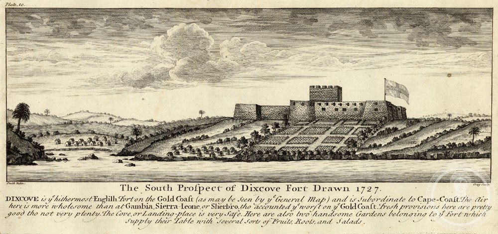
A coastal stronghold bearing witness to centuries of European-African trade and the Atlantic slave trade, Fort Metal Cross commands a promontory at Infuma in Ghana’s Western Region.
At a glance
Fort Metal Cross, originally known as Fort Dixcove, stands on a fishing community’s edge overlooking the Atlantic. Its strategic location made it a crucial node in trans-oceanic commerce and colonial enterprise.
History
Built as a European trading post, the fort served multiple commercial purposes across centuries. Its original name, Fort Dixcove, reflects its colonial origins, though it later took the name Metal Cross. The structure stands as testimony to the complex and often tragic history of Atlantic trade networks in West Africa.
What you see
The fort occupies a prominent coastal promontory, its military architecture designed for defense and commerce. The structure bears the hallmarks of European fortification adapted to the West African environment and strategic requirements of the period.
Cultural significance
Fort Metal Cross embodies Ghana’s layered colonial history and the continent’s role in Atlantic trade systems. Recognition as part of a UNESCO World Heritage Site alongside related forts and castles acknowledges the sites’ collective importance to understanding global commerce, European expansion, and African agency during this transformative period.
Key facts
- Country: Ghana
- Location: Infuma, Dixcove, Western Region
- Coordinates: 4.79321°N, 1.94484°W
- UNESCO World Heritage Site: Part of Forts and Castles of Volta, Greater Accra, Central and Western Regions (inscribed 1979)
Practical information & getting there
Fort Metal Cross is located in Dixcove, a working fishing community in Ghana’s Western Region. The site is accessible as part of Ghana’s network of preserved colonial forts. Consult local tourism resources for current visiting hours and access information.
Sources & resources
- Fort Metal Cross – Wikipedia
- Cultural Heritage Online
Find it on the map
See this place and what’s around it →📷 Become a Cultural Heritage Online photographer
Share your photos of places: they stay published under your name as the author. The more they're seen, the more you get noticed — and soon a contest will reward the most appreciated photos.
Log in or sign up free to add a photoIs this page about you?
This page is read by travellers and heritage enthusiasts who find it on Google. Tell us how you are connected to this place and we will take it from there.