
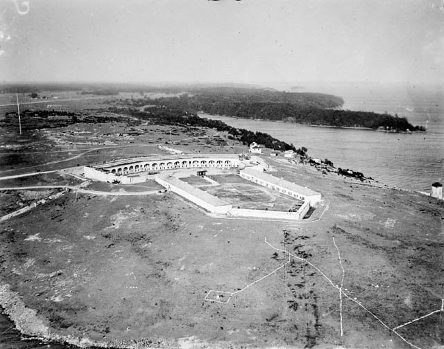
A stone fortification guarding the strategic mouth of the Cataraqui River, where it meets Lake Ontario and the St. Lawrence River. Fort Henry stands as a monument to Canada’s military heritage and the defence strategies of the early nineteenth century.
At a glance
Fort Henry occupies Point Henry, an elevated position commanding the eastern approach to Lake Ontario. The site protects the historic Kingston Royal Naval Dockyard and monitors the vital waterway connecting the Great Lakes to the St. Lawrence River.
History
A fortification was first constructed during the War of 1812 to defend the Kingston Royal Naval Dockyard on nearby Point Frederick from potential American attack and to control maritime traffic on the St. Lawrence and Lake Ontario. A substantially larger fort replaced this initial structure during the 1830s, reinforcing protection of the naval base and securing the southern entrance to the Rideau Canal. The point itself bears the name of Henry Hamilton, former Lieutenant Governor of the Province of Quebec. Following decades of use, the fort underwent restoration in the 1930s, transforming it into the public heritage site that exists today.
What you see
The fort’s stone construction reflects military engineering standards of the 1830s. Its elevated placement on Point Henry affords commanding views across the water, demonstrating the strategic importance of the location for surveillance and defence.
Cultural significance
Fort Henry represents a critical period in Canadian military history. The site illustrates the geopolitical tensions of the early nineteenth century and the importance of naval infrastructure to British North American defence. Today it ranks among Canada’s significant tourist attractions, offering insight into the region’s strategic role during the War of 1812 and the subsequent decades of imperial consolidation.
Key facts
- Country: Canada
- City: Kingston, Ontario
- Coordinates: 44.23026389, -76.45968056
- Original fortification: War of 1812
- Enlarged fort: 1830s
- Restoration: 1930s
Practical information & getting there
Fort Henry National Historic Site is open to visitors year-round. Located on Point Henry at the mouth of the Cataraqui River in Kingston, the site is accessible by road. Consult the site’s official visitor information for current hours, admission fees, and guided tour availability.
Sources & resources
Find it on the map
See this place and what’s around it →📷 Become a Cultural Heritage Online photographer
Share your photos of places: they stay published under your name as the author. The more they're seen, the more you get noticed — and soon a contest will reward the most appreciated photos.
Log in or sign up free to add a photoIs this page about you?
This page is read by travellers and heritage enthusiasts who find it on Google. Tell us how you are connected to this place and we will take it from there.