

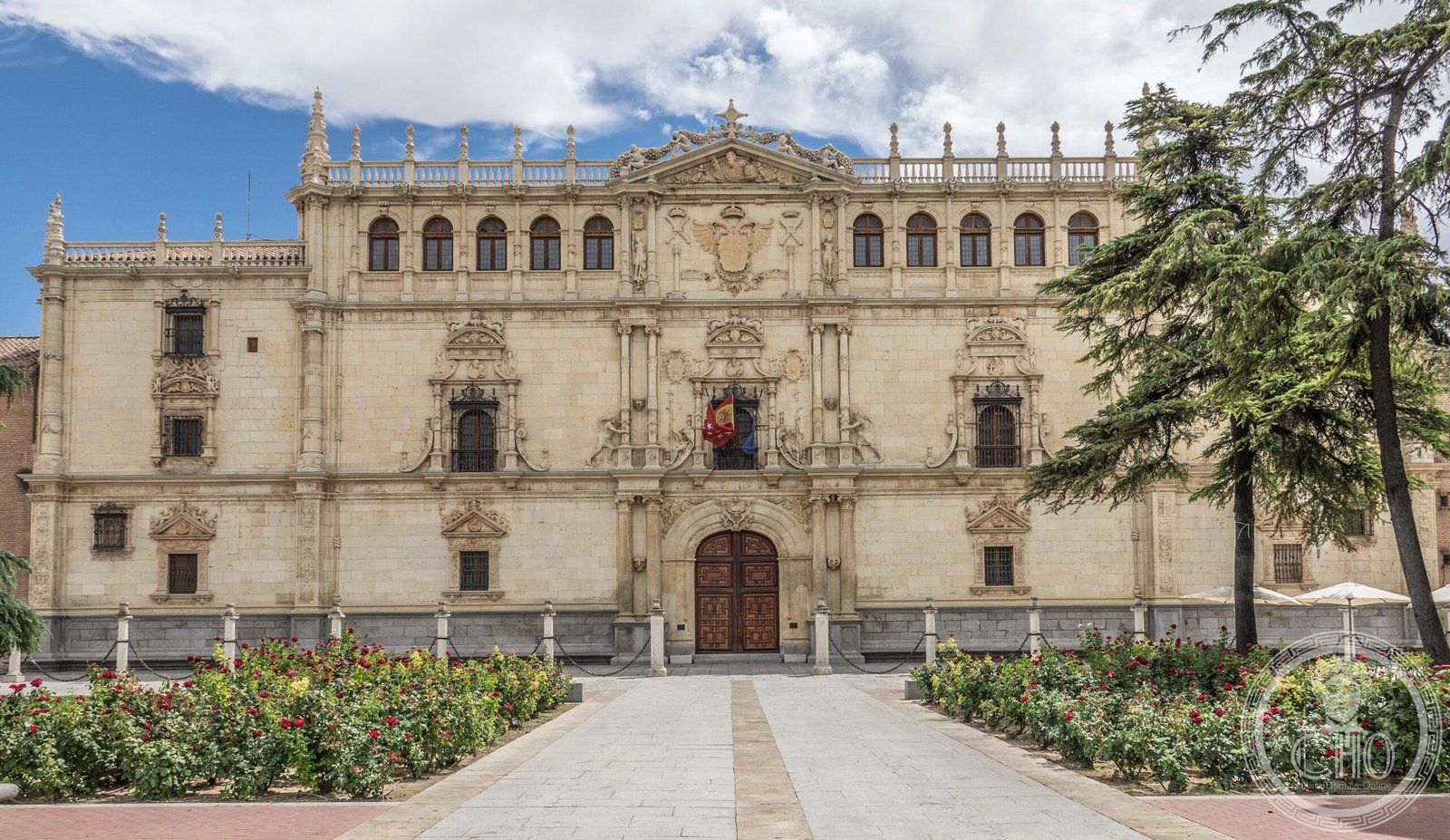
A historic university town east of Madrid, Alcalá de Henares rose from Roman foundations to become a centre of Renaissance learning and one of Spain’s finest ensembles of early modern architecture.
At a glance
Alcalá de Henares sits on the Henares river in the Community of Madrid, Spain’s third-most populated municipality with 193,751 residents as of 2018. Its historical centre is designated a UNESCO World Heritage Site, recognised for its urban planning and architectural heritage spanning two millennia.
History
The site was predated by hilltop settlements and the primitive Roman settlement of Complutum on the left bank of the Henares. A new Roman settlement was founded in the mid 1st century on the right bank, becoming a bishopric seat by the 5th century.
During the Muslim period, a citadel was established on the left bank—the name Alcalá derives from the Arabic word for citadel. After Christian conquest around 1118, the urban nucleus shifted back to the right bank. For much of the late medieval and early modern periods, Alcalá belonged to the archbishops of Toledo.
The town’s transformation came in the 16th century under Francisco Jiménez de Cisneros, whose patronage led to the founding of the University of Alcalá. This institutional anchor converted Alcalá into a thriving college town.
What you see
The historical centre preserves the urban fabric and buildings of its Renaissance collegiate period, reflecting careful early modern urban planning. Architecture spans from Roman foundations through medieval structures to Renaissance collegiate buildings commissioned under Cisneros’s patronage.
Cultural significance
Alcalá de Henares represents a rare example of a European university town, where institutional development shaped the entire urban design. The University of Alcalá became a beacon of humanist scholarship in 16th-century Spain. The town’s layered history—Roman, Islamic, medieval Christian, and Renaissance—is legible in its streets and monuments.
Key facts
- Country: Spain
- Region: Community of Madrid
- Coordinates: 40.4667°N, 3.3667°W
- Population: 193,751 (2018)
- UNESCO World Heritage Site: Historical Centre of Alcalá de Henares
Practical information & getting there
Alcalá de Henares is located east of Madrid and is accessible by regional rail and road. The historical centre forms the core of the town, centred on the university district and main plaza. More detailed visitor information, opening hours and current access details are available through local tourism services and the town’s official resources.
Sources & resources
Find it on the map
See this place and what’s around it →📷 Become a Cultural Heritage Online photographer
Share your photos of places: they stay published under your name as the author. The more they're seen, the more you get noticed — and soon a contest will reward the most appreciated photos.
Log in or sign up free to add a photo