
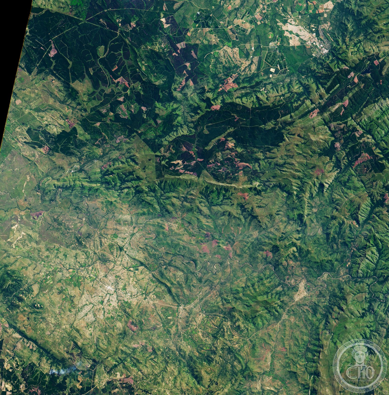
Makhonjwa Mountains
A UNESCO World Heritage range spanning the Barberton Greenstone Belt, these ancient mountains reveal some of Earth’s oldest rock formations across the border of South Africa and Eswatini.
At a glance
The Makhonjwa Mountains—also called the Barberton Makhonjwa Mountains—form a compact range of 120 by 60 kilometres. Approximately 80% lies within Mpumalanga province, with the remainder extending into Eswatini. The mountains constitute 40% of the Barberton Greenstone Belt, one of the world’s most significant geological formations.
History
The Makhonjwa Mountains are part of the Barberton Greenstone Belt, a region celebrated for preserving some of Earth’s most ancient and least-altered crustal rocks. These geological structures provide crucial evidence for understanding early planetary development and the conditions that existed billions of years ago.
What you see
Visitors encounter a landscape of small mountains and hills shaped by immense geological time. The terrain displays the characteristic greenstone formations—metamorphosed volcanic and sedimentary rocks—that define this belt. The exposed rock faces and geological outcrops tell the story of ancient tectonic processes.
Cultural significance
The Makhonjwa Mountains hold international importance for geological research and education. UNESCO recognition acknowledges their role in preserving a record of the Earth’s early history. Scientists and students visit to study Archean-age rocks and understand the geodynamic processes of the ancient world.
Key facts
- Country: South Africa (with portions in Eswatini)
- Region: Mpumalanga province
- Area: 120 by 60 kilometres
- Coordinates: -25.785, 31.052
- UNESCO World Heritage Site: Yes
- Represents: 40% of the Barberton Greenstone Belt
Practical information & getting there
The mountains are located in Mpumalanga province in northeastern South Africa. Access is typically via the town of Barberton, which serves as a gateway to the region. Consult local guides and current travel advisories before visiting, as geological sites may require permits or specialized access arrangements.
Sources & resources
Find it on the map
See this place and what’s around it →📷 Diventa un fotografo di Cultural Heritage Online
Condividi le tue foto dei luoghi: restano pubblicate con la tua firma come autore. Più vengono viste, più ti fai conoscere — e presto un concorso premierà le foto più apprezzate.
Accedi o registrati gratis per aggiungere una foto