
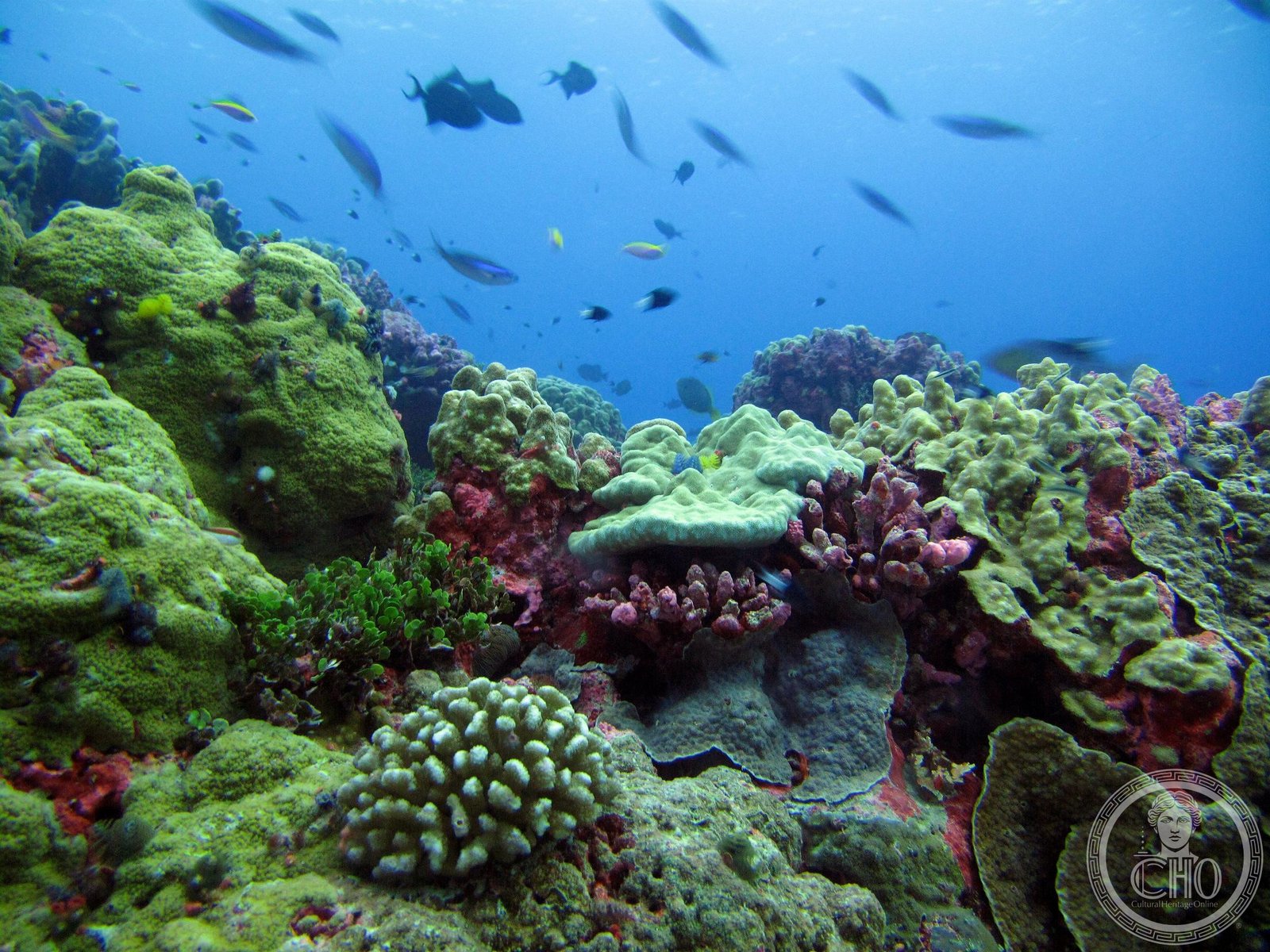
One of Earth’s largest marine protected areas, spanning 408,250 square kilometers of pristine oceanic coral archipelago in the central Pacific.
At a glance
The Phoenix Islands Protected Area (PIPA) represents one of the world’s most significant marine conservation zones. At 408,250 km², it covers an area equivalent to California, yet its land comprises just 25 km². The site encompasses 11.34% of Kiribati’s exclusive economic zone and was designated a UNESCO World Heritage Site in 2010 as the world’s largest and deepest example of its kind.
History
PIPA was established to protect one of the planet’s few remaining intact oceanic coral archipelago ecosystems. Its UNESCO designation in 2010 recognized both its exceptional biodiversity and the unprecedented scale of its protection. The area lies in the central Pacific, positioned approximately midway between Australia and Hawaii.
What you see
The protected area comprises 14 known underwater seamounts—presumed extinct volcanoes—and extensive deep-sea habitats. These geological features support a remarkable concentration of marine life across multiple depth zones. The landscape is defined by the interplay of coral systems, abyssal plains, and submarine topography rather than terrestrial formations.
Cultural significance
PIPA holds immense ecological importance as a refuge for one of the world’s last undisturbed oceanic ecosystems. For the Republic of Kiribati, a Pacific island nation vulnerable to climate change, the protected area represents both a scientific resource and a statement of environmental stewardship. Its designation underscores the global commitment to preserving marine biodiversity in an era of accelerating ocean degradation.
Key facts
- Country: Kiribati
- Size: 408,250 km² (157,630 sq mi)
- Land area: 25 km² (9.7 sq mi)
- Coordinates: 3°39′S, 172°51′W
- UNESCO World Heritage Site: 2010
- Marine fauna: approximately 800 known species, including 200 coral species, 500 fish species, 18 marine mammals, and 44 bird species
- Underwater features: 14 known seamounts
Practical information & getting there
PIPA is a marine protected area with restricted access. Visitors typically access the region through Kiribati’s main islands. The site is managed under strict conservation protocols to preserve its pristine condition. Consult official Kiribati tourism authorities for current regulations and permitted activities.
Sources & resources
Find it on the map
See this place and what’s around it →📷 Become a Cultural Heritage Online photographer
Share your photos of places: they stay published under your name as the author. The more they're seen, the more you get noticed — and soon a contest will reward the most appreciated photos.
Log in or sign up free to add a photo