
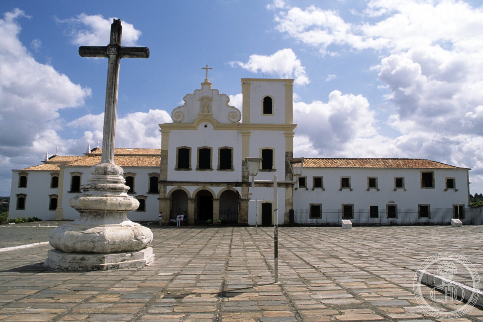
A stone-paved plaza in northeastern Brazil where Spanish and Portuguese colonial traditions converge, ringed by churches, convents, and civic buildings that survive largely intact.
At a glance
São Francisco Square is a 73-by-51-metre open space in São Cristóvão, Sergipe. It stands as one of Brazil’s finest examples of colonial urban design, blending Spanish plaza mayor principles with Portuguese Franciscan architecture. The square anchors a 3-hectare complex that includes the Church and Convent of Santa Cruz, the Misericórdia Hospital and Church, and the Provincial Palace.
History
The square’s layout follows the Codigo Philippino, a legal code introduced by the Iberian Union in 1603. This Spanish colonial ordinance governed city planning across Iberian territories. After the union dissolved in 1640, São Cristóvão’s urban development shifted to the Portuguese colonial model, yet the square retained its Spanish plaza mayor configuration.
Over time, additional religious and residential structures were built beyond the original plaza perimeter, extending the district’s architectural character.
What you see
The square presents a rare fusion of Spanish and Portuguese colonial traditions. Its perimeter comprises religious edifices—notably the Church and Convent of Santa Cruz (also called São Francisco Church) and the Misericórdia Church—alongside the Provincial Palace and residential buildings from colonial and later periods. The stone paving and open plaza design reflect Spanish influence, while the Franciscan religious architecture speaks to Portuguese dominion.
The structures demonstrate high-quality preservation, allowing visitors to read several centuries of architectural evolution within a cohesive spatial frame.
Cultural significance
São Francisco Square documents a pivotal moment in colonial Brazilian history: the overlap and transition between Spanish and Portuguese rule. Few urban ensembles in the Americas preserve this dual heritage so completely. The site illustrates how legal frameworks (the Codigo Philippino) shaped physical space, and how political change (the end of the Iberian Union) redirected development without erasing earlier patterns.
Key facts
- Location: São Cristóvão, Sergipe, Brazil
- Coordinates: -11.01611111, -37.21
- Size: 73 metres × 51 metres (240 ft × 167 ft)
- Complex area: 3 hectares (7.4 acres)
- UNESCO World Heritage Site: inscribed 1 August 2010
- Managing bodies: IPHAN (National Institute of Historic and Artistic Heritage) and municipal government
Practical information & getting there
The site is open to the public and managed jointly by the Brazilian federal heritage agency (IPHAN) and São Cristóvão’s municipal government. Contact local tourism offices for current visiting hours, guided-tour availability, and any access restrictions. The square’s location in Sergipe, in Brazil’s northeast, connects to regional road and air networks via Aracaju, the state capital.
Sources & resources
- São Francisco Square – Wikipedia
- Cultural Heritage Online
Find it on the map
See this place and what’s around it →📷 Become a Cultural Heritage Online photographer
Share your photos of places: they stay published under your name as the author. The more they're seen, the more you get noticed — and soon a contest will reward the most appreciated photos.
Log in or sign up free to add a photo